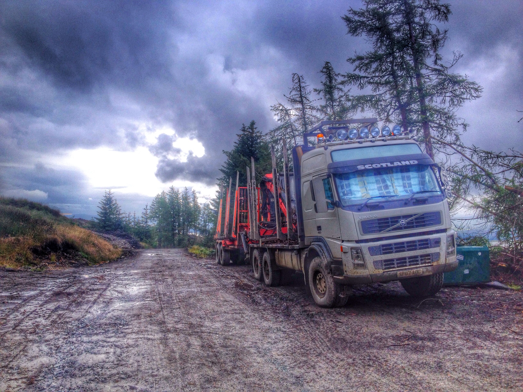
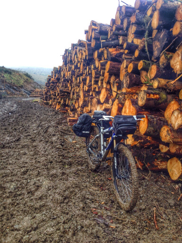
Although I’ve walked this hill before , I thought I’d try it from a different approach. Setting off from the FCS car park at Inverchapel,following the red route to the view point then leaving the hardcore track for the open hillside.
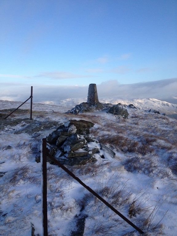
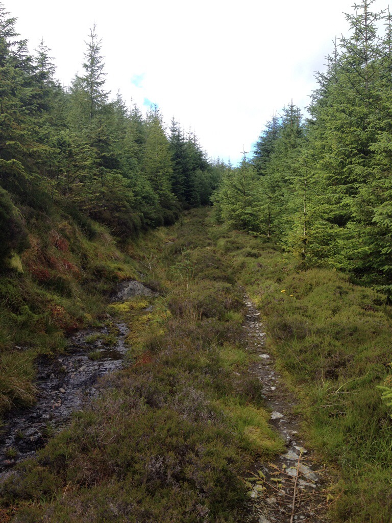
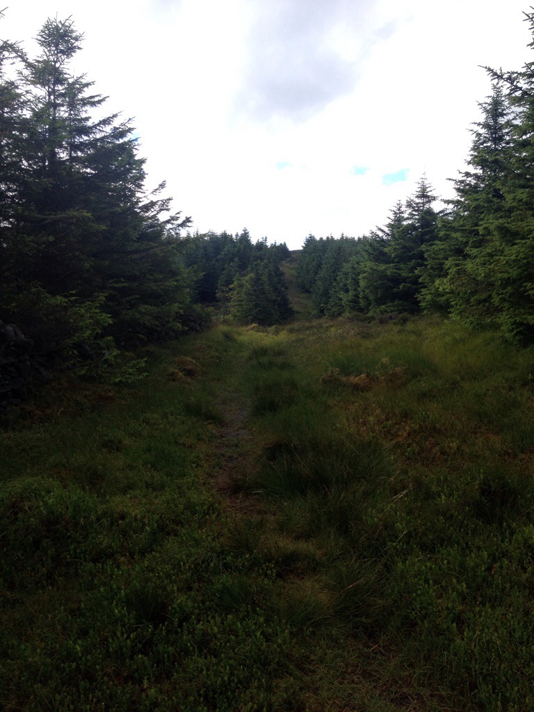
I’m not going to lie……….the initial climb over the varied and steep terrain did have me taking a few picture opportunities ( breathers), my legs were paying the price of the constant climb. There is no path, so it’s pretty much do your own thing. I had an idea to follow fence lines but the steep rocky terrain put me off. I’d plotted a rough route,dodging the larger rocky outcrops,so that’s the route I took. Looking on a map and seeing what’s actually on the ground are two different things!! Zig-zagging up the hill I eventually got to the section where I could see the summit,the walk from here is quite straight forward. There are a number of old iron fence posts that guide you to the summit.
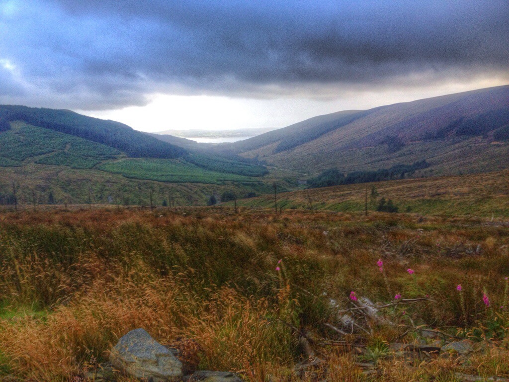
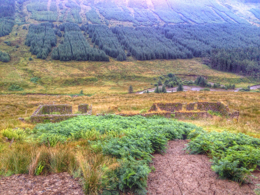
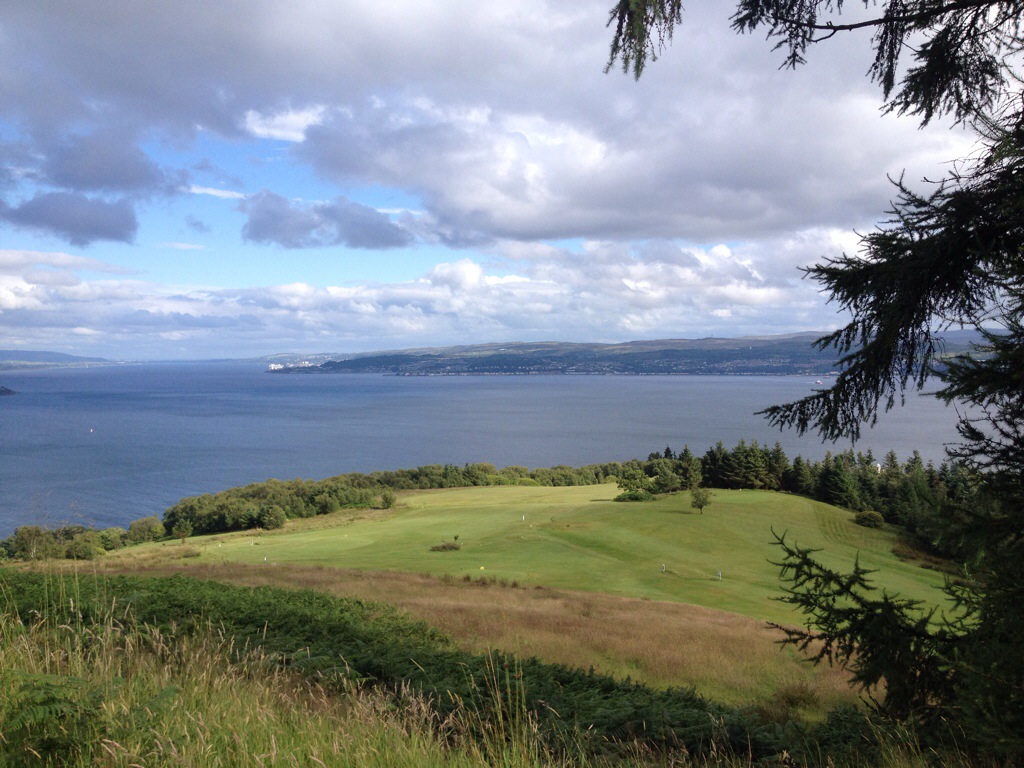
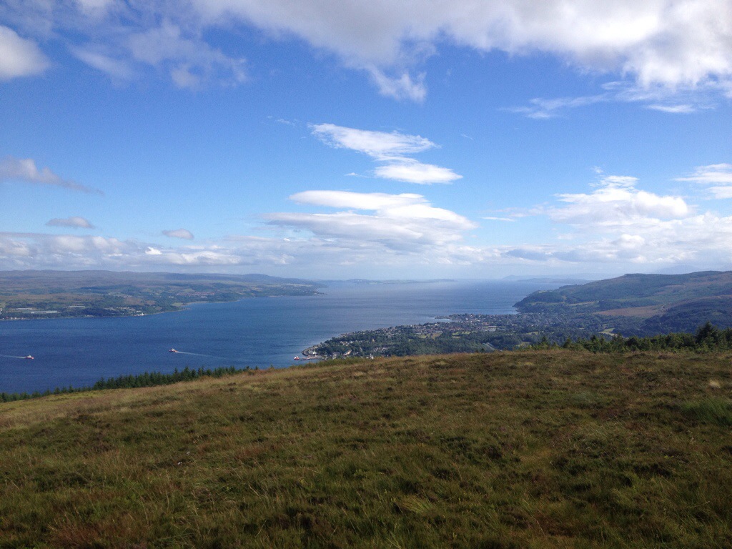
On the return, I decided to head out onto some of the outcrops to gain some great views over Loch Eck and the surrounding hills. I also decided to follow the fence line that took me back the the gate,mid hill. Thankfully I never took this route on the way up as the boulder strewn hill was not ideal walking terrain, especially with a dusting of snow. Some voids could take your leg !!
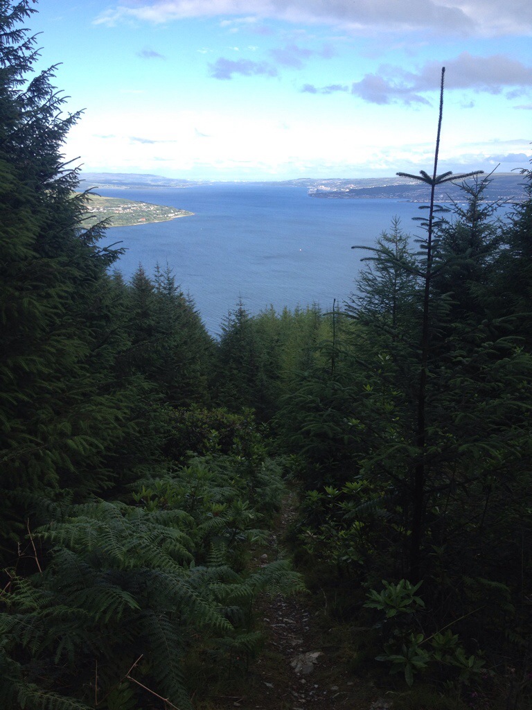
Despite the constant climb,it was a great way to do this hill. A great view was always had,more so with the hills topped with snow.
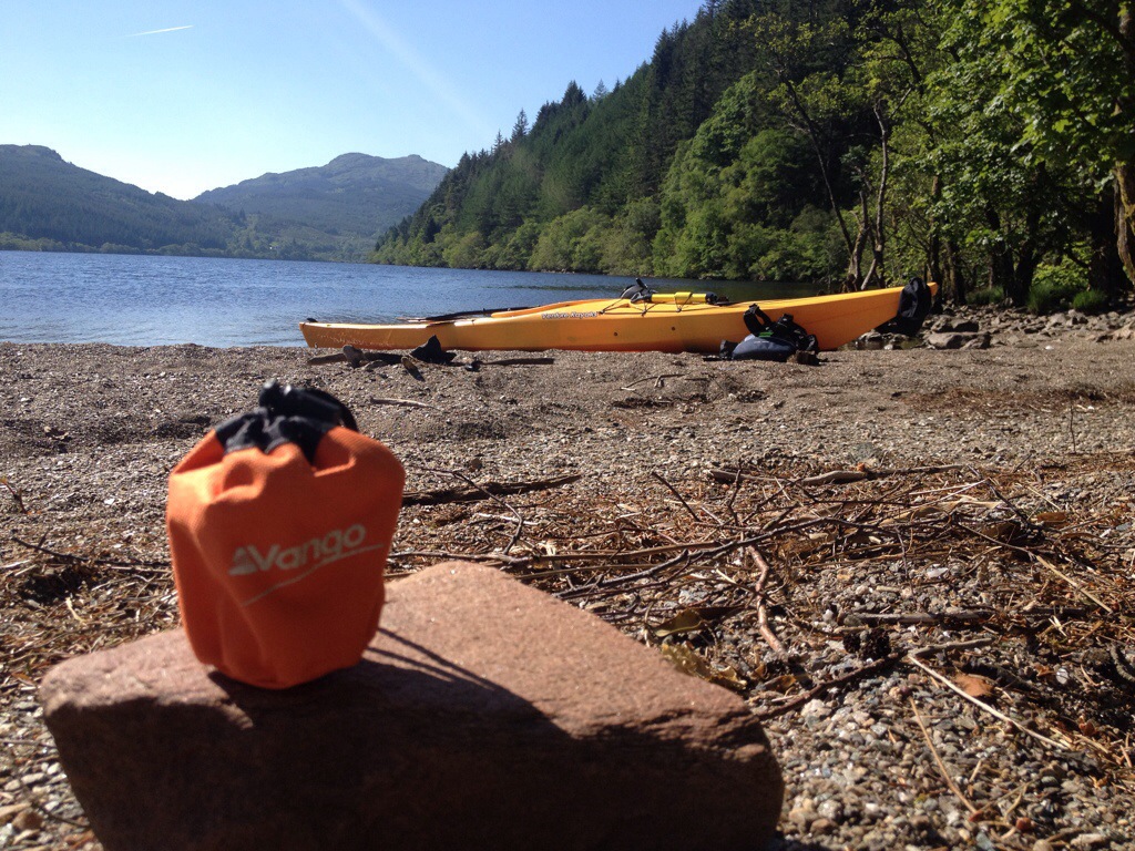
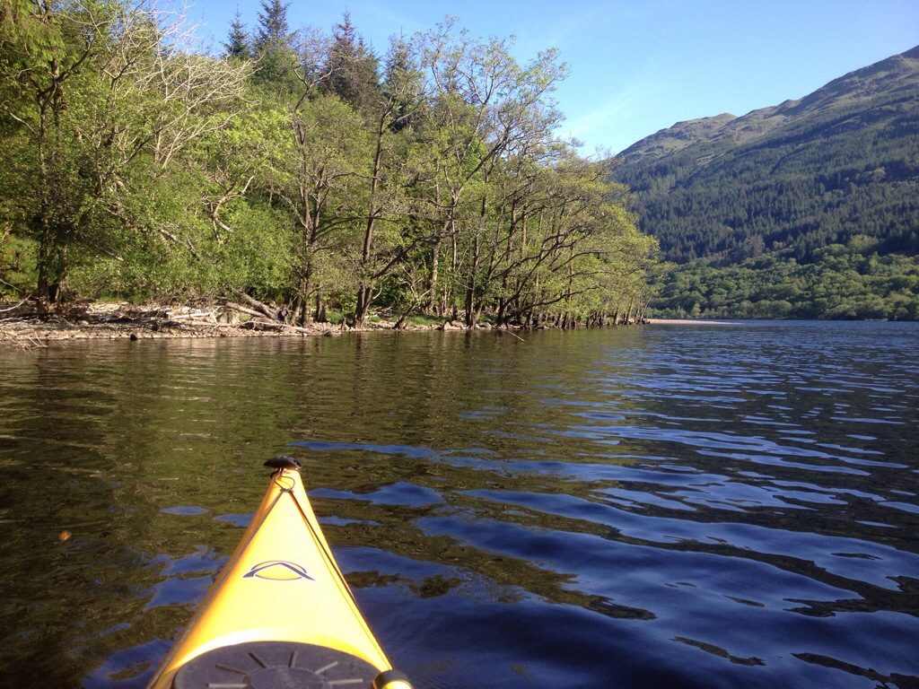
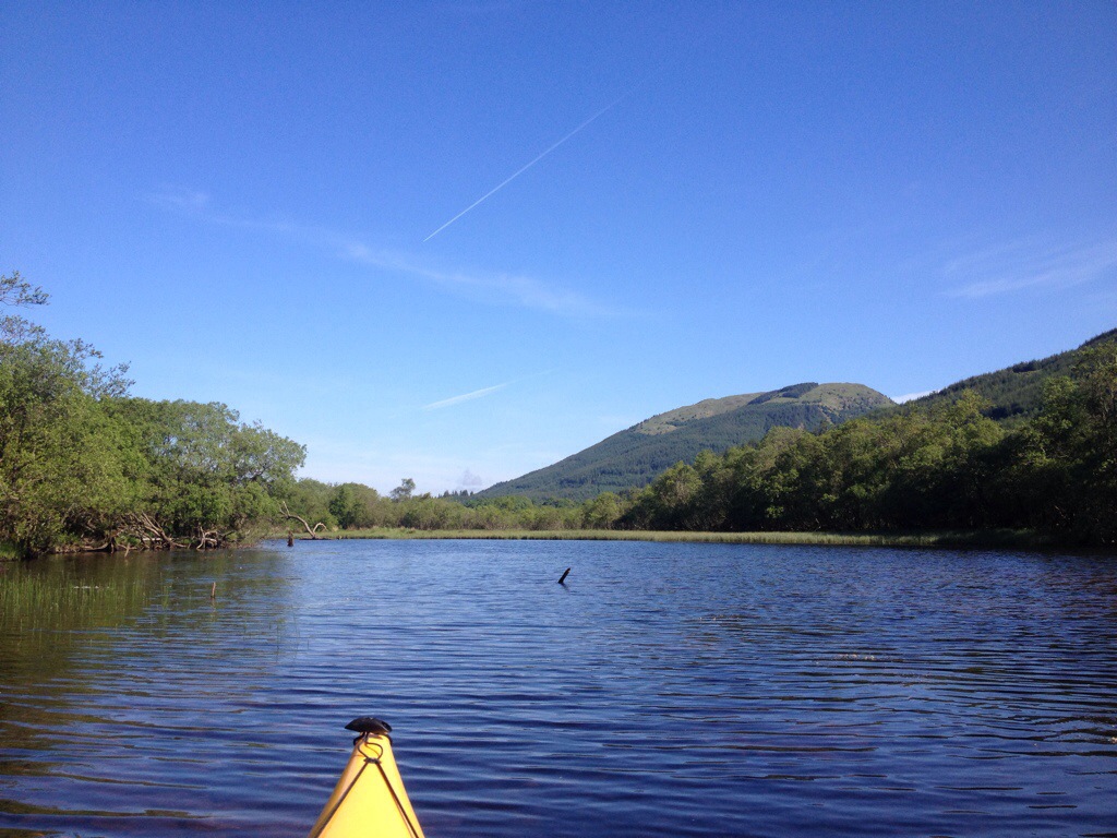
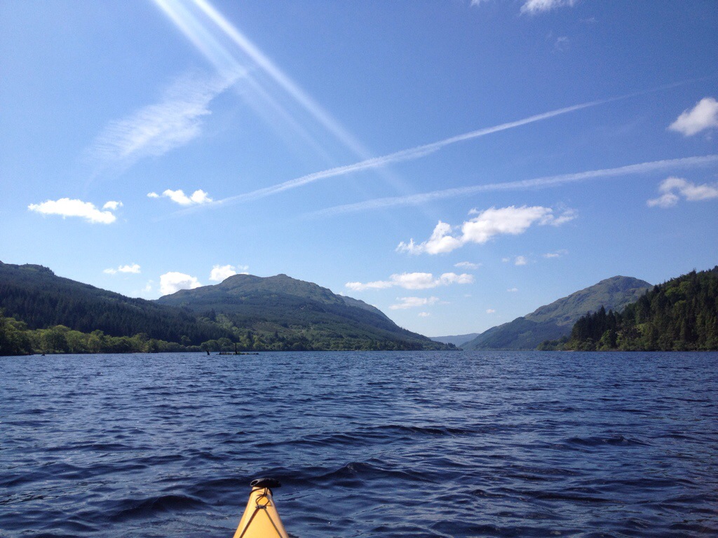
Below are all my pics (almost 100),I couldn’t bare to miss any out…………….well there is that dodgy ‘selfie’!!! Feel free to print it and it’ll keep the kids away from the fire !!
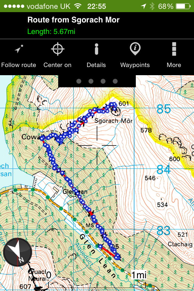
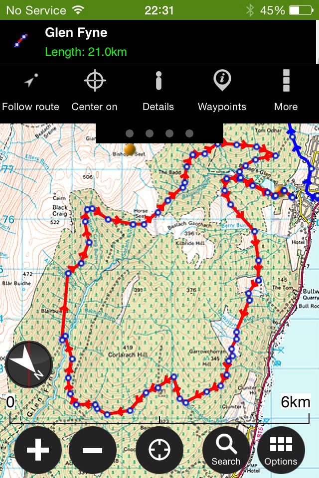
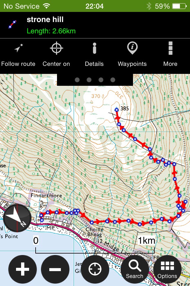
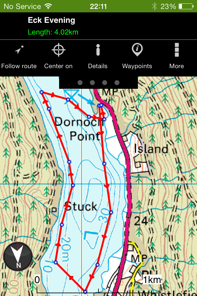
For interactive map and locations of pictures,click HERE
A walk I’ve not done for a while, Sgorach Mor was on the cards after last weeks trip ti Beinn Mhor. An interesting hill,giving great 360 degree views ( weather permitting ) not forgetting the views over Loch Tarsan.
5.7 (ish) miles :- 3 hrs.
Starting off on forestry roads,then onto a quad track (wet in places) and onwards to the open hill. The open hill is strewn with large boulders to start with along with many rocky outcrops. The summit it’s self is found on top of a rocky mass knows as the ‘volcanic plug’ !! It looks daunting on the approach but as you contour to the left and get to the rear of the hill,an easy final ascent to the summit is found. No trig point on this one,but a well defined Cairn awaits.
I made it up just in time,the clag wasn’t long in closing in on the summit.
A point to worth noting is where you come out of the tree line. Sometimes it can be hard to retrace to find your exit from the hill. I’m pretty sure there’s another way onto this hill from the top track,it looks to come out to the open hill by the burn at top of the climb then follow the fence line to Sgorach Mor, I just stuck to what I found last time up there.
Map of Route.
Interactive map with pictures and stats, click HERE
A quick note,on a trip to Beinn Mhor,one of Cowal’s Graham’s.
I decided in my wisdom to start this walk nice and early………….06.20 on Sunday morning. Needless to say the ascent was done in the dark with the aid of a head torch,switching off as I headed out of the trees onto the open hillside.
Starting of from the small car park at the top of Glenmassan,up the forestry road till it branched of to the right just beyond the old sheep fank. From here following another forestry road as it winds its way up the hill and into to trees. Eventually the road is reduced to a quad track,this is well defined and easy to follow. Once out the trees and onto the open hill I followed the track over to the left, contouring round the bottom of the hill then finally onto the ridge. The quad track from here leads you right to the summit,an easy navigation on all accounts.
I’ll do this walk again,maybe in daylight and favourable conditions so I can get some decent pictures.
Below are some pics, mostly on the way down due to darkness on way up !! Gives a rough idea of the type of terrain covered. Even encountered my first snow shower of the season !!!
360 degree video from summit
The snow shower
For some reason the GPS paused when heading to the summit, hence the ‘ as the crow flys ‘ straight line to the summit. The return shows the route better. Following the quad track makes sure you’ll find the exit from open hill to forest.
Route:Toward Hall to Glenbranter Forestry Office. Length: 26.2 miles 41.9 km Ascent: +1345m -1327m Naismith: 10h 38m (walking pace) Terrain : Forestry road and short sections of rural paved road.
I was looking to create a route similar in distance to the Loch Eck Loop, a route that isn’t weather dependent (lower level) or to difficult to navigate but still giving rewarding views. As always staying away from public roads as much as possible and making the route manageable in smaller sections if need be. The availability of public transport is always a bonus. The route can be either cycled or walked and tackled in either direction.
A scenic route, starting from Toward, South Cowal extending to Glenbranter,south of Strachur.
Leaving Toward,heading north, passing above Innellan and Dunoon enjoying view over the Firth of Clyde. Continuing through to Glenkin and on to Glenmassan, before heading to Benmore and finishing at Glenbranter.
I’m going to aim for the 26.2 miles as that’d make it a marathon, should Cowal ever hold it’s own Marathon Trail Run
Map will default to Auto,however there should be an option in the drop down menu (top right of map) to choose ‘Ordnance Survey GB’. If it’s not an option you may have to register with an email and password (Login). Perhaps set up an email and password (Login) for your club/group that can be shared.
0 miles to 9.5 miles.
Had an afternoon off work, so managed to cover the south section of Route 26. Toward Hall to the link bridge in Bishops Glen,Dunoon. Works in at exactly 9.5 miles.
Got to Toward via a lift but there is a bus service that takes you to the start point.
Further route info available on an interactive map with Route,Statistics and Pictures, click below.
Interactive map HERE.
Pictures from walk,due to light and conditions pictures aren’t the best but give an idea of views and route.
9.5 to 17.65 miles
A wet and windy Sunday morning! Might as well record some of the route in the worst conditions!!
Started off where section 1 finished at the link bridge at the Bishops Glen. This route takes in, Dunoon, Sandbank, Glenkin, Ballochyle, Lower Glenmassan and Benmore with lots to see ( weather permitting ).
Bridge to Bridge came in at 8.15 miles and took me 2hr 45mins, that’s including stopping for pics but little else in the conditions.
See below for pictures and interactive map.
Viewranger have made it possible to view pictures from the route rather than the track only. Clicking on the camera icon at each location should bring up a picture below the map. You can zoom in and out and pan round the map. Any feedback welcome on this mapping system.
I finally got round to recording the final section of route 26. This section starts off at Benmore Gardens and finishes at Glenbranter. A scenic loch side journey.
Once I’d figured out where the 26.2 accumulative total ended, I continued the loop of Loch Eck, decided to take the bike for this section so I could get the miles in.
The mathematics were done,I needed 8.55 miles to get the the 26.2 from the bridge at Benmore. Now,whilst it’s not an exact science but this distance brought me to a forestry gate,right in front of Glenshellish farm……an excellent finishing point.
Interactive map with pictures can be found by clicking HERE. It’s for the full Loch Eck Loop but details the western flank of the loch for Route 26. Could always continue and make the route an Ultra!! (38.5ish miles).
There marks the end of Route 26. Its an extra half mile to the Forestry Commissions office.
Now just to piece it all together in one run and report back.
Some scenic footage of sections 2 & 3. Dunoon to Glenbranter.
Planning on covering a route through Cowal with minimum walking on public paved roads. Whilst this can be done at lower level, I prefer off the beaten track with a bit of elevation for views. Not the easiest of walking in some areas (not defined paths all the way) , underfoot can be of varied terrain. Trying to split routes into sections that can be done in a day. Hopefully starting / stopping at points where vehicles can be left or lifts arranged,even public transport is available on some. Of course,some wild camping can be done if your that way inclined.
I’ll be updating this entry as I complete sections.
Map scale 1:25000 advisable as this shows the fence line for navigation on the latter sections.
Section 1
Dunoon(Kilbride FCS Car Park)-Bishops Seat (504mts)-Leacann nan Gall(568mts)-Cruach nan Capull(611mts)-Cruach Neuran(607mts)- Loch Tarsan (Coll dam).
Section one – Route 16kms/10 miles.
Ascent: +1229m -1167m ,Naismith: 5h 11m
Forestry road to start with then onto the open hills,navigation is aided by a fence line (which is quite convenient) once you’ve passed ‘Giants Knowe’ and contoured round the hillside.
Breakdown of route 1
Dunoon (Kilbride) to Bishops Seat
Bishops Seat to Leacann nan Gall
Leacann nan Gall to Cruach nan Capull to Cruach Neuran
Cruach Neuran to Coll Dam ( more detailed to show descent through fire break
Below are a selection of pictures,they are in sequence of the walk. Please click on them for full details.
Route to forestry road
Timber
View over dunoon
Cairns at turn of for Bishops Seat
Bridge to Bishops Seat
Views to Loch Eck and beyond
Bishops Seat summit
Cruach nan Capull in distance
Firth of Clyde
The ridge of Cruach nan Capull and summit od Cruach Neuran in the distance.
Giants Knowe looking over Glenkin.
Glemkin
Gully
Navigation aid
The 2nd climb begins
Looking back to covered ground
Loch Striven
The summit of Cruach nan Capull
Final climb to Cruach nan Capull.
Steep wee climb
Cruach nan Capull Summit
Cruach nan Capull summit
Mid Hill to Cruach Neuran
Steep descent from Cruch nan Capull to Mid Hill
Looking back to summitof Cruach nan Capull.
Out the passing shower for lunch.
Leading to burn you follow to Cruach Neuran
Following the Burn
Stag hiding…not very well!
Looking back over to Cruach nan Capull
Cruach Neuran Summit
Wrapped up after challenge.
The pool I took my ‘ Ice bucket challenge’ in. A facebook craze where your nominated by a friend in aid of charity.
Loch Tarsan
Loch Tarsan and beyond
Loch Tarsan
Entrance to fire break
Fire break descent
Avoiding wind blown trees
Forest break at Pylons
Coll Dam
Altitude Chart
Just worked out that this walk is only 123mts less in ascent than doing Ben Nevis !!! Over pretty much the same distance!!
Bishops Glen, High Loop
4 Miles (Approx)
Start/Finish Kilbride car park.
A circular route on forestry roads and tracks. Includes 1 burn crossing and one stream crossing,which are easy enough if rivers not in full spate after prolonged rain.
Leaving Kilbride car park, continuing on forestry road taking the trail on the left (marked by Blue/Yellow marker posts), climb till you meet the forestry road again.
The view will be opening up behind you.
From the trail turn right and follow the forestry road downhill to the S bend, you leave the road and cross the burn and join the path on the other side. The path continues till it meets another forestry road.
From here turn right and follow the road as it heads towards the town, you’ll eventually come to a fork in the road. Take the road on the right as it turns back on its self heading down to the link bridge and continue on the road back to the car park.
A good walk without climbing too high for stunning views over Dunoon.
Approx 13 miles on forestry roads with a river crossing.
A great circular route, giving great views. Walk it, run it or cycle it.
Starting and finishing at Kilbride car park in Dunoon,via the top road behind Kilbride hill,down Glen Fyne returning with views over the Clyde as you head from Innellan to Dunoon. Opposite to what I’ve plotted on the map, but can be done either way.
Overlooking Dunoon after climb from Kilbride car park.
Looking down Glen Fyne
The road down to the river crossing. A tad muddy due to forest operations. All good fun though.
Looking back up the Glen to the far away plantation,where the descent started.
Road conditions slightly better
Ruins of Blairbuie
The river crossing at the old concrete bridge and the wind blown road/track on the other side!
Back on the open road.
Left here.
Then left again.
The home straight,including a few bends and a wee climb at Kilbride before returning to the car park.
Also see this report for further pictures and alternative return via Innellan-Dunoon main road. Click here.
Strone Hill
385mts
5kms(ish). (3 miles)
1hr 30 mins
Never walked this hill before but I have seen it mentioned by one of the local walking clubs. In recent weeks they have carried out some clearing of the pathways, a job well done.
It was a spur if the moment decision to walk this hill,a combination of finishing work early and good weather meant I was heading somewhere!!!
Interactive map with currently up to date pictures can be found HERE
Parking just past Graham’s Point there is a tarred road just next to the housing scheme ( can’t remember the name!!). The path to the summit starts here, starting with a narrow path which leads onto a forestry road. Once the road is reached, turn left followed by a right onto the top road. This takes you to a great view point over the golf course, just after this it’s a left turn doubling back in yourself. The road on the map is more like a path in reality but easily distinguished, especially now it’s been brasher/cut back. There are a few marker posts to help guide you through the woods.
Blairmore Golf Course and beyond.
The path that leads off forestry road.
Always remember to look back and enjoy the views as you climb!!
There’s one particular steep bit that runs parallel to an old stone wall, this allows for some photo opportunities ( get breath back).
Once out the thick if the trees things begin to open up.
From here it’s a straightforward path to the summit, giving some spectacular views of the area. !!!!
Saturday morning and again I was heading to Loch Eck. This time with a purpose…to find a spot for a nights camping. There’s a couple of large beaches on the Loch,but was looking for something different.
Also wanted to try out my new stove ( Vango Ultralite,73gms) ,have had it for ages and testing it in the garage just isn’t the same.
The beach has great views and usually has on side that’s sheltered from any wind, or the options to head into the trees.
After the beach stop I headed North to the River Cur just to give the arms a work out…….looks like alligator territory up there!!!!
Whilst paddling I did notice some areas of the dreaded Japanese Knotweed growing!!! Having received an email from a member of the local walking group to record any locations I got some pictures and reported back. Hopefully the organised group will be able to treat and eradicate the problem on the shores.
Looking forward to the next visit to this beach……maybe even with the tent.
A paddle on Loch Eck was well overdue,roughly 7 months was the last time I paddled here. With a new vehicle sourced and a roof rack fitted last weekend,there was no holding me back ( well work and weather permitting,ha).
Loch Eck it was !!! Loaded up after work and took the 20 minute drive north of Dunoon. Loch Eck has a number of possible launch points and there’s usually at least one that’s sheltered from the worst of any wind. I chose to launch at the north end of the Loch at Dornoch Bay. With no set plans I decided to paddle south to Jubilee Point then cross the Loch and return on the west side passing the ruin of Stuck Farmhouse.
In the short time I had on the water I think I spent more time taking photos than I did paddling ,but in the conditions it’d have been rude not to.