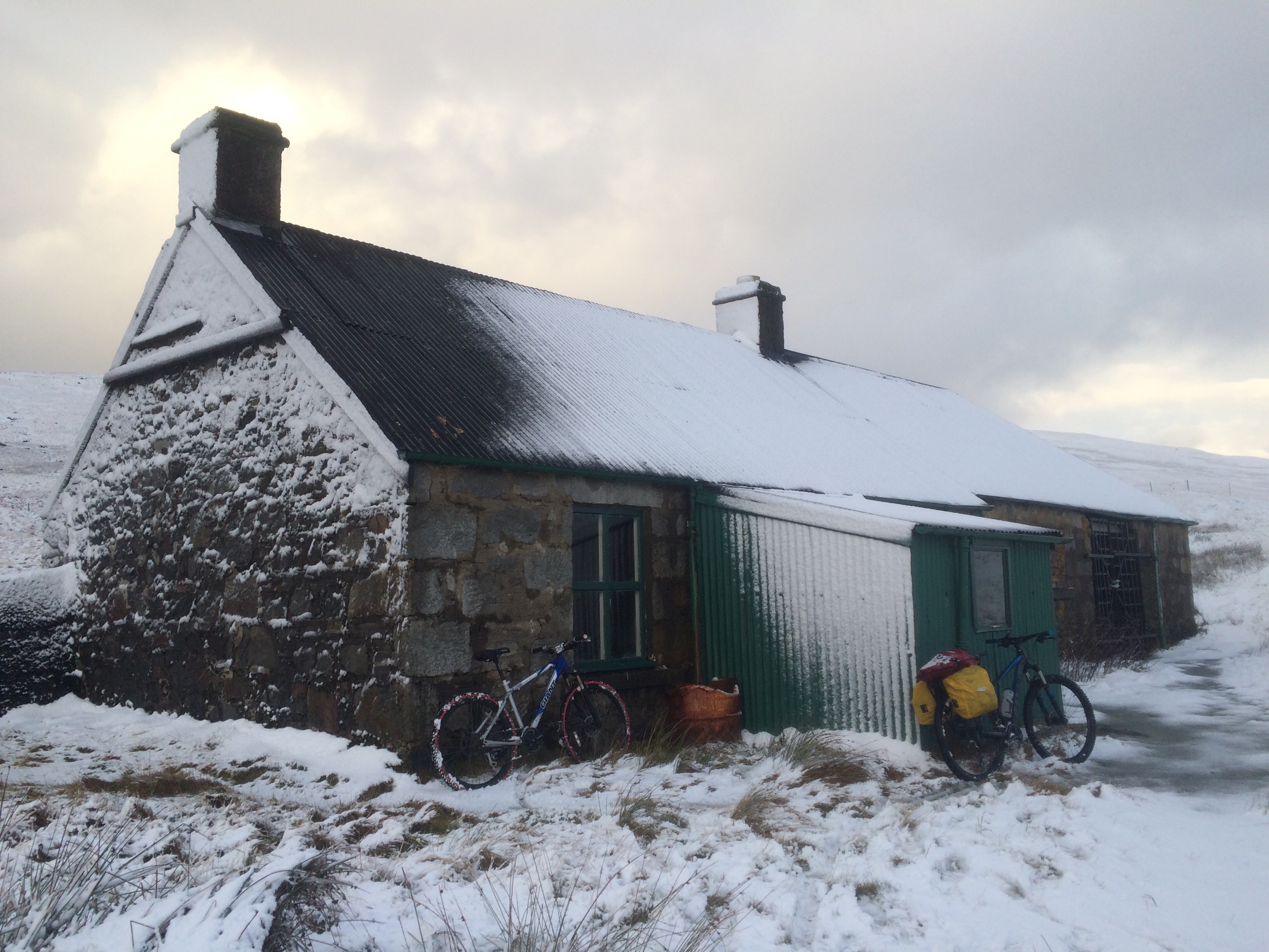
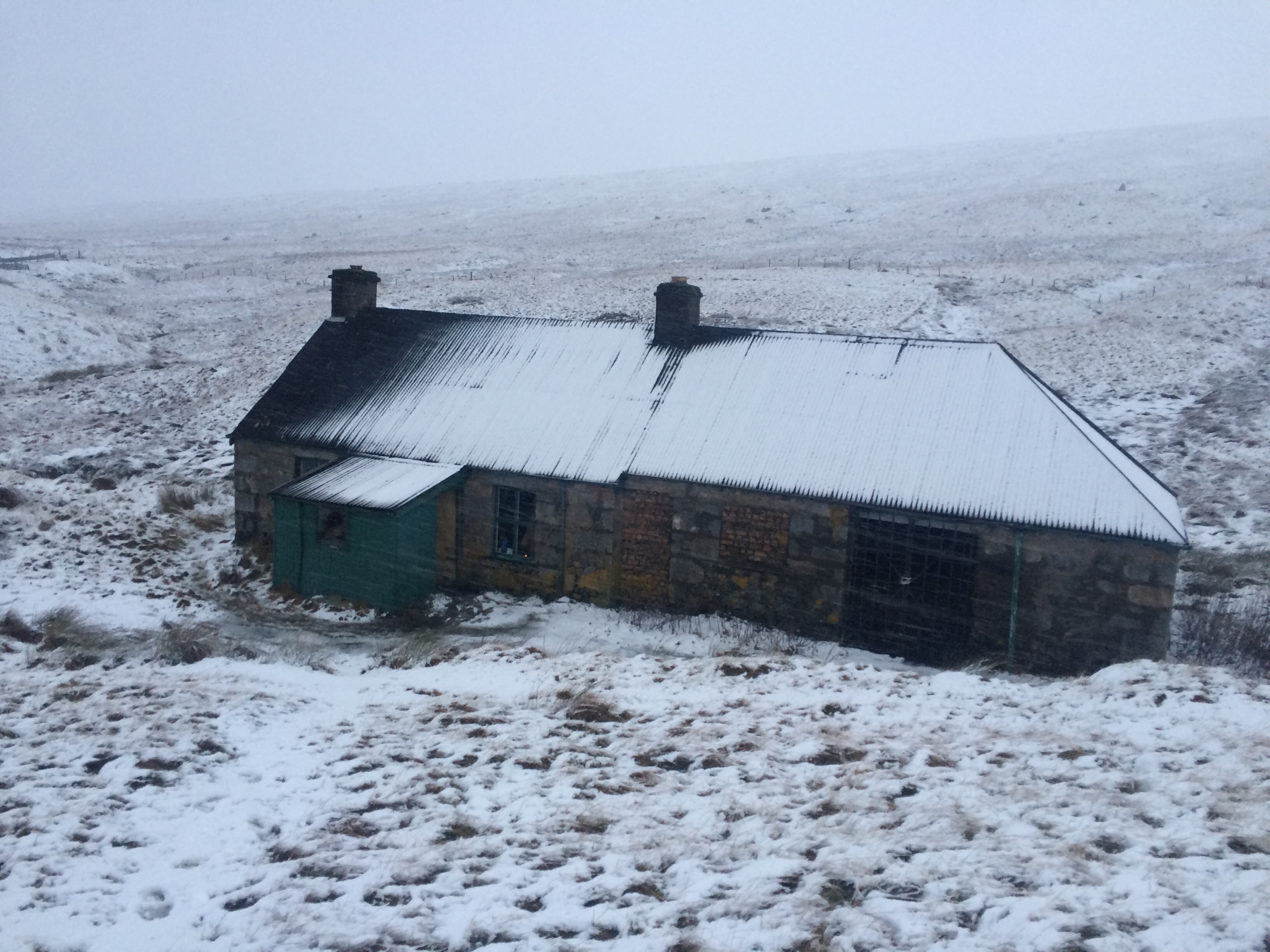
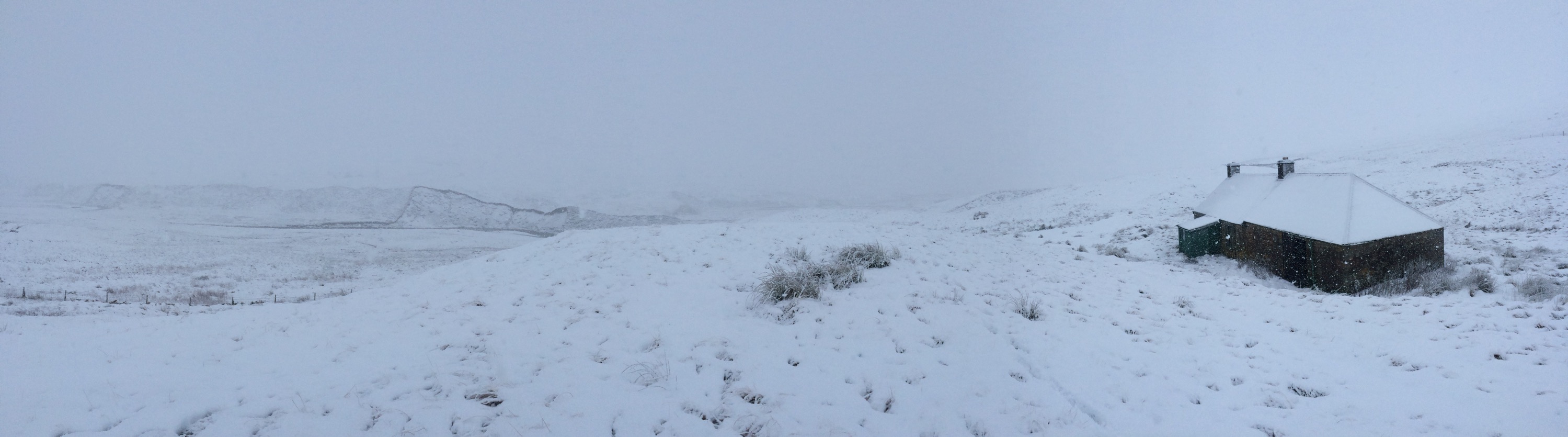
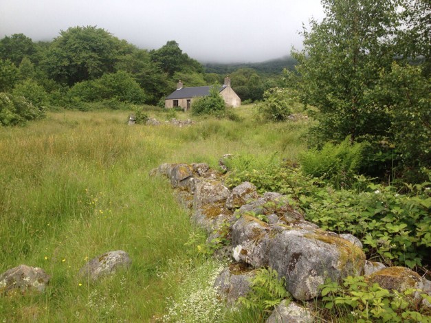
Explore Cowal

"Take nothing but pictures…leave nothing but footprints..kill nothing but time".

  • ‘Route Cards’
  • .Cowal
  • Bike Cowal
  • Kayak / Canoe Cowal
  • Walking Cowal
  • Wild Camp Cowal
  • ‘Useful Links’

Clyde Charity Swim ’16

Posted by explorecowal on July 3, 2016
Posted in: Uncategorized. Tagged: charity, clyde, dunoon, swim. Leave a comment

The normal format for the annual Clyde Swim is to leave Dunoon in RIB’s and head to the Cloch lighthouse on the eastern shore. The swimmers disembark into the Clyde and make the return journey under their own steam, landing at the West Bay,Dunoon. 
This year, due to the weather forecast a change of plan was required. The chosen start point was Seal Rock, just north of the Balaclava Garage. This guaranteed that the usual 1.6 nautical miles were covered and the finishing point stayed as originally planned. 

I volunteered to help out with the support for the event. Basically getting in the kayak to help keep an eye on the participants, should they require assistance. 

 A few pics my dad took from the shoreside.   
    
    
The brother in law coming in 2nd 👍


Some footage from the kayak at the start. 

Huge congratulations to all taking part and a huge well done to those that organised and helped on the day.  

Loch Lomond Sea Plane – West Explorer

Posted by explorecowal on June 25, 2016
Posted in: Uncategorized. Tagged: Argyll, Cowal, loch, Lomond, plane, sea. Leave a comment

IMG_6271 (Copy)

Being fortunate enough to receive a voucher for a Sea Plane tour leaving from Loch Lomond let me see Cowal (and beyond) from a totally different perspective.

The weather was dry, with a cloud base down to 400 mts in some areas. The flight route we took was Loch Lomond over to Loch Long, passing over the Waverly for some aerial photographs. Followed by a tour of the Holy Loch then heading through Glenlean to the Kyles of Bute, passing over Tarbert, Crinan and out toward Jura and Islay.The return route was via Lochgilphead,Portavadie , The Kyles of Bute, Colintaive, Toward Point then north taking in the Firth of Clyde before returning to Loch Lomond.

A fantastic way to see Cowal and it’s surroundings, West is definitely the best.

Below are only a few pictures taken on the day…………….

IMG_6274 (Copy)
IMG_6276 (Copy)
IMG_6277 (Copy)
IMG_6278 (Copy)
IMG_6286 (Copy)
IMG_6289 (Copy)
IMG_6291 (Copy)
IMG_6294 (Copy)
IMG_6302 (Copy)
IMG_6305 (Copy)
IMG_6307 (Copy)
IMG_6310 (Copy)
IMG_6313 (Copy)
IMG_6318 (Copy)
IMG_6325 (Copy)
IMG_6330 (Copy)
IMG_6331 (Copy)
IMG_6333 (Copy)
IMG_6336 (Copy)
IMG_6342 (Copy)
IMG_6348 (Copy)
IMG_6350 (Copy)
IMG_6352 (Copy)
IMG_6356 (Copy)
IMG_6359 (Copy)
IMG_6361 (Copy)
IMG_6366 (Copy)
IMG_6372 (Copy)
IMG_6375 (Copy)
IMG_6378 (Copy)
IMG_6382 (Copy)
IMG_6388 (Copy)
IMG_6390 (Copy)
IMG_6401 (Copy)
IMG_6411 (Copy)
IMG_6415 (Copy)
IMG_6417 (Copy)
IMG_6418 (Copy)
IMG_6420 (Copy)
IMG_6426 (Copy)
IMG_6428 (Copy)

Beinn an Lochain,Rest and be Thankful. 

Posted by explorecowal on May 14, 2016
Posted in: Walking. Tagged: an, beinn, Cowal, Explore, Lochain, walk. 2 Comments

Beinn an Lochain,once listed as a Munro but demoted to Corbett status after additional surveys. 

  View over Loch Restil at start of ascent. 

Views from the rocky trail that leads to the summit never disappoint, making the 1.5 mile ascent worth every step. 

Parking available in the lay-by between Loch Restil and Butterbridge.

The start of the walk is over soft wet ground,however due to the recent dry spell conditions were favourable. Once the climb starts the soft ground gradually turns to a well defined rocky path that has been carved into the vegetation of the hillside.  The ascent continues to the summit with very little in the way of level ground or drop in altitude. 

  A small and short lived scramble doesn’t pose a problem. 

The well defined and easy to navigate  path changes direction as it zig zags its way up the hill, climbing  to the base of the final ascent. It is a steep walk and the rocky trail varies over the rugged terrain. There are numerous grassy outcrops giving access to additional vistas.   


The views en route to the summit  just get better and better. 


  Summit


An interactive Map with stats and additional pictures can be found by clicking HERE. 


Dunoon – Glenkin Glen, Return

Posted by explorecowal on April 2, 2016
Posted in: Biking, Walking. Tagged: Cowal, cycle, dunoon, glenkin, walk. 4 Comments

12 Miles Walk or Cycle. 

A walk leaving from John Street, Dunoon Heading for Glenkin and completing the loop of the Glen before returning to Dunoon.

An easy to navigate route on forestry roads giving great views over Dunoon, the Holy Loch and Glenkin.

The walk can be easily extended by starting from the Bishops Glen.


IMG_5480 (Copy)
IMG_5482 (Copy)
IMG_5488 (Copy)
IMG_5492 (Copy)
IMG_5493 (Copy)
IMG_5496 (Copy)
IMG_5498 (Copy)
IMG_5500 (Copy)
IMG_5501 (Copy)
IMG_5504 (Copy)
IMG_5506 (Copy)


A fully interactive map with pictures and stats can be found HERE


Sunrise from Kilbride

Posted by explorecowal on March 7, 2016
Posted in: Uncategorized. Leave a comment

A sunrise over the Firth of Clyde, taken on the FCS Blue route. 

Route details HERE. 


Lairig Gartain and Lairig Eilde, Glen Coe

Posted by explorecowal on March 3, 2016
Posted in: Walking. Tagged: Coe, Eilde, footpath, Gartain, glen, Glencoe, Lairig, public. Leave a comment

With ideal conditions and not wanting to summit the High Tops of Glen Coe, a circumnavigation of Buachaille Etive Beag was the order of the day. A fantastic route passing through the giants that tower over the Glens. Setting off through Gartain and returning via Eilde, the sense of remoteness kicks in after you leave the noise of the A82 behind. A rewarding view of Glen Etive awaits at the half way point, the snow adding to the dramatic scene.

IMG_5206 (Copy)
IMG_5207 (Copy)
IMG_5208 (Copy)
IMG_5214 (Copy)
IMG_5220 (Copy)
IMG_5225 (Copy)
IMG_5232 (Copy)
IMG_5233 (Copy)
IMG_5235 (Copy)
IMG_5244 (Copy)
IMG_5247 (Copy)
IMG_5250 (Copy)


Interactive map with pictures and statistics can be found by clicking HERE. 

Beinn Mhor, winter walk. 

Posted by explorecowal on January 26, 2016
Posted in: Trig Point, Walking. Tagged: beinn, Cowal, mhor, walk, Winter. Leave a comment

I haven’t visited Beinn Mhor since October last year whilst on a walk with Cowalfest. 

Route and pictures HERE

Instead if carrying onto the ridge this time, once the summit was reached I headed back following the ascent route. 

A winter wonderland 👍


Bothy Basics. 

Posted by explorecowal on January 11, 2016
Posted in: Bothy, Uncategorized. Tagged: basics, Bothy, info, MBA, visit. Leave a comment


What’s a bothy ?

A bothy is a basic shelter, usually left unlocked and available for anyone to use free of charge. It was also a term for basic accommodation, usually for shepherds, stalkers or other workers on an estate. 

Where can I find out about Bothies? 

The Mountain Bothy Association has a great website, visit by clicking HERE. 

Where are these bothies ?

The MBA ( Mountain Bothy Association) website details lots of information about Bothies. In amongst that information lies a location map, giving grid references and brief information. 

Locations can be found by clicking HERE.  

Round the Bothy fire, ‘ the bothy TV’ is another great source for information. The more bothies you visit the more information you can perhaps extract from fellow visitors ( application of alcohol may be required). There are many Bothies that aren’t documented, mainly on private grounds such as estates. 
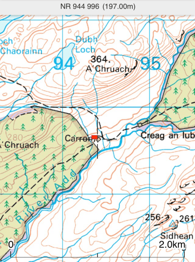
  
Grid references?

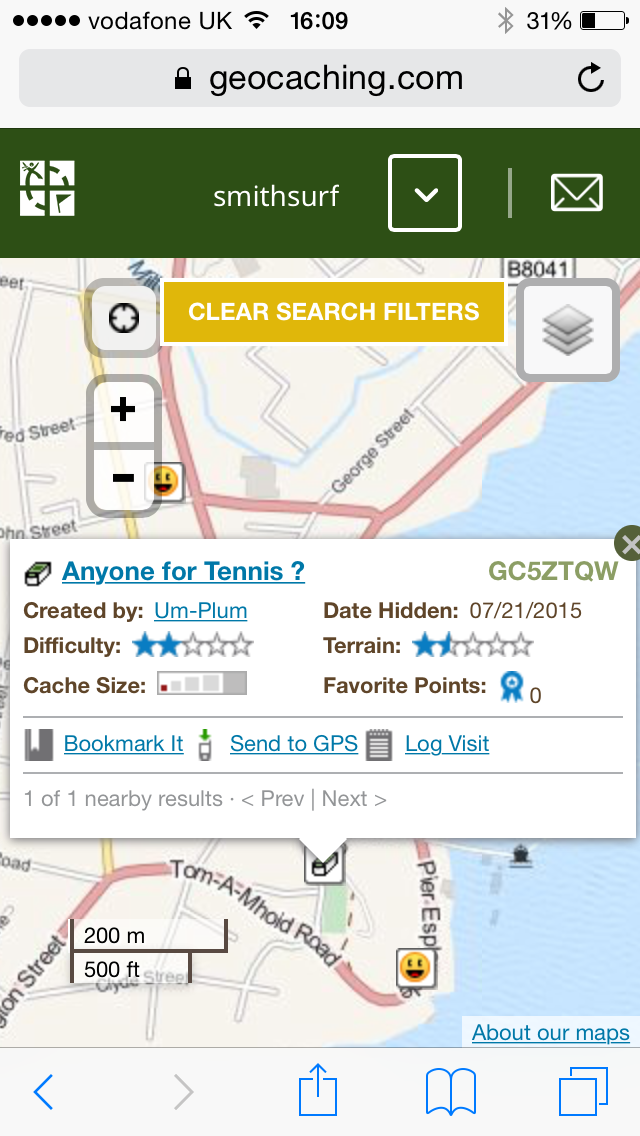
Grid references can be entered into this website, gridref.org.uk

Once the coordinates are entered it plots a point at the location.

Of course, if visiting a bothy, more so the remote ones,a map, compass and the knowledge to use them is a must. 


What to take to a bothy ?

Similar to camping minus the tent, although a tent can sometimes be a good idea should a bothy be full on arrival. Although some say, ‘a bothy is never full’ and you’ll always find a space. 

Having a tent gives you somewhere to retire to as the well known bothy shenanigans carry on into the wee small hours. 
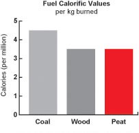
  

 Fuel for the fire. 

The majority of bothies have a fireplace or a stove. It’s always worth carrying in any fuel you can, some bothies have no nearby resources. 

Fire lighters and candles are handy too. 


Membership of the MBA is optional, but any monies raised from membership fees go towards maintaining these fantastic buildings. A worth while cause and money well spent. 

Membership info HERE. 

Some bothies I’ve visited and info, click HERE. 

Basic guidelines. 

As bothies are located in such remote places some are affected by deer stalking and other estate activities. The MBA detail contact info and activity timings. This could restrict access and some bothies may be closed for a duration. 

Outdoor access Scotland – Hill Phones , is also a provider of Stalking information. Visit the site by clicking HERE. 

The call of nature. If you need to go, you need to go. There’s usually a spade at each bothy, this isn’t for turning over the flower beds! Out with the  vicinity of the bothy and away from any water courses. 

Always leave a bothy as you found it, if anything, in better condition. Take all rubbish back out with you. Leaving any spare fuel or scavenging some wood for the next person is good practice. 

Perishable foods should not be left as this encourages vermin. 

The Bothy Code, click HERE 

Most importantly………. ENJOY! 
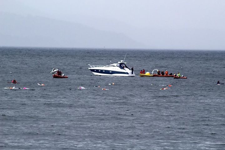
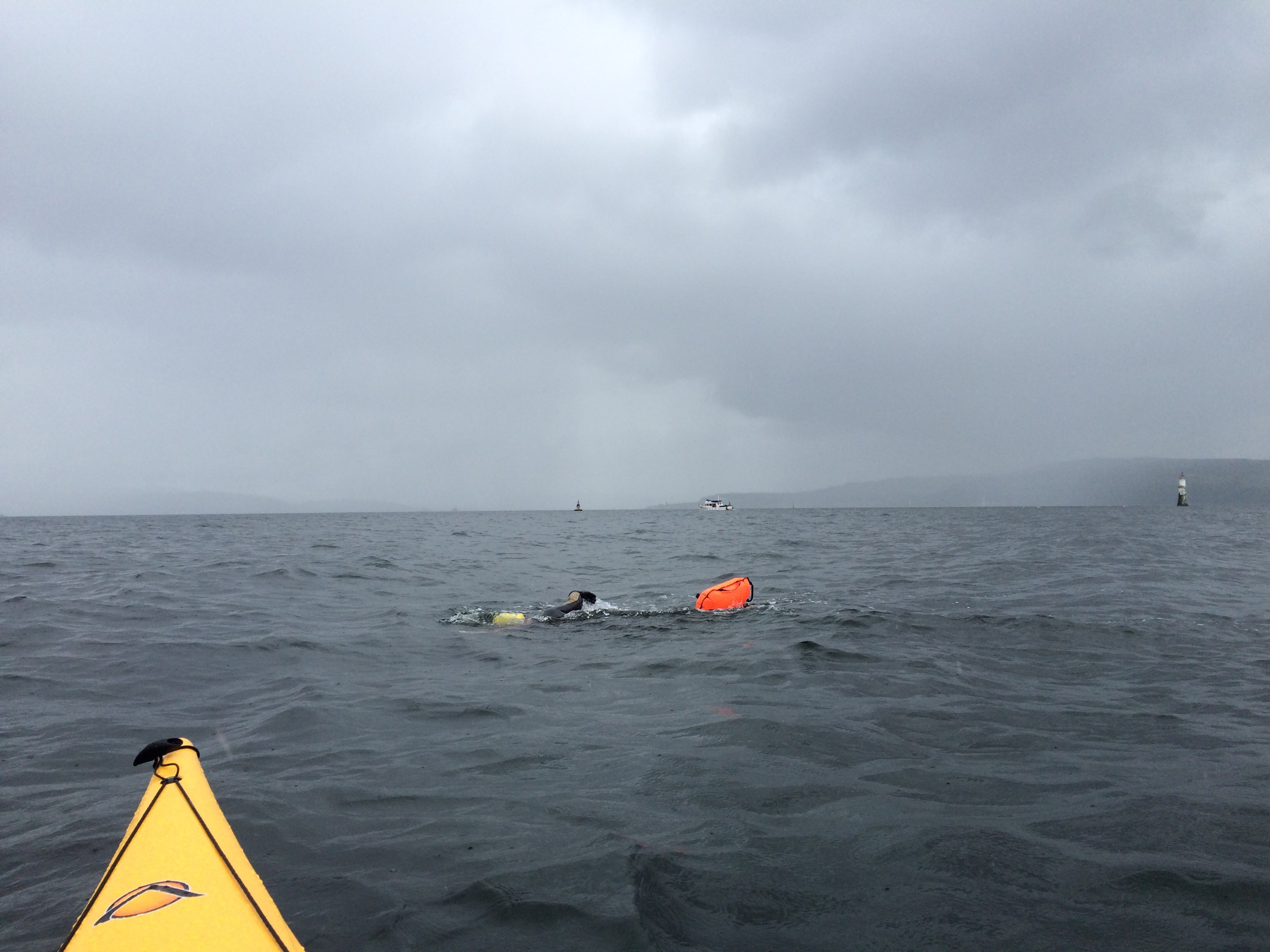
  

Viewranger & Geocaching via Drop Box

Posted by explorecowal on January 4, 2016
Posted in: Viewranger. Tagged: dropbox, geocaching, viewranger. 4 Comments

  
Viewranger is the app I use whilst out and about on the hills, mapping and navigation my primary usage. 

Viewranger website. 
With my daughter turning 3 and looking for something to do that’d keep her interested whilst out and about………Geocaching! 

  
Geocaching website. 
I took part in Geocaching as a training platform  to familiarise myself with a new GPS many years ago for off road driving.  It involved downloading GPX files to my PC  (easyGPS ) then again transferring to my GPS,a drawn out process. 

Having Viewranger on my mobile device ( iPhone 5s) gives me access to the maps I own. Points of interest such as Geocaches can be added manually, again a slow process. 

Viewranger files can be stored and shared in Dropbox available within the app. Available to share and upload/download. 

Not sure if this the easiest way for transferring caches from Geocaching to Viewranger but it works for me as far as plotting goes, no manual input required. 

Step 1.  

Find cache on website. 

 
Step 2. 

Open detail. 

 
Step 3. 

Click on Cache name for additional data. 

  
Step 4. 

Click Loc waypoint file (GPX file is greyed out and unavailable) ?

Step 5.

Choose open in Dropbox ( account should be have been created and logged into prior to transfer ). 

  
Step 6. 

Create and store in Viewranger file, amend file name to one you’ll recognise. 

  
Step 7.

File now appears on list. 

 
 Step 8.

Open Viewranger, when in maps goto Settings then Import/export and select Dropbox. 


Step 9. 

File will be available to open and import. 


Step 10. 

Cache should appear on map. 

  
Job done. Easy to one repeated a few times. 👍


MBA. Gorton Bothy (Outwith Cowal)

Posted by explorecowal on December 11, 2015
Posted in: Bothy, Uncategorized. Tagged: Bothy, gorton, MBA. Leave a comment

Gorton Bothy, maintained by the MBA is situated north of Tyndrum approximately 5 miles from the main road.

Stone built with corrugated roof. Wood cladding to interior walls and ceilings. Two rooms, one with open fire. No raised sleeping platforms. The building extends to the east, this section is used for storage of farm materials ( locked ). Porch of timber construction, ideal storage area.

Fuel: Nothing at location. Take fuel in.

Altitude : 302 mts.

Bike friendly : 10/10


Posts navigation

← Older Entries
Newer Entries →
  • Recent Posts

    • YouTube
    • North West Loch Striven from B836
    • Strachur, Hill Lochs and Waterfalls. Scotways routes 97 and 98.
    • Cnocan Sgeir’e Trig point – Glendaruel
    • Cruach nan Capull Trig @565mts, St Catherine’s/Cairndow
  • Topics

    • About
    • Bikepacking
    • Biking
    • Bothy
    • Cowal High Way
    • Cowal Way
    • Cowalfest
    • Family
    • forestry commission
    • Gear
    • Heritage Paths
    • Outwith Cowal
    • Paddling
    • SIB
    • Trig Point
    • Uncategorized
    • Viewranger
    • Walking
    • wildcamp #microadventure
  • Blog Stats

    • 213,392 hits
  • Contact

    explorecowal@gmail.com
Blog at WordPress.com.
Explore Cowal
Blog at WordPress.com.
  • Subscribe Subscribed
    • Explore Cowal
    • Join 53 other subscribers
    • Already have a WordPress.com account? Log in now.
    • Explore Cowal
    • Subscribe Subscribed
    • Sign up
    • Log in
    • Report this content
    • View site in Reader
    • Manage subscriptions
    • Collapse this bar
 

Loading Comments...