Explore Cowal

"Take nothing but pictures…leave nothing but footprints..kill nothing but time".

  • ‘Route Cards’
  • .Cowal
  • Bike Cowal
  • Kayak / Canoe Cowal
  • Walking Cowal
  • Wild Camp Cowal
  • ‘Useful Links’

DD Hammock and Tarp. 

Posted by explorecowal on March 10, 2015
Posted in: Gear, wildcamp #microadventure. Tagged: DD, Hammock, tarp, Travel. 1 Comment

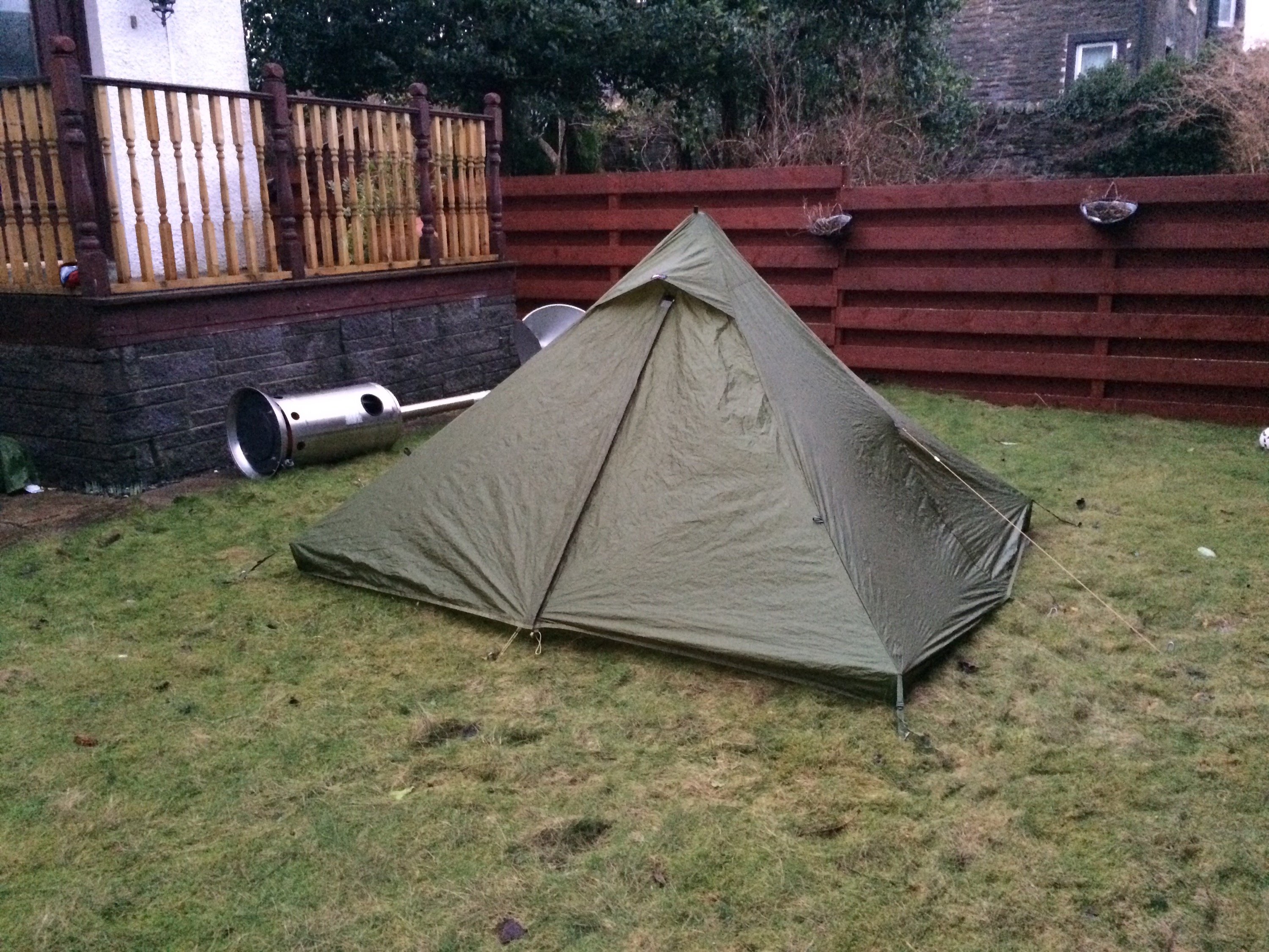
An alternative way to spend the night in the great outdoors!!! 

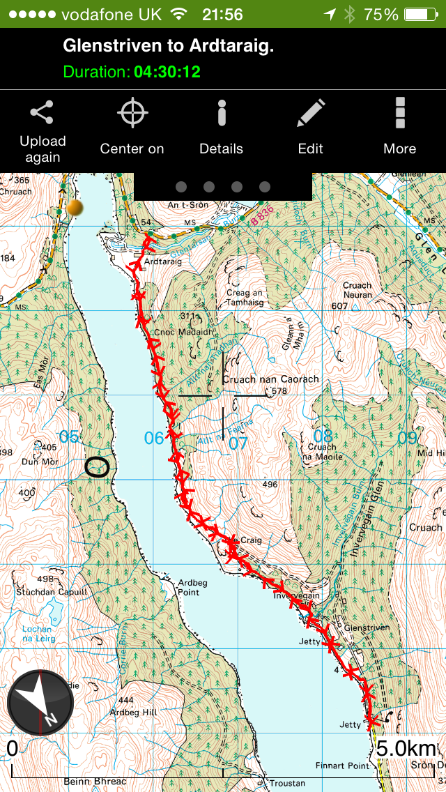
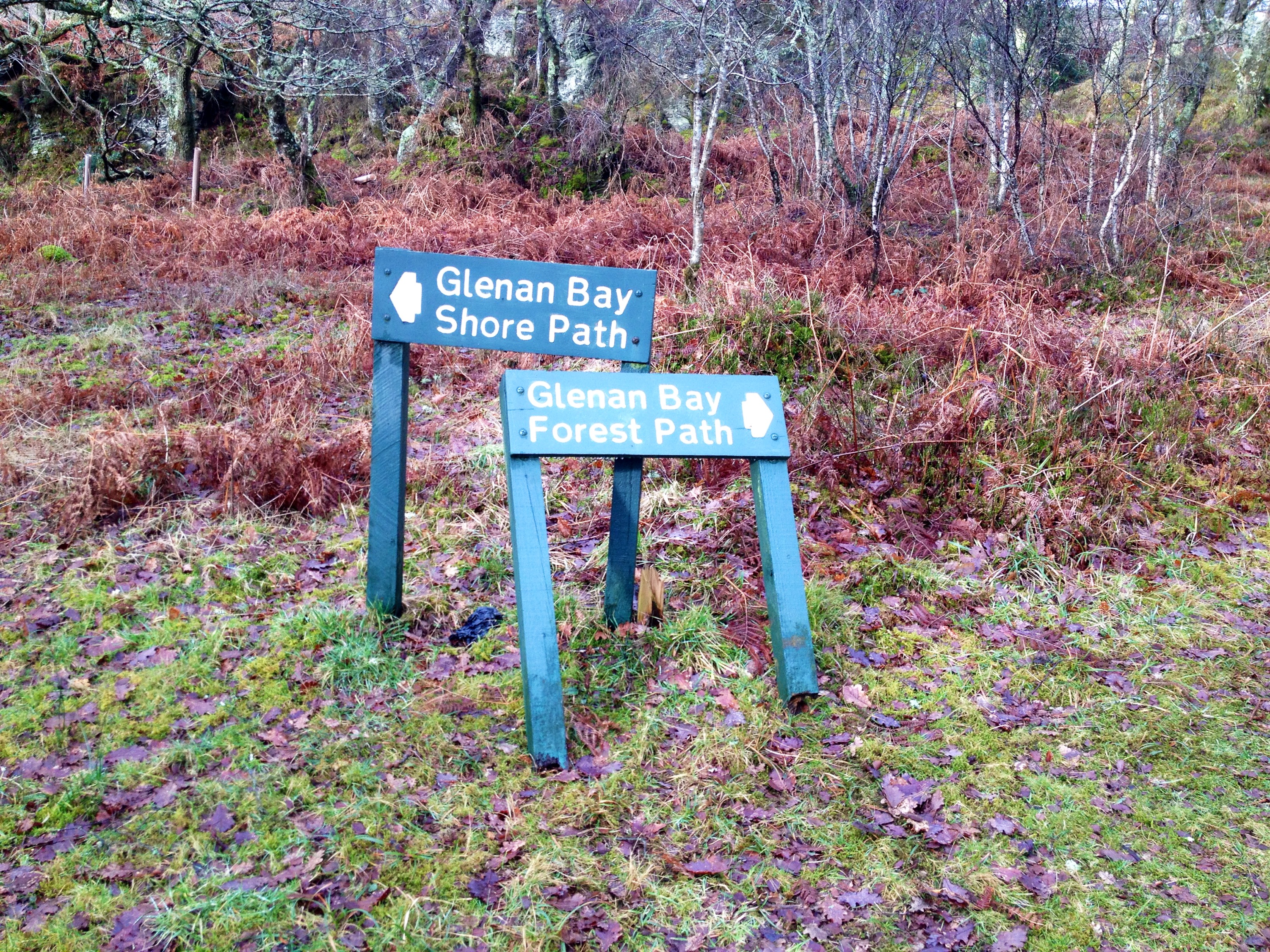
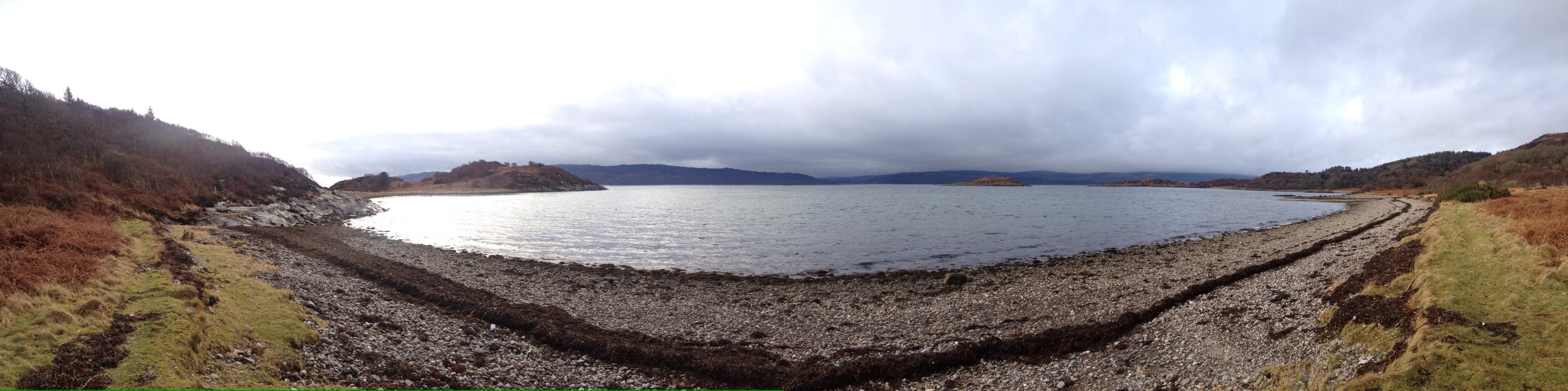
My friend has a similar (newer) set up to this ,I was never convinced on the whole hammock concept . However whilst on a recent walk looking for a nice flat, clear site that’d suit a tent….I found nothing. 


Whilst browsing the classifieds of an outdoors forum I found these up for sale at a bargain price. Older versions but never used. 
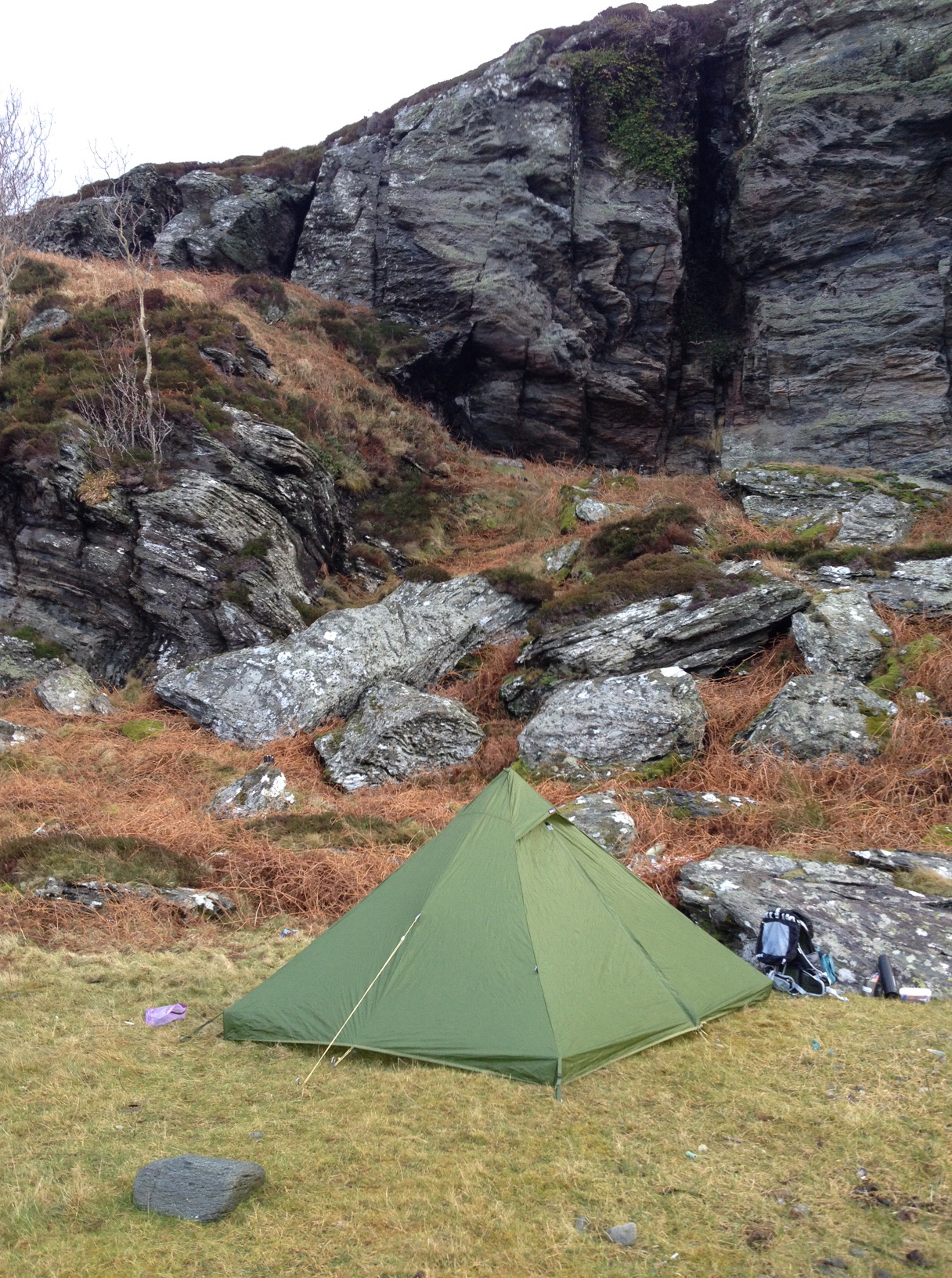
DD Travel Hammock


DD Multicam Tarp


The advantages of a Hammock are the fact your off the ground, can be pitched over rough terrain or even on a slope. Disadvantages are slightly longer set up time ( this will improve over time) , the sleeping position may not suit everyone and … the need for trees!!!! 

Dependant on weather it could be Tarp first then Hammock, Hammock then Tarp or even just the Hammock on its own. 

Tonight was just a trial set up, seeing what goes where. Plenty of room for improvement, fine tuning the set up to make it easier and faster. At one point it had more lines set up than a British Telecom exchange. 

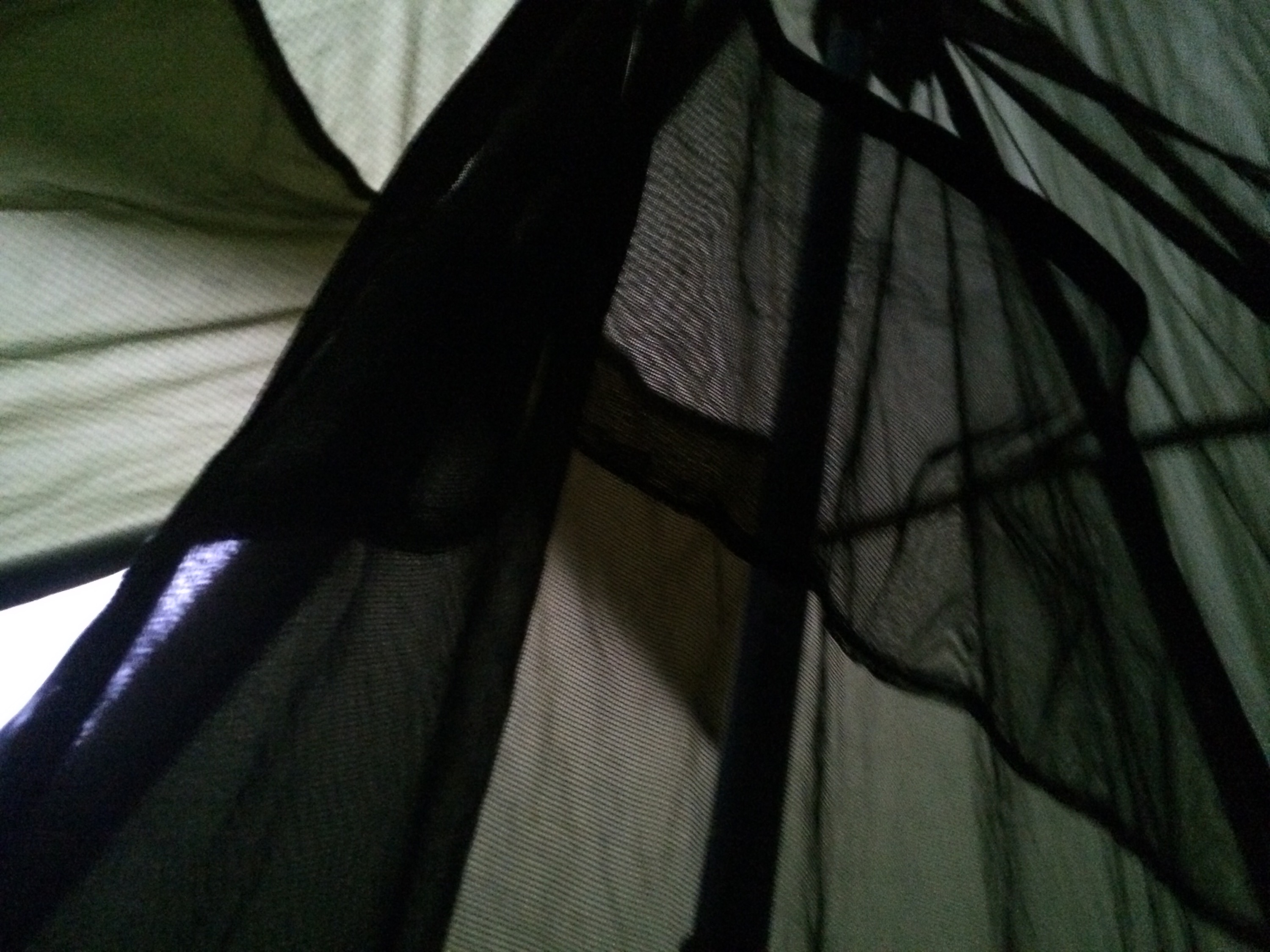
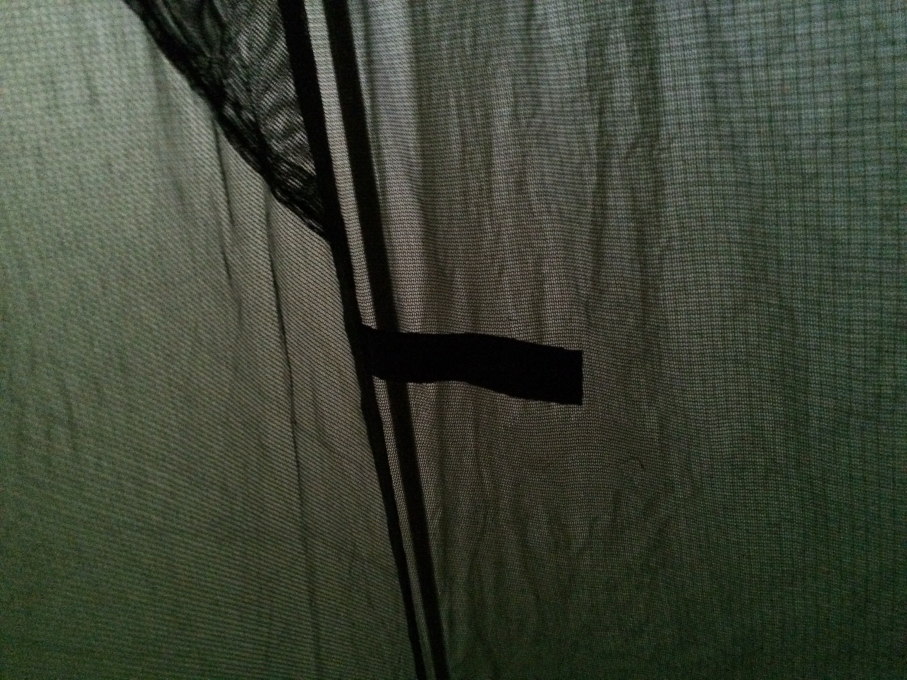
The Travel Hammock  has a built in mosquito/ midge net. A second layer in the base to allow a sleep mat or under blanket to be inserted and a waterproof base that means the hammock can be used as a bivi if ground dwelling. 


Hammock set up


Net lifter with stick ‘spreader’

The newest version comes with small poles as standard , but the spreader loops are designed to take sticks. These are attached to the tree either end but can be put onto the ridge line of the tarp if using one. 


Looking forward to trying it on an overnighter to see how I take to it. Never know you may see it for sale……at a bargain price.  

Will report back after I’ve survived my first night with this setup. 


Puck’s Glen – Lower Glen – Cowal’s Amazon forest.

Posted by explorecowal on March 8, 2015
Posted in: forestry commission, Walking. Tagged: benmore, glen, pucks. 2 Comments

A wee walk round the lower section of Puck’s Glen this morning,the burns in spate after yesterdays rain.

An ideal walk for the family,but as always,where near water care is needed on the uneven paths and steps.

Combine this walk with a walk from the Puck’s Glen car park to Benmore Gardens for a bite to eat at the Cafe.

DSCF6743 (Copy)
DSCF6742 (Copy)
DSCF6741 (Copy)
DSCF6739 (Copy)
DSCF6738 (Copy)
DSCF6736 (Copy)
DSCF6734 (Copy)
DSCF6733 (Copy)
DSCF6731 (Copy)
DSCF6728 (Copy)
DSCF6727 (Copy)
DSCF6726 (Copy)
DSCF6725 (Copy)
DSCF6724 (Copy)
DSCF6723 (Copy)
DSCF6721 (Copy)
DSCF6720 (Copy)

Rifle Range, Bishops Glen.

Posted by explorecowal on February 22, 2015
Posted in: Walking. Tagged: Bishops, dunoon, glen, range, rifle, target. Leave a comment

Had looked for this on one previous occasion, but no joy. However on today’s wander i stumbled across part of the old Rifle Range dating back to what possibly could be World War I.

IMG_9905

Remainder of the target lifts and surrounding brickwork.

IMG_9904

IMG_9903

More info on the site can be found by clicking HERE.

Heritage Paths.

Posted by explorecowal on February 18, 2015
Posted in: Heritage Paths, Walking. Tagged: Cowal, heritage, of, paths, Rights, way. Leave a comment

IMG_9869

On a recent walk I discovered Heritage Paths. There are a number of these within Cowal.

Heritage Paths..“Heritage paths are old routes that have been used for a specific purpose, examples include:

Roman roads
Drove roads
Pilgrimage routes
Miners’ paths
Trading paths
Military roads
Turnpike roads
Shieling paths
”

Paths local to Cowal are:-

– Glenstriven to Ardtaraig , Loch Striven. 7.5kms
– Old road through Strath Eachaig, Pucks Glen to Benmore Gardens. 1.7kms
– Lochgoilhead carriage road, Bridge to Bridge adjacent to the B839. 3.25kms.
– The Dukes Pass, Lochgoilhead to Mark Cottage, Loch Long. 9.5kms.

More information on the paths click…Heritage Paths

My reports on the walks ( updated as I complete them ). Click on route name for information.

Glenstriven to Ardtaraig.

IMG_9868

Glenstriven Estate to Ardtaraig Estate………..and back.

Posted by explorecowal on February 15, 2015
Posted in: Heritage Paths, Walking. Tagged: Ardtaraig, footpath, Glenstriven, heritage, loch, of, paths, right, striven, walk, way. 1 Comment

A walk I’ve been wanting to do far a while. Originally intended on doing this in January but on advice I waited till the shooting season has finished. Pheasant season finishes on the 1st of February and starts again 1st of October. The early part of the year is a good time to do this walk as all the bracken has died back, making it easier to navigate the path.
The footpath joins up two shooting estates that border the shores of Loch Striven and connects the C10 to the B836.
It’s a Right of Way as publicised by HERITAGE PATHS that covers just over 4.7 miles each way following an old track through natural woodlands between the two esates.

IMG_9815 (Copy)

There isn’t any signs for the Pathway on the Glenstriven side,so it’s advisable to get a copy of an OS Map. The path is detailed on both 1:50k and 1:25k.
Starting off from Glenstriven it was an easy walk through the estate,firstly turning left onto the shore road and following it past the cottages,over the bridge and uphill to the turn off point.

Parking
Parking
Start of the Estate
Start of the Estate
Paved access
Paved access
Shore Rd
Shore Rd
Past the cottages
Past the cottages
Boathouse , looking back
Left,down towards the shore
Loch Striven
Loch Striven
Continuing uphill
Continuing uphill

The turn off at apex of the bend.

IMG_9773 (Copy)

Once on the track there was an option of left or right,right being the wise choice. The path is defined by a narrow track winding its way through the heather then on to more open ground and woodland.

Narrow trail
Narrow trail
Open hillside
Open hillside
Ardbeg ruins on far side of Loch
Old gate
Old gate

The map shows a number of Fords to cross,but these are easily negotiated.
The remainder of Bot nan Creagan can also be founf en route.

One of the Fords
One of the Fords
IMG_9783 (Copy)
Path
Path
Sheep fank ?
Sheep fank ?
Views up the Loch
Views up the Loch
Ruins of Bot nan Creagan

Onwards to Ardtaraig,the path still well defined. Some sections do fade away but are picked up again in no time. There’s a number of trees down over the path,but these are easly negotiated either by threading yourself through them or going round the obstacle.

Path
Path
PAth
PAth
Trees down
Trees down
...and cleared
…and cleared
Loch n hills
Loch n hills
Pass the boulder
Pass the boulder

Mussel Farm

Mussel Farm

The gated Boundary between the Estates.The Ardtaraig side is the smaller section,once through the gate its a short section of path then onto the hardcore road. I went round the front of the first house/chalet along the beach then up onto the road.
From here it’s straight on towards the big house then passing to the right of the barn with green doors.

Boundary Gate
Boundary Gate
1st Sign
1st Sign
Short path section
Short path section
Shore at the Chalet
Shore at the Chalet
Road
Road
Stile
Stile
Ardtaraig house
Ardtaraig house
Pass to the right of the building with green doors

The final section once through the back of the estate is to pass the next barn to the right,heading over the bridge and follow the path as it winds it’s way to the B836, you have arrived at your destination! Well…retrace your steps to pick up the car!

Shed/barn,pass to right
Final section of path
Gate to main road.
Gate to main road.
Pole...but a missing sign
Pole…but a missing sign
Looking back down the path from B836

Some pictures of the signs i never seen on the way in. There is also some old faded tape round a few trees.

Return Sign
Return Sign
..and another
..and another
Tape
Tape

A fully interactive map is available by clicking HERE. Contains locations of pictures and some stats.

Basic map.

IMG_9839

Useful links

Heritage Paths
Glenstriven Estate

Can’t find anything for Ardtaraig.

Light my Fire. (LMF)

Posted by explorecowal on February 14, 2015
Posted in: Gear, wildcamp #microadventure. Tagged: fire, fireknife, light, my, rope, sweedish, tinder. Leave a comment

Tinder on a Rope

IMG_9665

-Easy to light even when wet.
-All natural & environmentally-friendly.
-Up to 80% resin content.
-It is the resin (oil) that burns not the wood.
-Burns with a hot flame compared to paper and paraffin.
-No “dangerous goods” shipping restrictions
-150x22x22 mm, 50-70 g.

A great way to start a fire. I’ve only tried this out in the garden so far, but it’s always good to familiarise yourself with new products before using it in a real scenario.
The tinder lights up straight away, burn time is dependant on how much fuel you use and the thickness you shave off the tinder stick.

A wee demo video…
( excuse the blunt knife and lighter, I now have the LMF Fireknife).

Swedish FireKnife

IMG_9679

-Flexible and sturdy profile-grounded blade.
-Sheath with clip.
-High-friction rubber handle.
-Includes an original Swedish FireSteel® firestarter.
-Lights campfires, gas-stoves, gas-barbecues.
-Works equally well when wet.
-Predictable performance at all altitudes.
-Produces a 2,980°C (5,400°F) spark.

A knife and Swedish Fire Steel in one….perfect.

Will update as I trial…….

Both items available from Argyll Outdoors

IMG_9759

Kilbride Bay, Winter Picnic

Posted by explorecowal on February 10, 2015
Posted in: Family, Walking. Tagged: beach, Cowal. Leave a comment

In summer time this place is always busy,but in winter most tend to forget about it.
At just under a miles walk from the roadside, there’s no excuse not to visit this gem of a beach.
Navigation isn’t a problem as it’s well signed and the defined path leads you to the beach.

A Golden beach with shallow waters, an ideal spot for some beach combing or a wee picnic with the family.

IMG_9724

IMG_9726-0

IMG_9727-0

IMG_9728-0

IMG_9729

IMG_9731

IMG_9737

IMG_9741

IMG_9734

Simple……

Posted by explorecowal on February 10, 2015
Posted in: Uncategorized. Leave a comment

IMG_9722-0

Portavadie. Walks in the West.

Posted by explorecowal on January 29, 2015
Posted in: forestry commission, Walking. Tagged: bay, glenan, low, portavadie, ruin, settlement, standing, stillaig, stones, town, walk. Leave a comment

Home of the starting point of the Cowal way, an ever expanding impressive Marina, historic settlements and standing stones.

IMG_9307

With the forecast for wind, rain and poor visibility I decided to do some lower level walks. Both walks were new to me and contained points of interest, mainly the Standing stones of Low Stillaig and the old settlement of Glenan.

Low Stillaig, 4 miles

Parking at the end of main road the route to the small summit and view point is well signed and marked out. A well defined track guides the way through the open landscape towards the wee summit.

IMG_9305

A stop off at the Standing Stones for a picture. They date back to 2,000 years BC.

IMG_9306

Summit panoramic…..

IMG_9309

From here I headed round the hill down to the ruins of Low Stillaig. There’s no defined path here that I could see but the surrounding bracken had died back meaning easy progress.

IMG_9310

IMG_9312

From here I picked a route heading for the isthmus that gives access to Eilean Aoidhe, I went down past the house that looks as if it’s amidst renovation. Sections here are pretty wet and there’s a wee burn to step over further on.
I’m always on the look out for kayaking stop off points and campsites so this area didn’t disappoint. Perhaps that is why the BB group chose this location for their hut.
Once on Eilean Aoidhe it was time for a coffee and the chance to try a set up of my new tarp tent at a great wee location.

IMG_9323

Coffee finished and packed up , return was made via the BB hut then following the farm road to the main road passing another standing stone en route.

IMG_9327

IMG_9328

Glenan Bay and old Settlement, 2.4miles.

IMG_9611
An abandoned settlement surrounded by an Oak and Birch woodland.

Second walk of the day. A walk through the woodlands to the old settlement of Glenan, returning on the coastal route.
Leaving from the Forestry car park situated prior to the ferry, an information board offers a map and further details of the walk.

IMG_9334

IMG_9335
Setting off through the picnic site picking up the woodland trail once over a few rocky steps. Navigation again is easy, as the well trodden path guides you through the woodland.

IMG_9337

It is wet underfoot so a good pair of walking boots are essential, or a pair of wellie boots. There are a few welcome walkways that keep you above the very worst.

IMG_9342
There’s also in impressive tree that forms 3 arches.

IMG_9343

The final approach to the settlement involves crossing a wee burn, but there is a small bridge that spans it just upstream.

IMG_9345

The old abandoned settlement awaits.

IMG_9347

IMG_9351

IMG_0460

After spending a while at the site I retraced my steps, turning right when prompted for the return via Glenan Bay.

IMG_0463

The Bay

IMG_0466-0

Heading back towards Portavadie weaving through the rocks to pick up the woodland walk back to the car.

IMG_9357

IMG_9359

Map showing the two walks.

IMG_9361

Whilst the weather wasn’t the best the views and points if interest were worth the walk. I’ll need to revisit in better clearer conditions to enjoy the vistas.

55.946097 -4.932299

Sil Mini Peak, lightweight tent/shelter

Posted by explorecowal on January 23, 2015
Posted in: Gear. Tagged: gear, mini, peak, shelter, sil, tarp, tent, test. Leave a comment

2015/01/img_9479.jpg

Specifications:

Fly: 40D/230T Siliconized nylon ripstop fabric
Fly: HH 2000mm
Inner Tent: High density nylon mesh
Floor: PU Coated nylon with HH 4000mm
Guys: 11 supplied with glow in dark line locks
Weights: Tarp 710g, Nest 418g, Pegs 116g = Total 1244g

A lightweight shelter that can be erected with the use of a walking pole or an adjustable tarp/tent pole. It even has a loop so it can be pitched from the branch off a tree!! Basically an outer and an inner, the inner taking up half the floor space giving plenty of room for storage or cooking in the remainder.
The inner has a ‘bathtub floor’ with netting to keep the bugs out. This is attached to the outer pegging points and to a hook at the peak of the shelter……simple.
The outer is made from siliconised nylon ripstop fabric, light and strong. The corners have a stiffening band giving a box like construction ensuring the outer is kept low to the ground, minimising draughts.

2015/01/img_9487.jpg
Inner

2015/01/img_9483.jpg
Handy pocket

2015/01/img_9484.jpg
Attach a light here

Best thing about this is the weigh….1224kgms ( excluding pole).

I’ll update as I put this to use, hopefully soon.

See a video by the stockist ‘Bob’ for further details. Or visit his site HERE

Took the Sil out for a walk today. An ideal haven for a coffee stop away from the elements.

Sil Mini Peak

Modification

Carried out a wee modification, seen it on the Internet. The 4 main pegging points are loops at the end of the adjustable webbing. However with these being flat they need to be twisted when pegging down. Simple fix, some triangular loops threaded onto the webbing allowing a straight even pull.

IMG_9624

IMG_9626

IMG_9621

Posts navigation

← Older Entries
Newer Entries →
  • Recent Posts

    • YouTube
    • North West Loch Striven from B836
    • Strachur, Hill Lochs and Waterfalls. Scotways routes 97 and 98.
    • Cnocan Sgeir’e Trig point – Glendaruel
    • Cruach nan Capull Trig @565mts, St Catherine’s/Cairndow
  • Topics

    • About
    • Bikepacking
    • Biking
    • Bothy
    • Cowal High Way
    • Cowal Way
    • Cowalfest
    • Family
    • forestry commission
    • Gear
    • Heritage Paths
    • Outwith Cowal
    • Paddling
    • SIB
    • Trig Point
    • Uncategorized
    • Viewranger
    • Walking
    • wildcamp #microadventure
  • Blog Stats

    • 213,395 hits
  • Contact

    explorecowal@gmail.com
Blog at WordPress.com.
Explore Cowal
Blog at WordPress.com.
  • Subscribe Subscribed
    • Explore Cowal
    • Join 53 other subscribers
    • Already have a WordPress.com account? Log in now.
    • Explore Cowal
    • Subscribe Subscribed
    • Sign up
    • Log in
    • Report this content
    • View site in Reader
    • Manage subscriptions
    • Collapse this bar
 

Loading Comments...