Decided to try something different,a bike followed by a hike to get to this trig point.

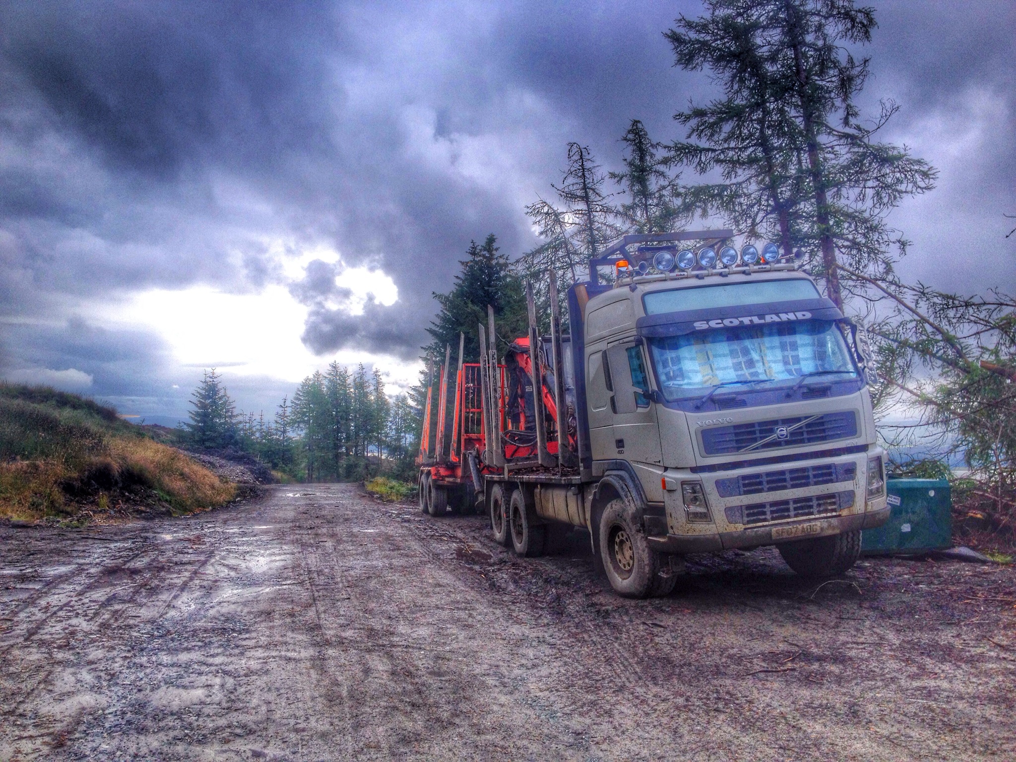
Parking at Glenbranter at the FCS car park, I headed off on the bike for the forestry road section. I’d found an ATV track by chance when descending from Beinn Bheag a good while back, so relocating this track for access to the hill was the next step. Remarkably I found the track, as if I was there yesterday, just as I remembered. The track too steep to cycle up, I pushed the bike the point of the washed out burn crossing then walked the remainder and onto the open hill. There’s a couple of splits in the track, two lefts and a right gets you onto the hill. The second left hand track was unknown to me as my descent on last trip came from the right, but the choice paid off.
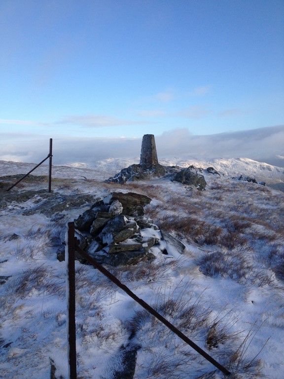
The track took me out at the base of the hill, leaving a short and steep ascent to the trig, far easier than I thought it’d be.
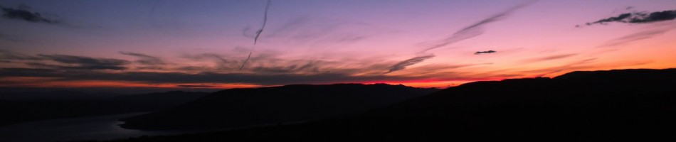
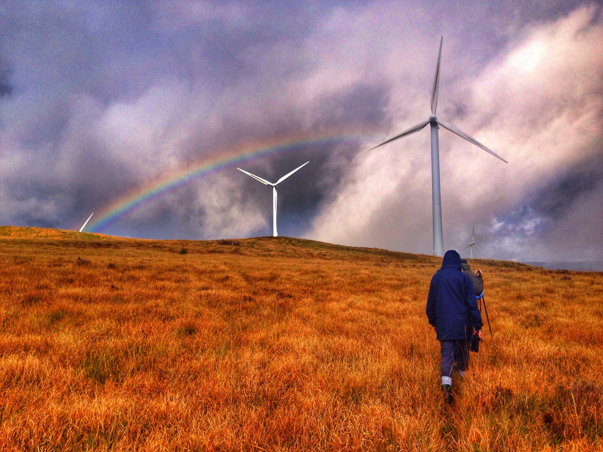
Stunning views were to be had, snow covered hills and mountains all around, along with partial views over Loch Eck.
I remember seeing a mast at the top of this hill many years ago, but it had vanished and I never thought anything about it…….until I reached the summit. The control station still exists along with the dismantled mast, the internals of the station stripped out…..a good wee place to hide in extreme weather! Even if there’s no door.
After a wee wander about the tops I returned on the same route, picking up a frosty bike for the downhill return. I’m no mountain biker, mostly forestry roads but I enjoyed hanging of the back of the bike on the track section!! The forestry road hardly took a turn of the pedals to get back to the car, the quickest descent I’ve ever done!!!
Time saving and energy saving……it’s the future!!!! 😉


")


")

")

")


")

")
")
")
")

")
")
")
")
")

")


")

")
")
")

")


")
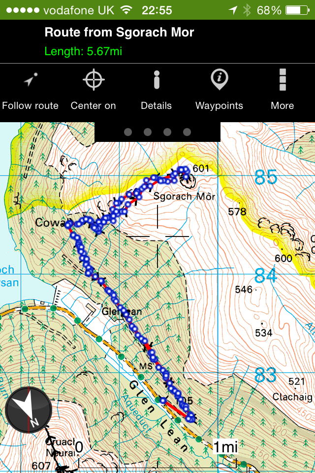
Interactive map and pictures HERE
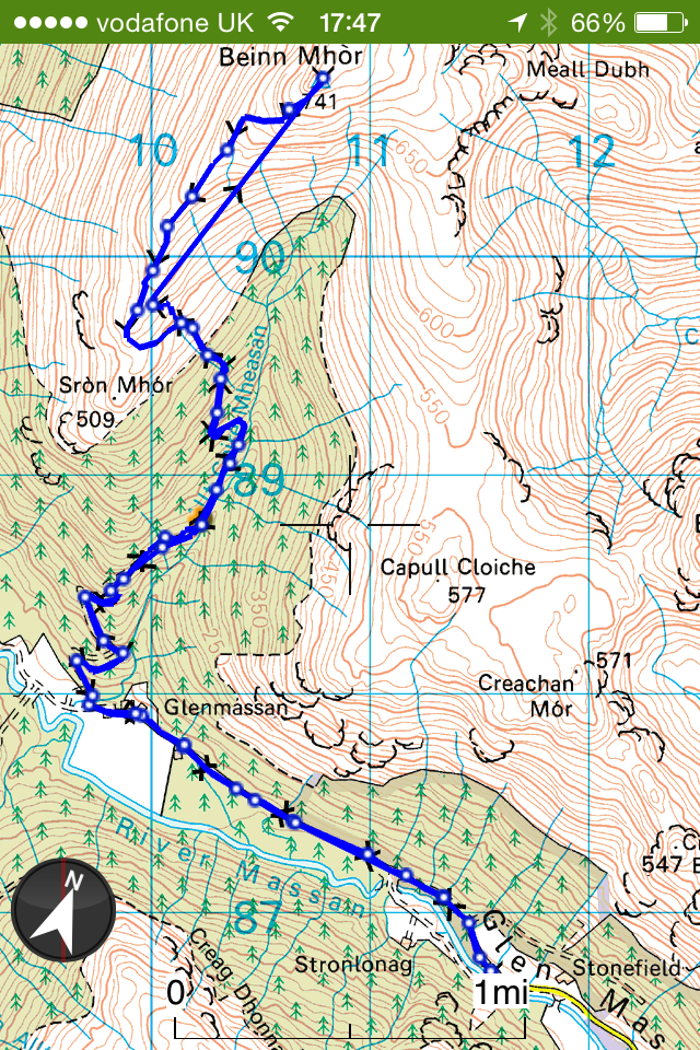
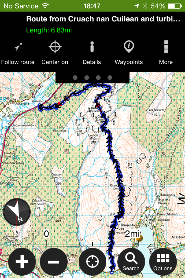
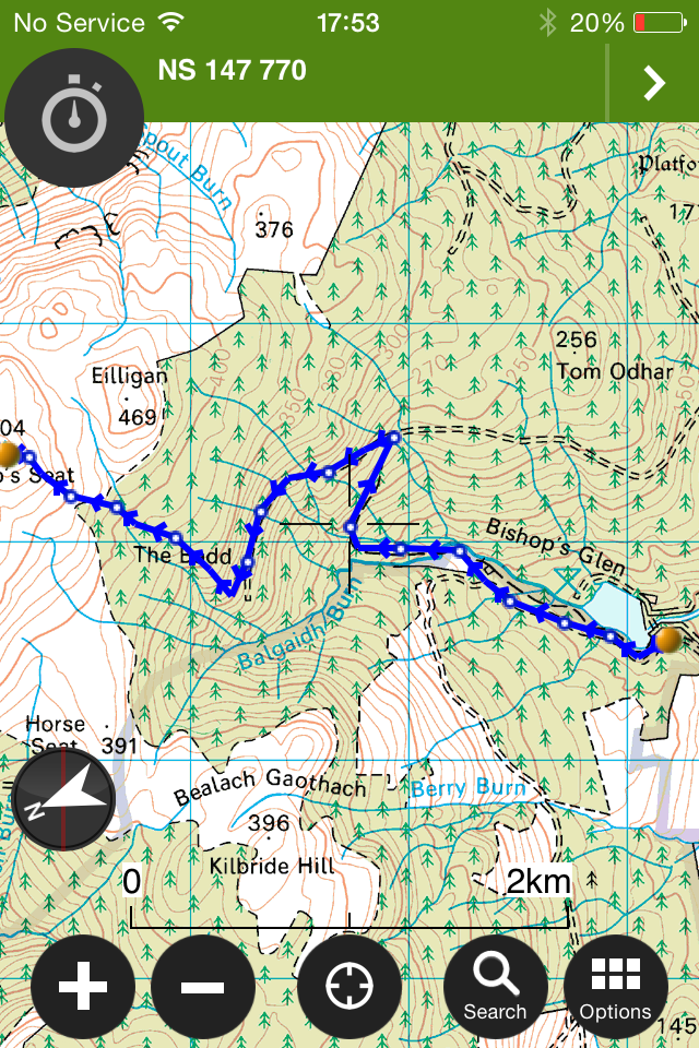
Location map below.

")
")
")
")
")
")
")
")
")
")
")
")
")
")
")
")
")
")
")
")
")
")
")
")
")
")
")
")

")
")
")
")
")
")
")
")
")
")
")
")
")
")
")
")
")
")
")
")
")
")
")
")
")
")
")
")
")
")
")
")
")
")
")
")
")
")
")
")
")
")
")
")
")
")

")
")
")
")
")
")
")
")
")
")
")
")
")
")
")
")
")
")
")
")
")
")
")
")
")
")
")
")
")
")
")
")
")
")
")
")
")
")
")
")
")
")
")
")
")
")
")
")
")
")
")
")
")
")
")
")
")
")
")
")
")
")
")
")
")
")
")
")
")
")
")
")
")
")
")
")
")
")
")
")
")
")
")
")
")
")
")
")
")
")
")
")
")
")
")
")
")
")
")
")
")
")
")
")
")
")
")
")
")
")
")

")
")
")
")
")
")
")
")
")
")
")
")
")
")
")
")
")
")
")
")
")
")
")
")
")
")
")
")
")
")
")
")
")
")


")
")
")
")
")
")
")
")
")
")
")
")
")
")
")
")
")
")
")
")
")
")
")
")
")
")
")
")
")
")
")
")
")
")
")
")
")
")
")
")
")
")
")
")
")
")
")
")
")
")
")

")
")
")
")
")
")
")
")
")
")
")
")
")
")
")
")
")
")
")
")
")
")
")
")
")
")
")
")
")
")
")
")
")
")
")
")
")
")
")
")
")
")
")
")
")
")
")
")
")
")
")
")
")
")
")
")
")
")
")
")
")
")
")
")
")
")
")

")

")
")
")
")
")
")
")
")
")
")
")
")
")
")
")
")
")
")

")
")
")
")
")
")
")
")
")
")
")
")
")
")
")
")
")
")
")
")
")
")
")
")
")
")
")
")
")
")
")
")
")
")
")
")
")
")
")
")
")
")
")
")
")
")
")
")
")

")
")
")
")
")
")
")
")
")
")
")
")
")
")
")
")
")
")
")
")
")
")
")
")
")
")
")
")
")
")
")
")
")
")
")
")
")
")
")
")
")
")
")
")
")
")
")
")
")
")
")
")
")
")
")
")
")
")


")


")

")
")
")


")

")
")

")


")


")

")

")
")


")
")

")


")
")


")

")
")
")
")
")