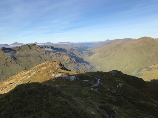
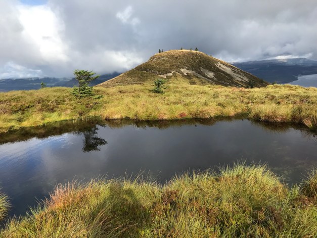
A classic Corbett. Been here before and will do so again, a great hill…..one of the best. Just a few pics 👍


Cowal
All posts tagged Cowal
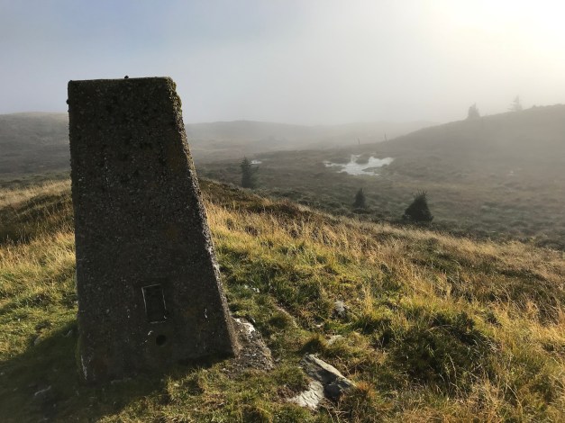
A trig point and a wee hill.
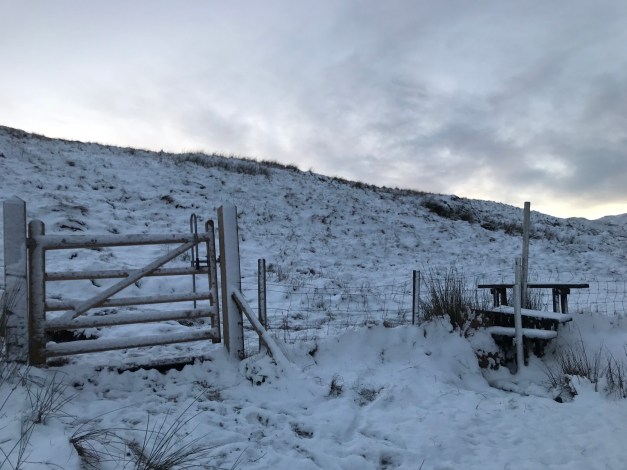
Looking for a quick fix, the trig of Cruach nan Capull was the target. There seems to be a number of Cruach nan Capulls, this one off the A886 with the Fairy Knowe as it’s neighbour – a great combination.

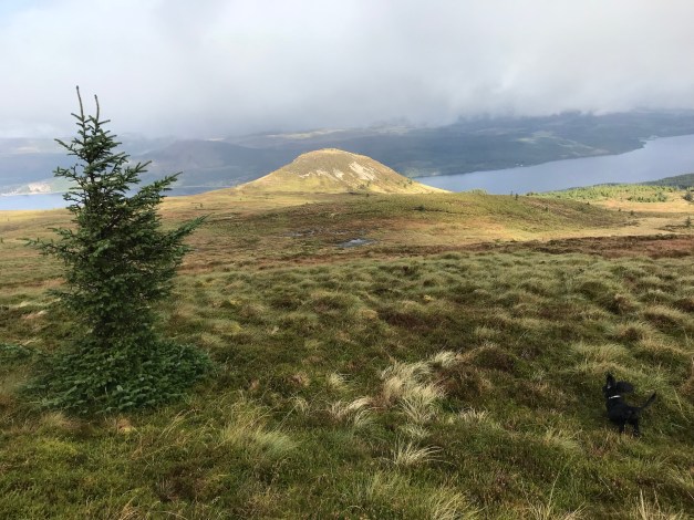
Headed off from the lay-by on the A886 above Strachur. Easy to navigate using the fence lines, the trig was an easy find despite the boggy terrain in some sections. Once the trig was conquered we headed over to Sidhean Sluaigh (Fairy Know) a prominent hill seen from the main road.


It’s been a while since I put anything on here! I have been out n about but mostly mundane repetitive stuff aimed at shifting some weight! Been busy the last 6 months renovating a flat so I’ve lost a few seasons!!

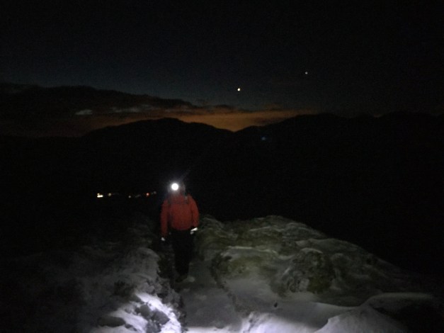
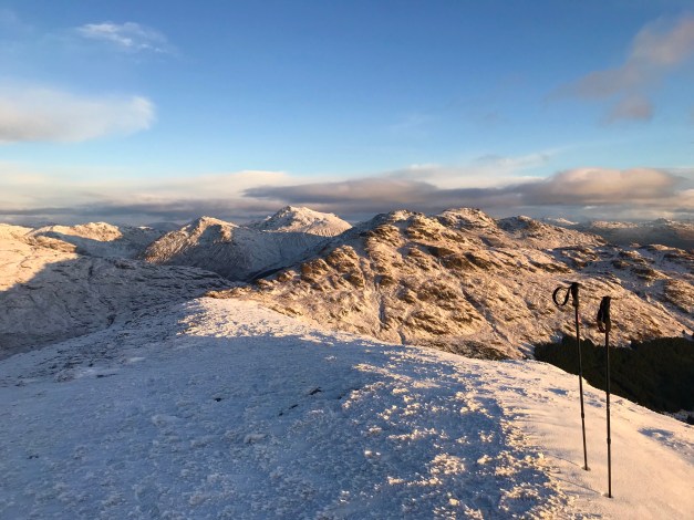
Anyway……. the Cobbler in Arrochar, Ben Arthur as it’s also known. A fine Corbett and always a busy one too – despite the £9 a day parking charge at the Succoth car park. A well documented hill, with a well trodden defined path to the summit, threading the needle an option for the brave or mentalists 😂.
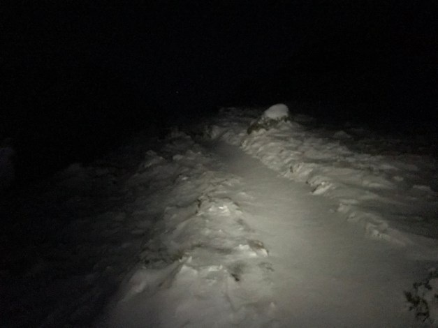
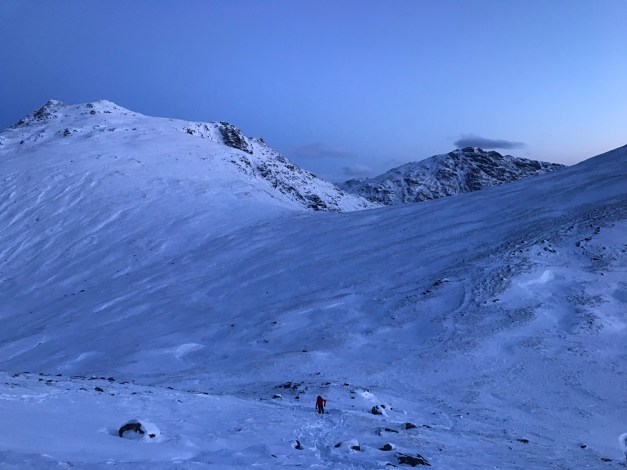
Moral of the story is my mate text to see if I wanted head to the Cobbler on Saturday, sure….why not? I could do with some Hill time. He then confirmed it’d be good to be on the summit for sunrise!! A 04:30 drive from Dunoon was the start of our journey. This did afford us the luxury of being first on the hillside breaking a trail through the spindrift sometimes hard to distinguish snowy path.
Enough narrative, photos can explain the rest 👍
Dark ascent.


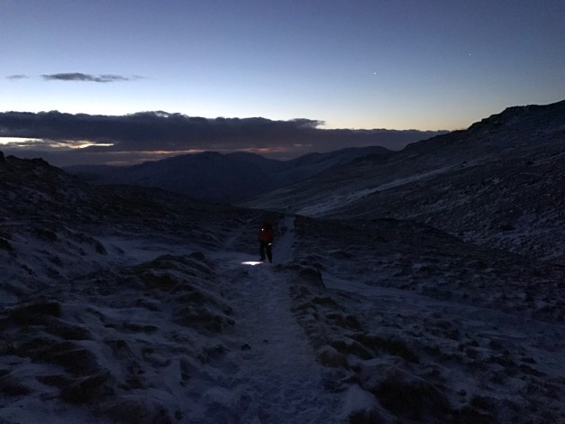
First light.


Final ascent.

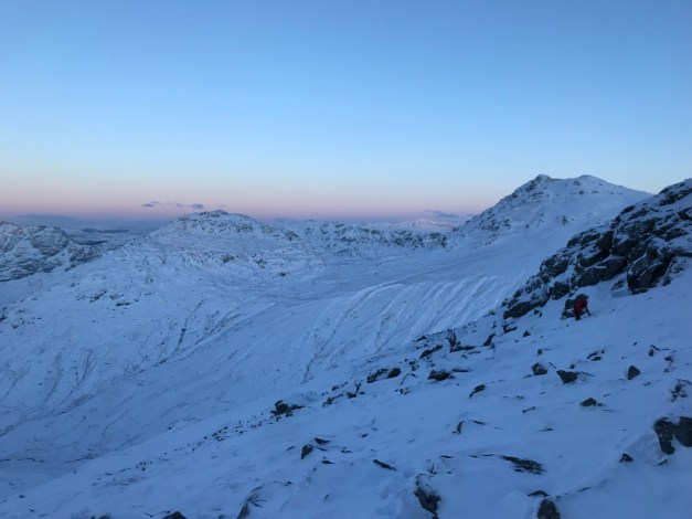


It was -18 on the summit for sunrise! Needs less to say, spending 20 minutes at the top was enough time up there. A great day on a fantastic hill in great conditions. My micro spikes proving their worth on the lower paths, especially on the descent.

Attempted to load a video but it’s not having it!!
Looking forward to getting back out 👍🍺
At 764mts the recent addition to the Corbett family (July 2016) provides an excellent walk.

The walk beginning in Lochgoilhead initially takes in part the Cowal Way before heading away from the way marked trail.

The snowy summit of Beinn Bheula on the opposite side of Loch.
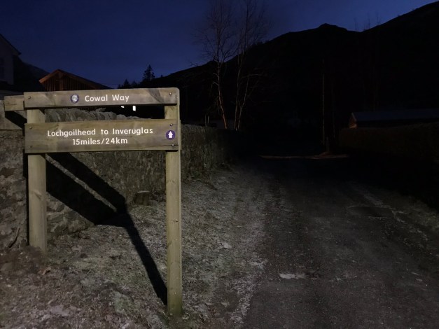
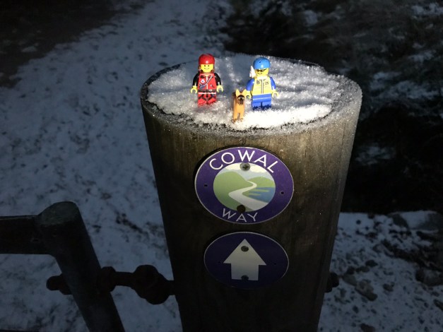


Navigation of the Cowal Way isn’t problematic, initially on a forestry road, then a hill track to the gates fence line before the open hill. The path is less distinguished however, marker posts lead the way.
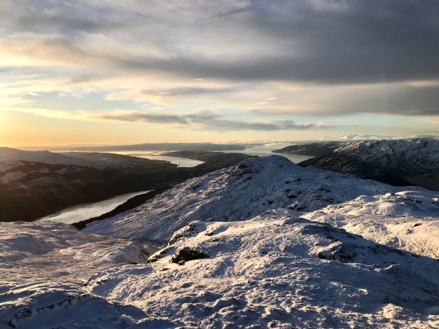
Once on the open hill, the views open up, the hills enhanced by the recent snow fall-caught at sunrise only made the views better.

From the top marker post, it’s time for the open hill. I was fortunate to pick up a track through the snow made by a previous group, looks like they’d headed in via The Brack.
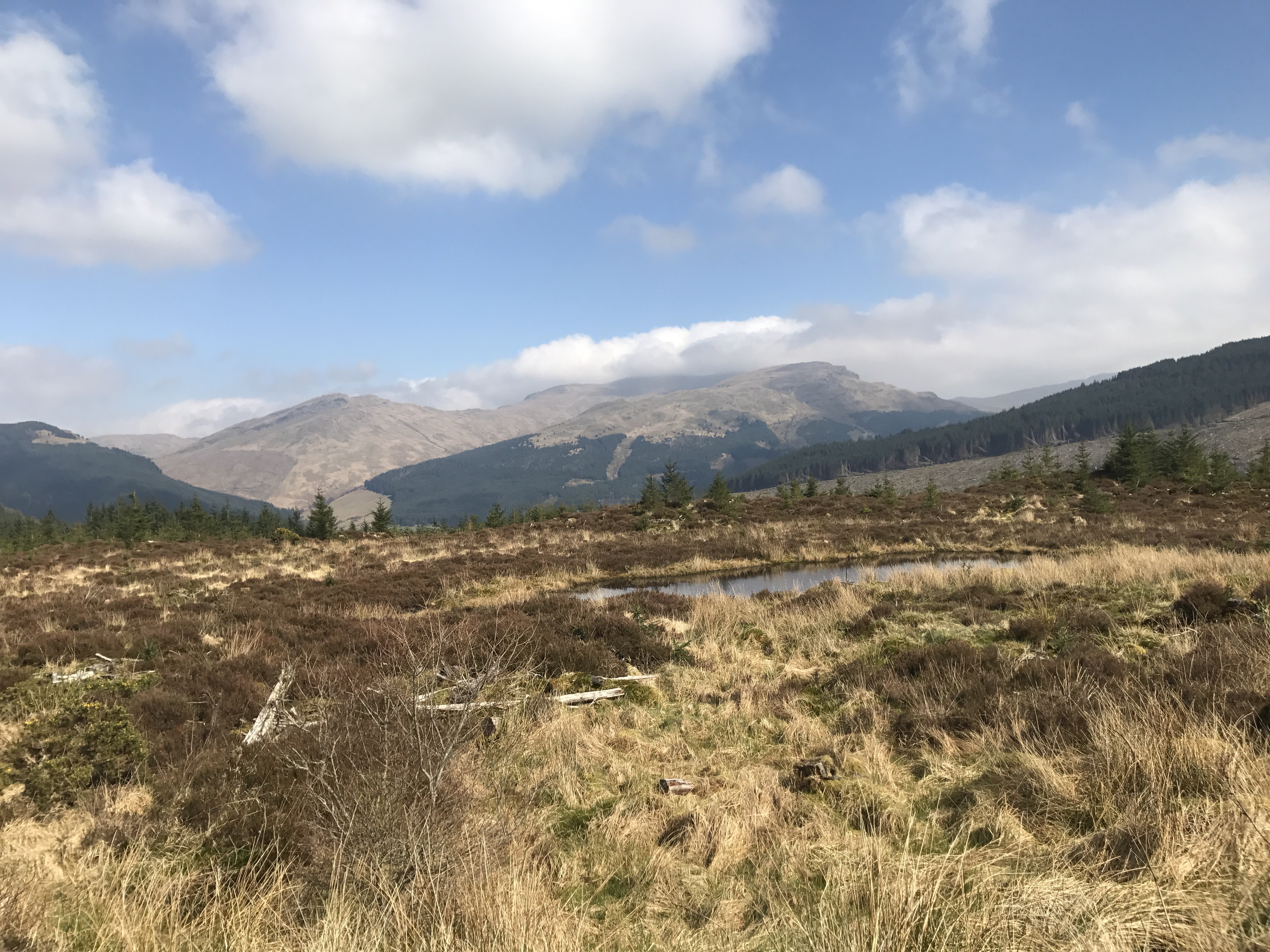
The gain in elevation provides more stunning views in all directions.

The summit view is stunning. It’s worth walking out to the furthest point to gain a better vantage point over the surrounding lochs.
Summit 360.
Descent made by the ascent route in slightly better light. Allowing a quick stop off at one of the waterfalls.
A great shift on the hill in ideal conditions, providing excellent vistas.
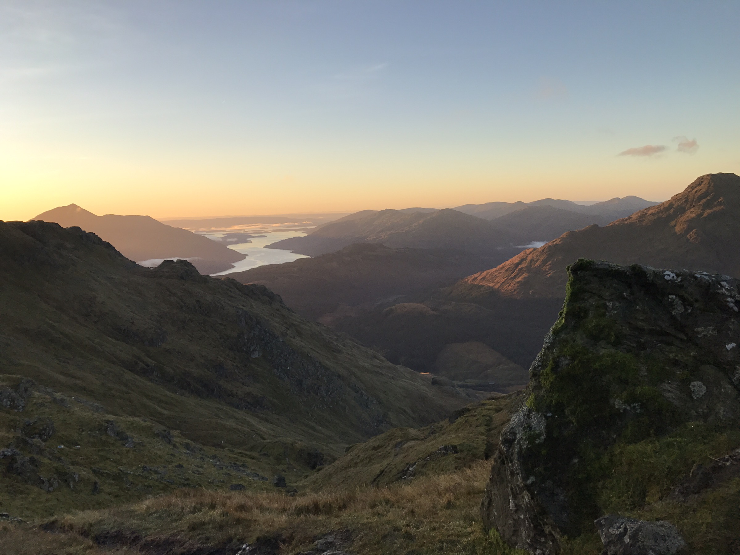
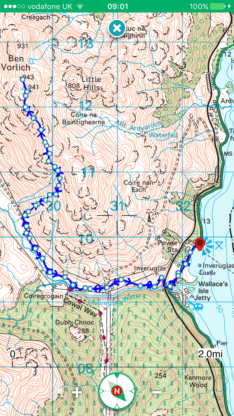
At 943mts Ben Vorlich is a Munro and forms part of the ‘Arrochar Alps’.

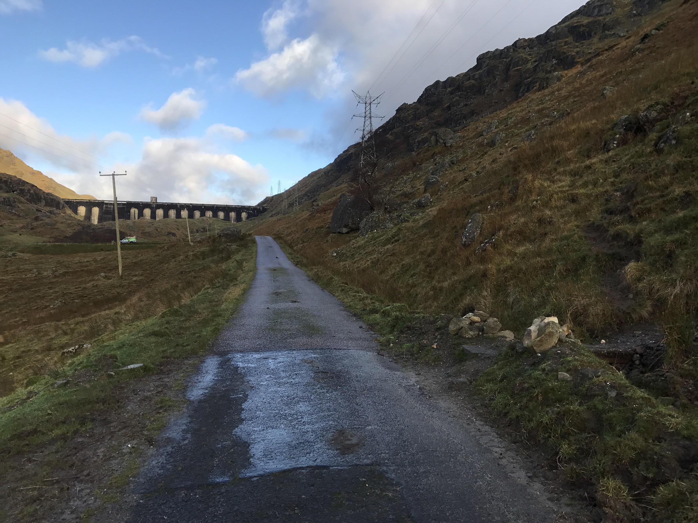
The start/finishing point is at Inveruglas, Loch Lomond. Parking is adjacent to the Loch Sloy power station on the shoreside, charges apply when the machine is working.
An early start meant the first few miles were in darkness. Initially along the main road then onto the tarred access road to the Sloy dam, an easy straightforward approach.


The start of the hill section is highlighted by a cairn at the side of the road.
Pic taken on return off hill.
Leaving the main road it’s a steep ascent, eroded path, washed out and boggy sections await until the path improves higher up. Views over Loch Sloy are obtained in the initial climb.

Pushing on, the views only get better – Loch Lomond and it’s islands catching the most attention.


The path eventually tapers out to become a less relentless, enjoyable ascent.

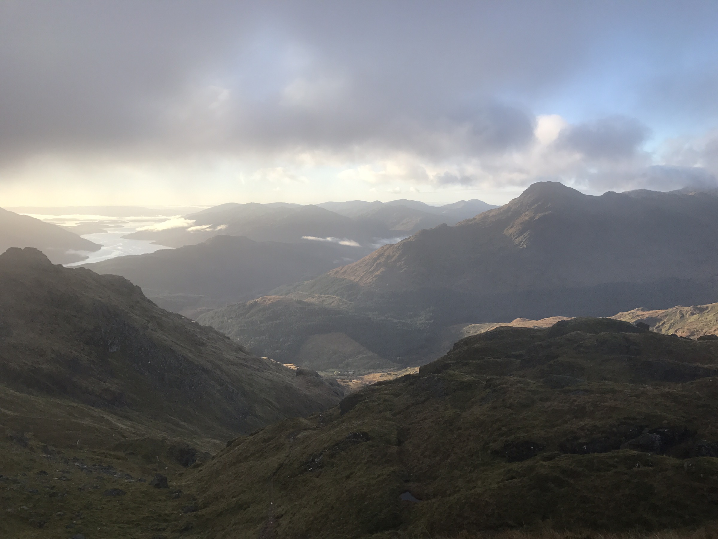
Onwards to the trig and the summit cairn just beyond, sadly the clag came in within seconds of reaching the summit.


Returning on the same route, the descent of the lower section was a slippy one!

A great morning on the hill and well worth the early start! 👍
Back in the Kayak 👍
With a forecast of calm waters and no precipitation, the kayak was loaded up to head to Colintraive for the start of the journey.
The Kyles of Bute is a stunning place to paddle and well frequented by numerous watercraft.

The Burnt Islands provide a great locus for the resident seals, they’re certainly not shy as the launch themselves to come and check you out! Perhaps keeping you company for a while too.

Once through the islands a crossing to Caladh Harbour is a must, the sheltered area used by yachts to drop anchor.
This crossing in particular was a tad misty yet still enjoyable.

Next stage was to head for Tighnabruaich where the community jetty provides the perfect stop off to visit the village. I opted to call into the cafe for a coffee and a generous portion of chocolate brownie, sheerly to restock on energy for the return leg.


The colourful village


Coffee and cake consumed it was time to return to Colintraive, the surrounding hills providing a stunning backdrop.


A wee stop off on Bute at the Kayak stop prior to Colintraive.


A few wee locations, all offering something different.
** Please take your litter home, leave any site as you found it, if not better**

OFF GRID:
Ardentinny: Semi Rural – Large
Coastal-Forestry Walks/Cycles-Forestry Toilets (seasonal), no drinking water.


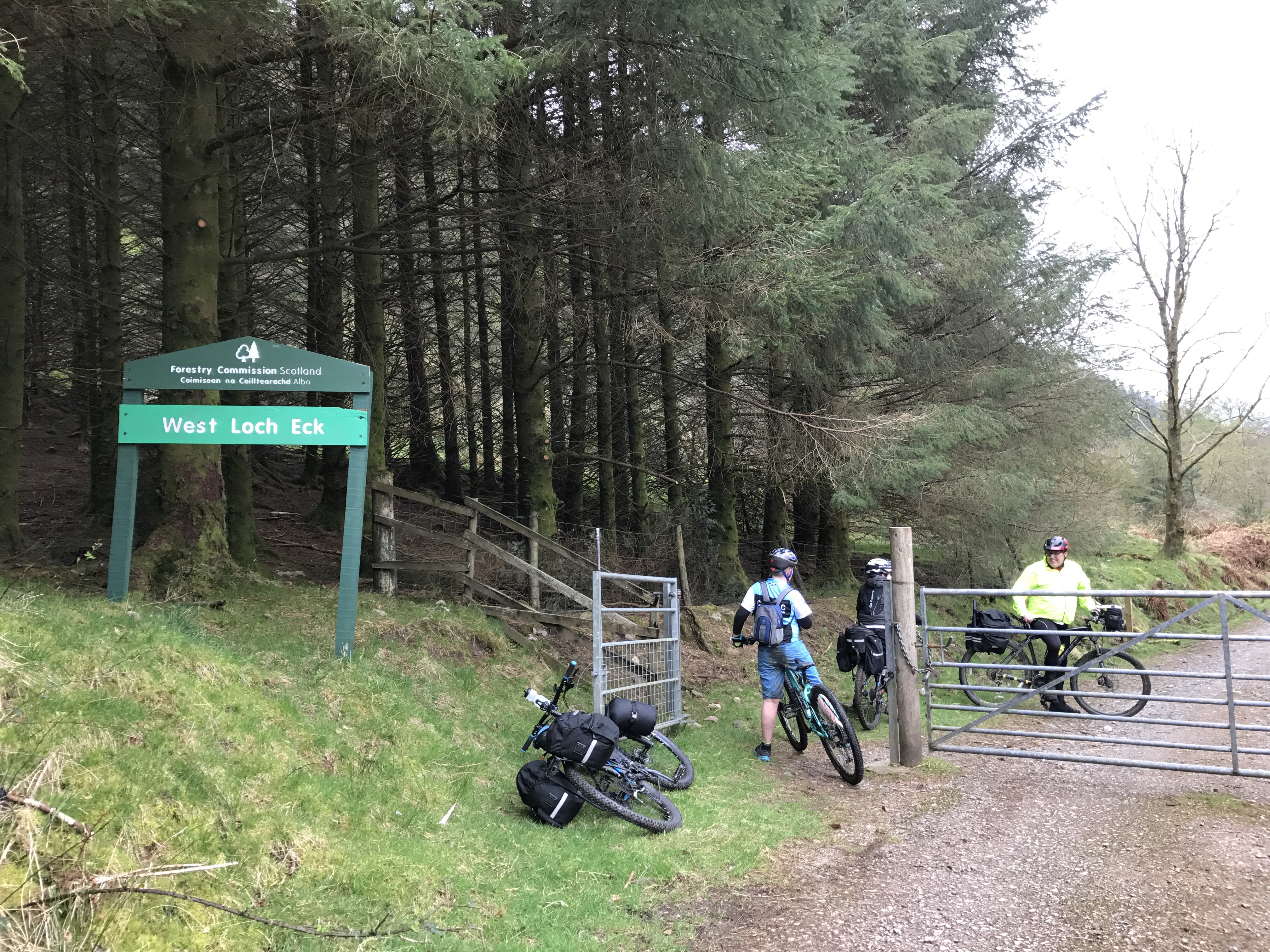
Loch Eck, Dornoch Point: Rural – Small
Lochside-Kayak-No facilities.


B836,Loch Tarsan: Rural
No Facilities-Walking


With the SIB sold, the garage had a void that needed filled. Not wanting to be completely off the water returning to a kayak was the choice.
A P&H Scorpio LV.

A longer and narrower boat than I’m used to so the initial trial will be ‘interesting’.
Taking to the open road, a self-propelled and self-sufficient trek. An opportunity to absorb the surroundings at a moderate pace. As opposed to going totally off grid, a night’s camp was enjoyed at the Glendaruel Caravan Park where there are facilities available such as toilets and showers. There is also an undercover camper’s shelter with, hot and cold running water.
Saturday, Outward Bound: Ardnadam Pier – Glendaruel Caravan Park (26 miles).


A mix of approximately 70% Forestry Road and 30% public road (A and C class)
A circular route starting off from the shores of the Holy Loch (free carpark at Ardnadam Pier), taking to the public road via the A815 and the Glenmassan C class road. Leaving the public road prior to Deer Park and opting for the forestry road that follows the River Echaig to Benmore Gardens with its Café – approx. 4.3 miles from start.

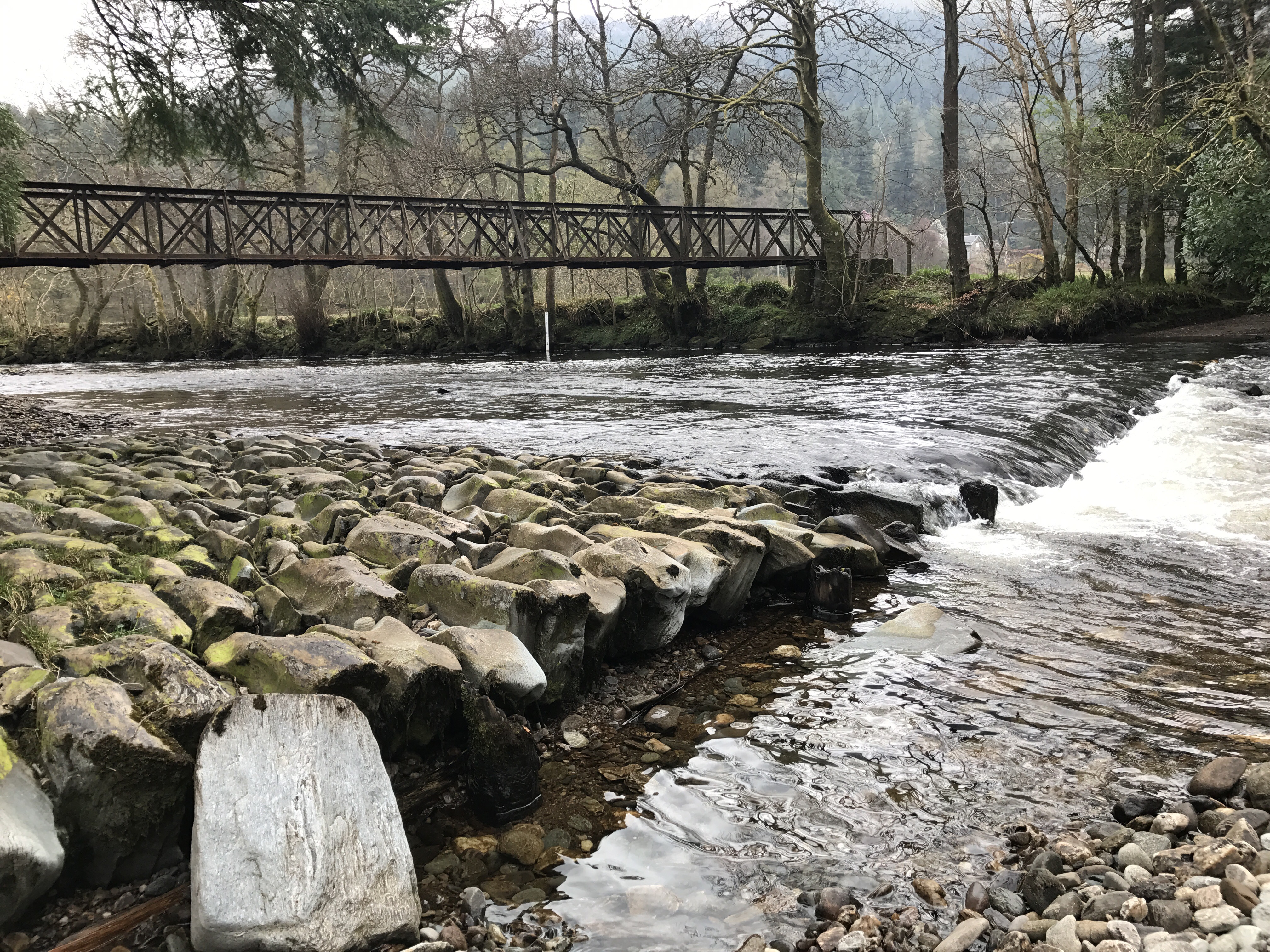
The road continues through the Benmore estate then northwards towards the outfall of Loch Eck, the vistas opening up as the steep hills flank either side of the loch. The forestry road through to Glenbranter is mostly undulating, perhaps a few climbs but they don’t raise any major concerns. The local Forestry Commission offices are located in Glenbranter, an opportunity to regroup, stop for a break and use the facilities – approx. 13.5 miles from the start and the mid-way point.


After a break it’s time to tackle the climb out of Glenbranter heading for Garvie Farm – this section encompasses part of the Cowal Way . The initial and steepest part of the climb lasts for approximately 0.5 miles before lessening for the remaining 3, there is no shame whatsoever in dismounting and pushing to the summit – the sense of achievement is still the same. On the flip side, what goes up must come down, the rest of the journey to Garvie Farm is a breeze with only one short lived climb to contend with.

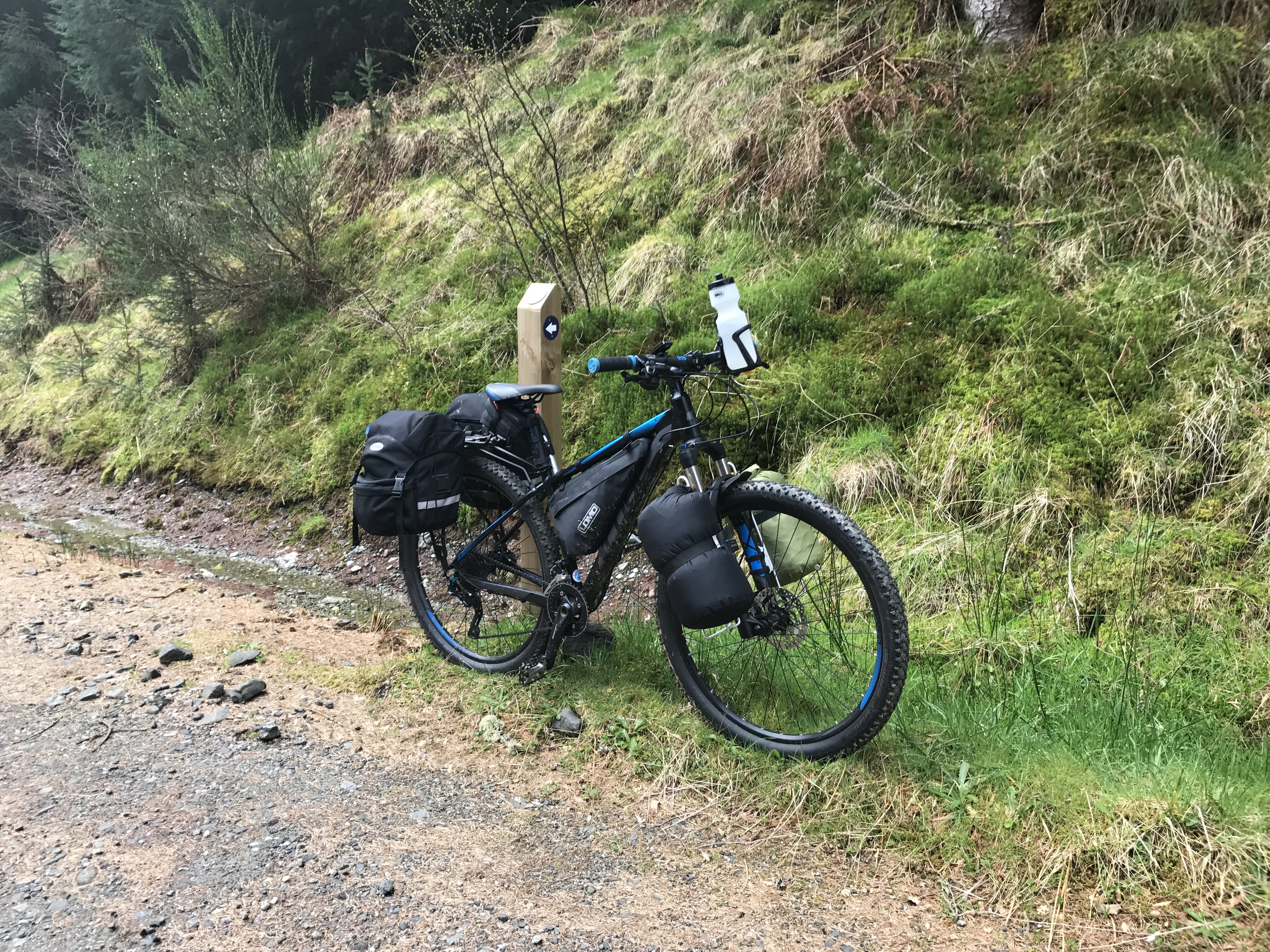


Leaving Garvie Farm (approx. 22 miles from start) a short section of the A886 is covered prior to turning on to the West Glendaruel public road. The West Glen road is single track with passing places, not that you’ll meet much traffic. Again, no noticeable climbs worth mentioning.

On arrival at the Glendaruel Caravan site, a wee rest, then pitching of the tents prior to something to eat and refreshments.


Sunday, Inward Bound: Glendaruel Caravan Park – Ardnadam Pier (17 miles). Public road (A and B class).


Sunday: Refreshed, fed, watered and ready to roll! Well 3 out of 4 isn’t bad. The fact that the home stretch is 9 miles less than the previous day is encouraging for a start. Sunday’s roads were all public surfaced road, initially on the West Glen Road till it meets with the junction of the A886 then onto the B836 before re-joining the familiar A815.
The West Glen road is undulating and progress easy. The A886 starts off downhill to the A8003 junction then a steady gradual climb towards Stronafian.


The B836 junction, reached at approximately 4 miles from the start is a different beast however, a beast that can be tamed! It has two noticeable gradual climbs, again the laws of physics apply and what goes up must come down. The smooth surface helps with progress and the climbs are not as hard going as originally thought.

The climbs are both similar in distance and elevation, roughly one and quarter miles (2kms) with a gain of 400ft (120mts). The first being from the B836 junction to the top of the ‘Long Brae’, the second being from Ardtariag to Tarsan Dam. As before, there is no shame in dismounting for a push or a rest – these should be promoted as photo opportunities! There are ample stop off points to allow regrouping and a break to refuel.


Enough of climbs, now for the fun bits…..descents. After the first climb the descent is a steep and fast one. Brakes should be in tip top condition as the gradient will have them working, care must be taken. The second descent is a more gradual affair, from Tarsan Dam down, through the flats to Clachaig then to the A815. A welcome easy run after the epic (perhaps too strong a word) taming of the climbs. The return via the A815 on to its shore road to the carpark is uneventful.

An epic wee adventure, from sea loch to fresh water loch, from East Cowal to West Cowal, a night under canvas……and back.
Thanks to Iain for attending and helping organise the weekend, also thanks to Fin and James for their company and keeping me right.
Glendaruel Caravan Park provides an excellent base for exploring the area, offers a variety of accommodation and there is always a warm welcome.

An excellent walk whilst in the area is accessed from the back road at the caravan park – Lochan Chuilceachan

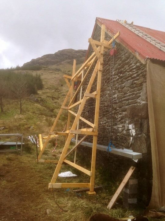
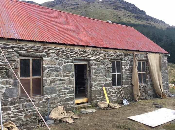
Abyssinia Bothy,an abandoned building that has recently been added to the list of MBA Bothies. With planned works at the end of April 2017, the building will will be renovated and maintained by the MBA volunteers.
Fuel: Some deadwood in area however, advisable to take fuel in.
***No fire installed at the moment. Chimney blocked off. Will update. ***
Altitude: 252mts.
Bike Friendly: 10/10.
Is it in Cowal – Yes 👍
Having visited Glen Kinglas previously a re-visit to the area on the news of the bothy project was a must.
The estate road is undulating and reaching the Bothy is no mean feat, especially with the bike.
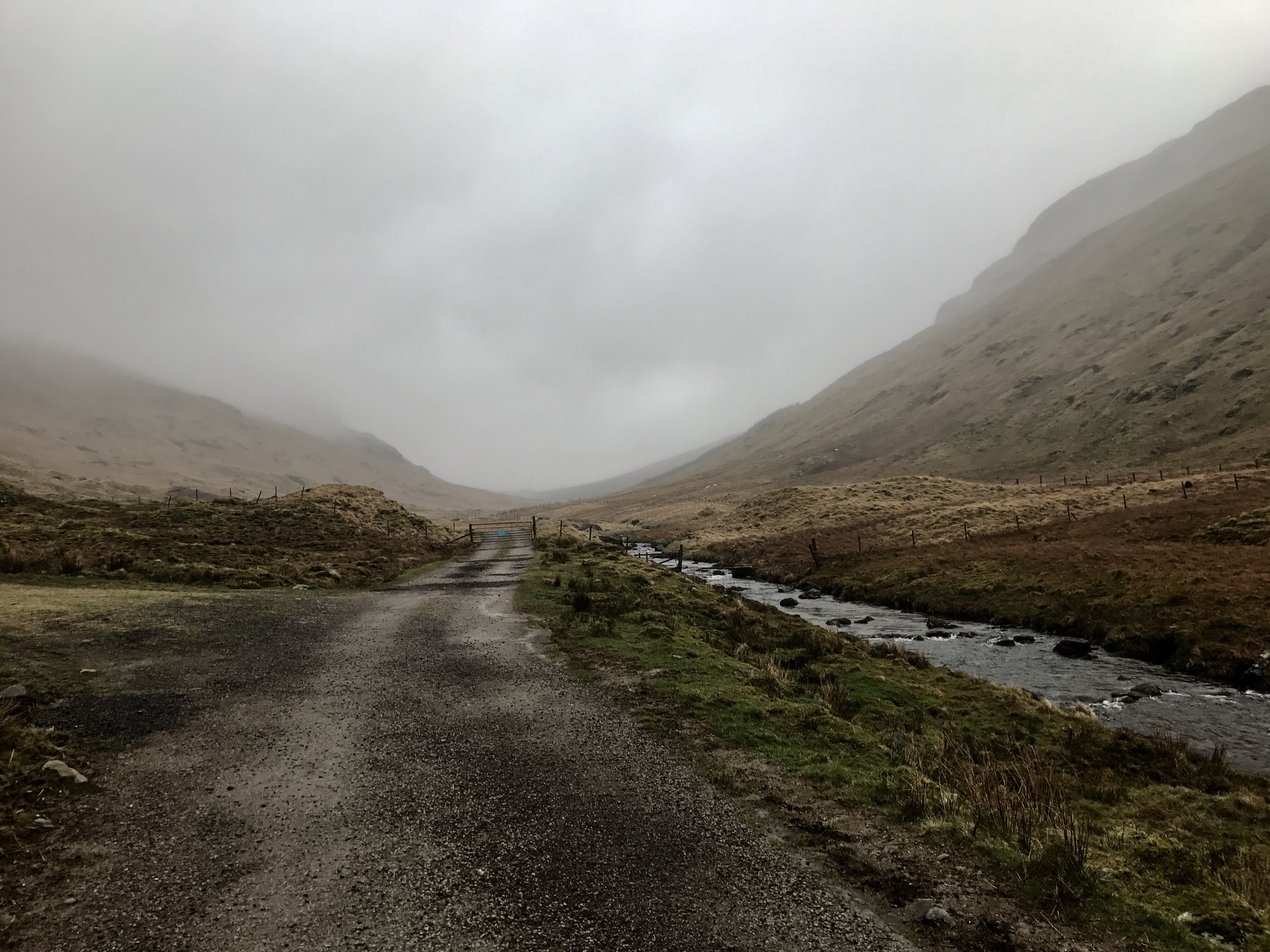
The Bothy sits on the opposite side of the river,so a crossing was required on this visit – no idea if there are any proposals to install two wee bridges over the smaller burns.

Abyssinia in its current state.


Hopefully the Bothy will be complete or at minimum habitable by summer.
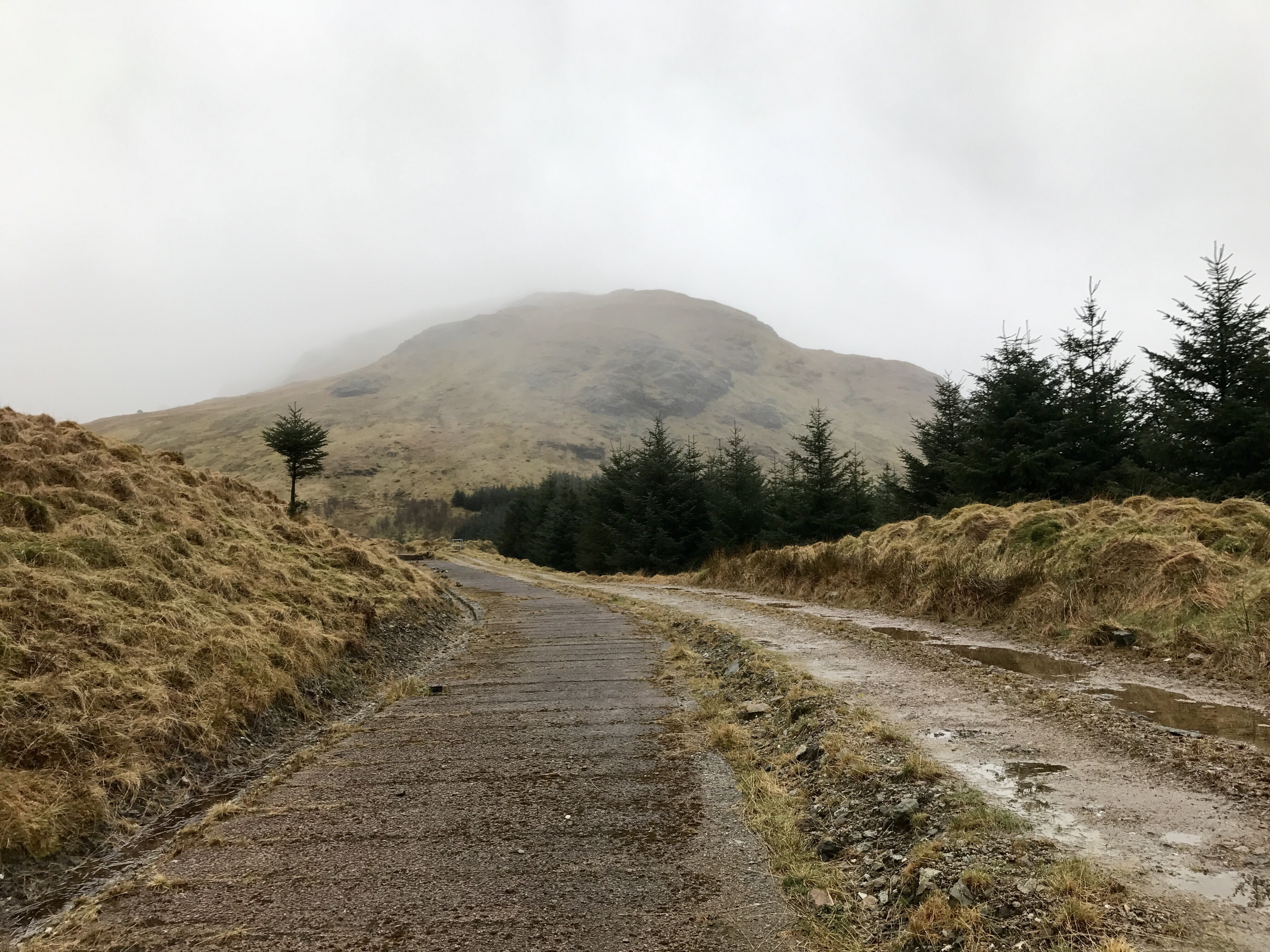
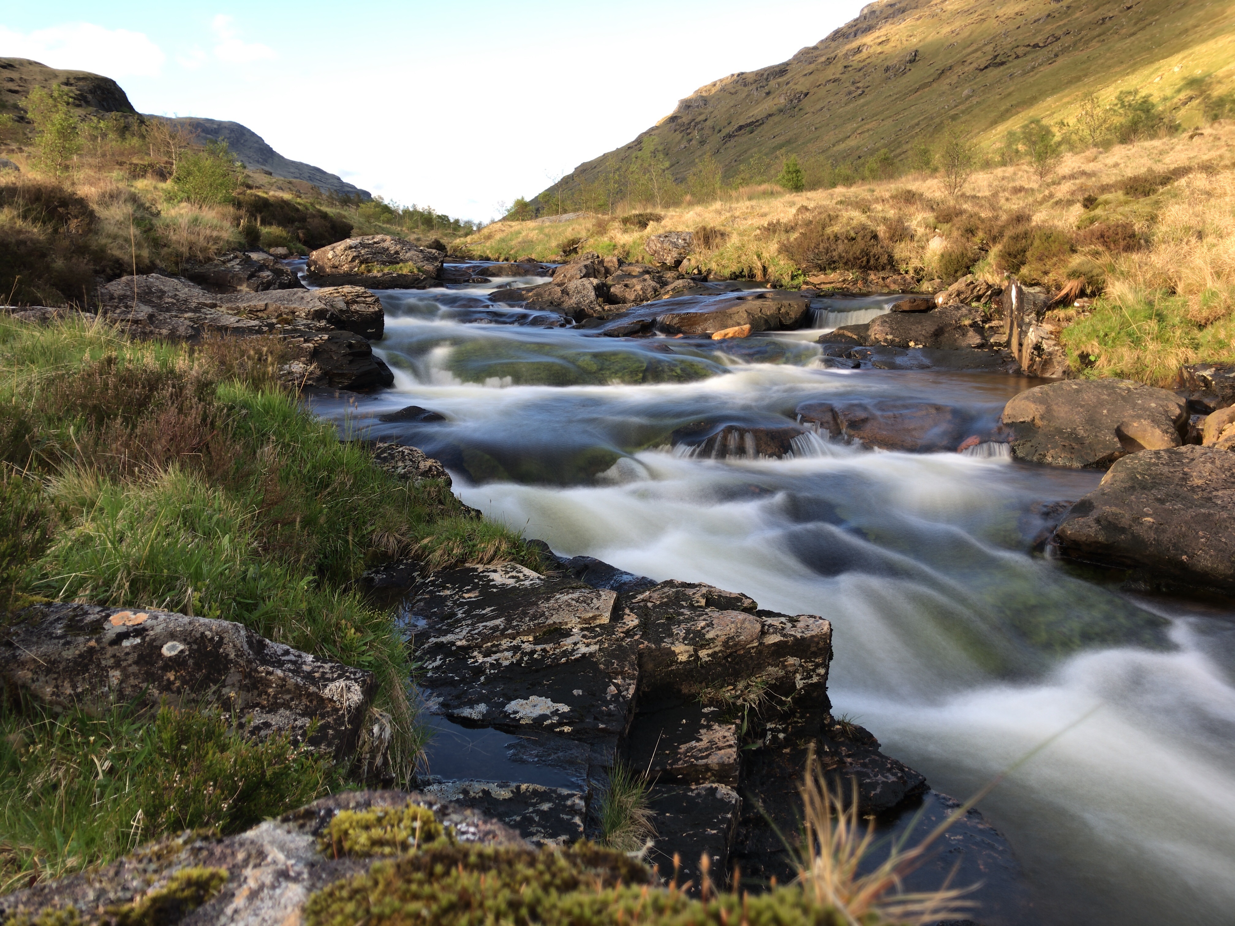
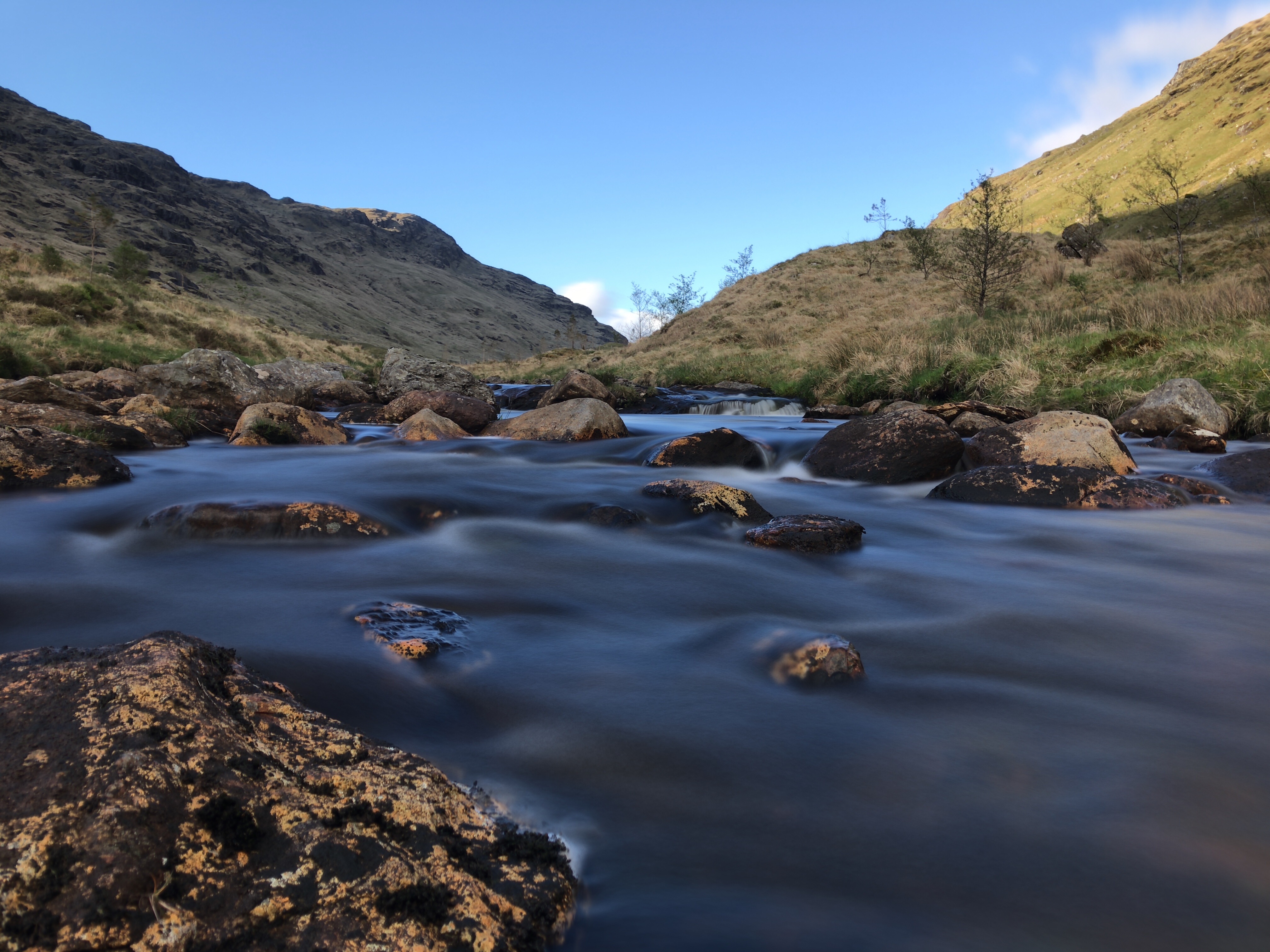
Whilst in the area I decided to head for the aqueduct that runs above the Bothy. Covered by concrete slabs, progress is easy if the road is to rough. A tour visiting the intake and outfall is an easy cycle, something different.


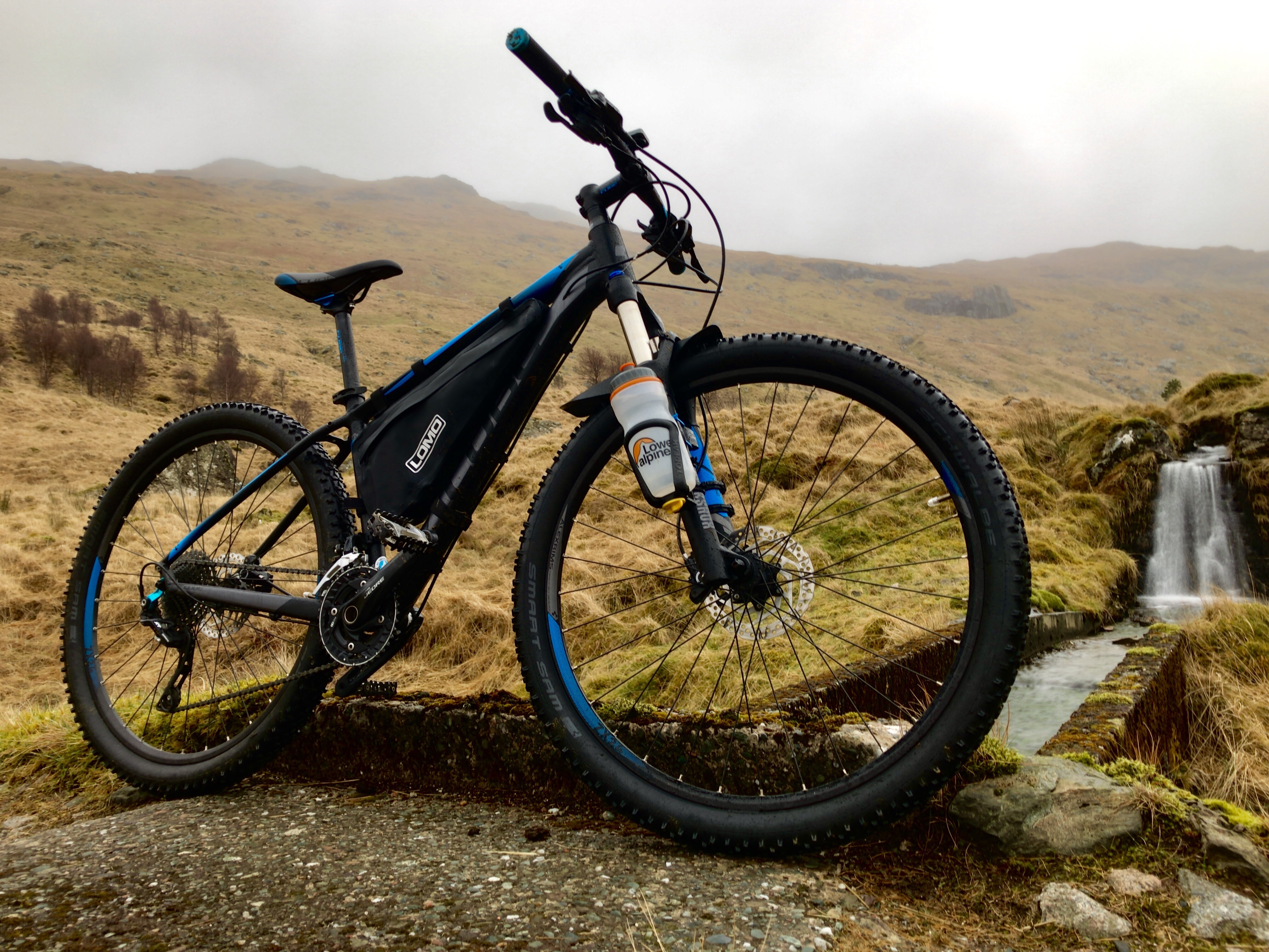


I shall update this post as works progress. Definitely a 10/10 bike friendly Bothy.
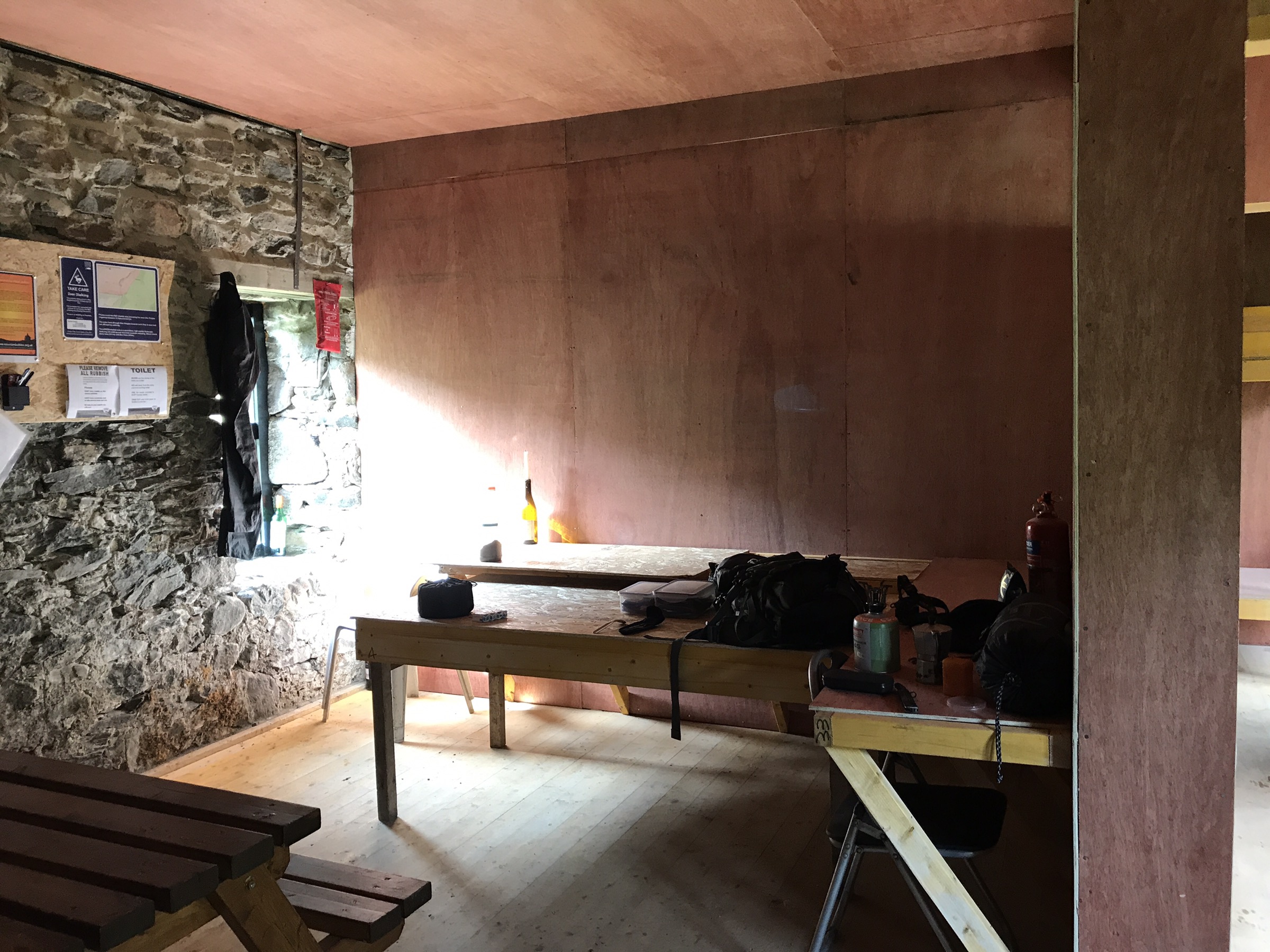
The Build………
Photos courtesy of Andy MacArthur 👍🥃


Re-visit on a clearer day.


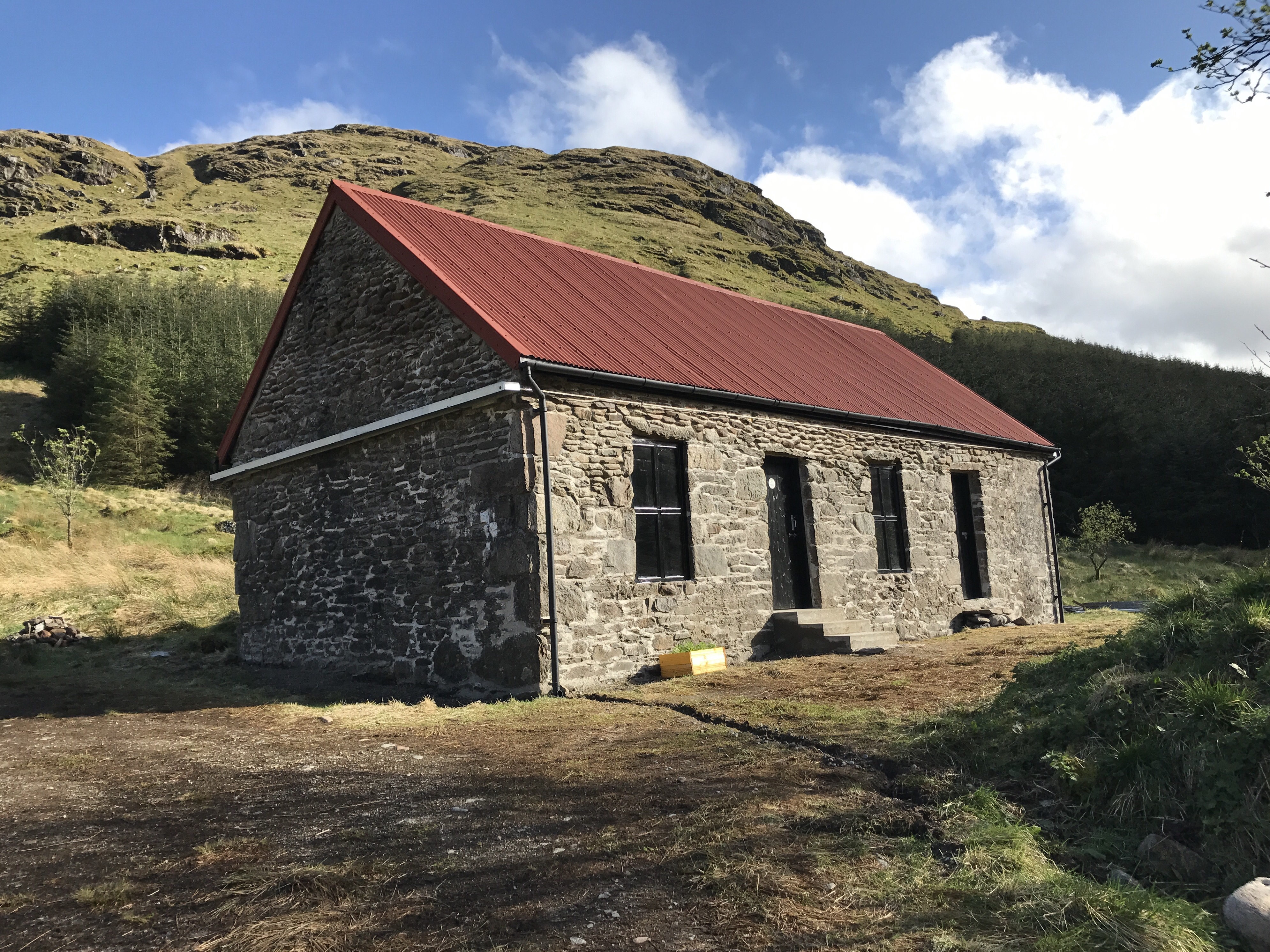

18.08.2017
A wee return as in the area visiting a trig point.
Bedroom that can sleep up to 10 on the platforms 👍