I haven’t visited Beinn Mhor since October last year whilst on a walk with Cowalfest.
Route and pictures HERE
Instead if carrying onto the ridge this time, once the summit was reached I headed back following the ascent route.
A winter wonderland 👍


I haven’t visited Beinn Mhor since October last year whilst on a walk with Cowalfest.
Route and pictures HERE
Instead if carrying onto the ridge this time, once the summit was reached I headed back following the ascent route.
A winter wonderland 👍
Did this trip a while back and forgot to Blog it !!
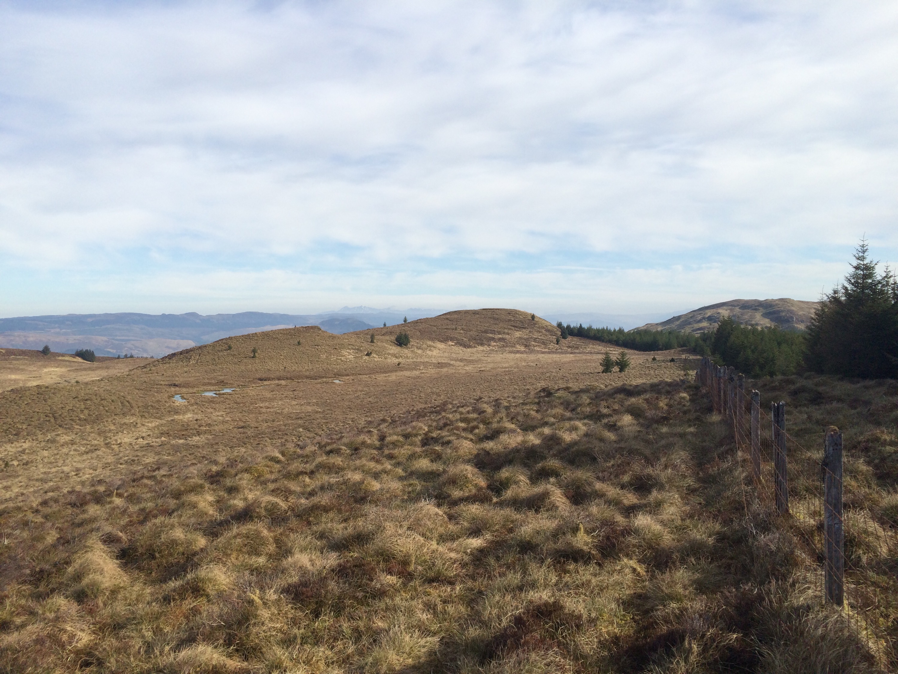
Decided to take the bike for this one,but it can also be walked in one day or alternatively split into two days/sections.
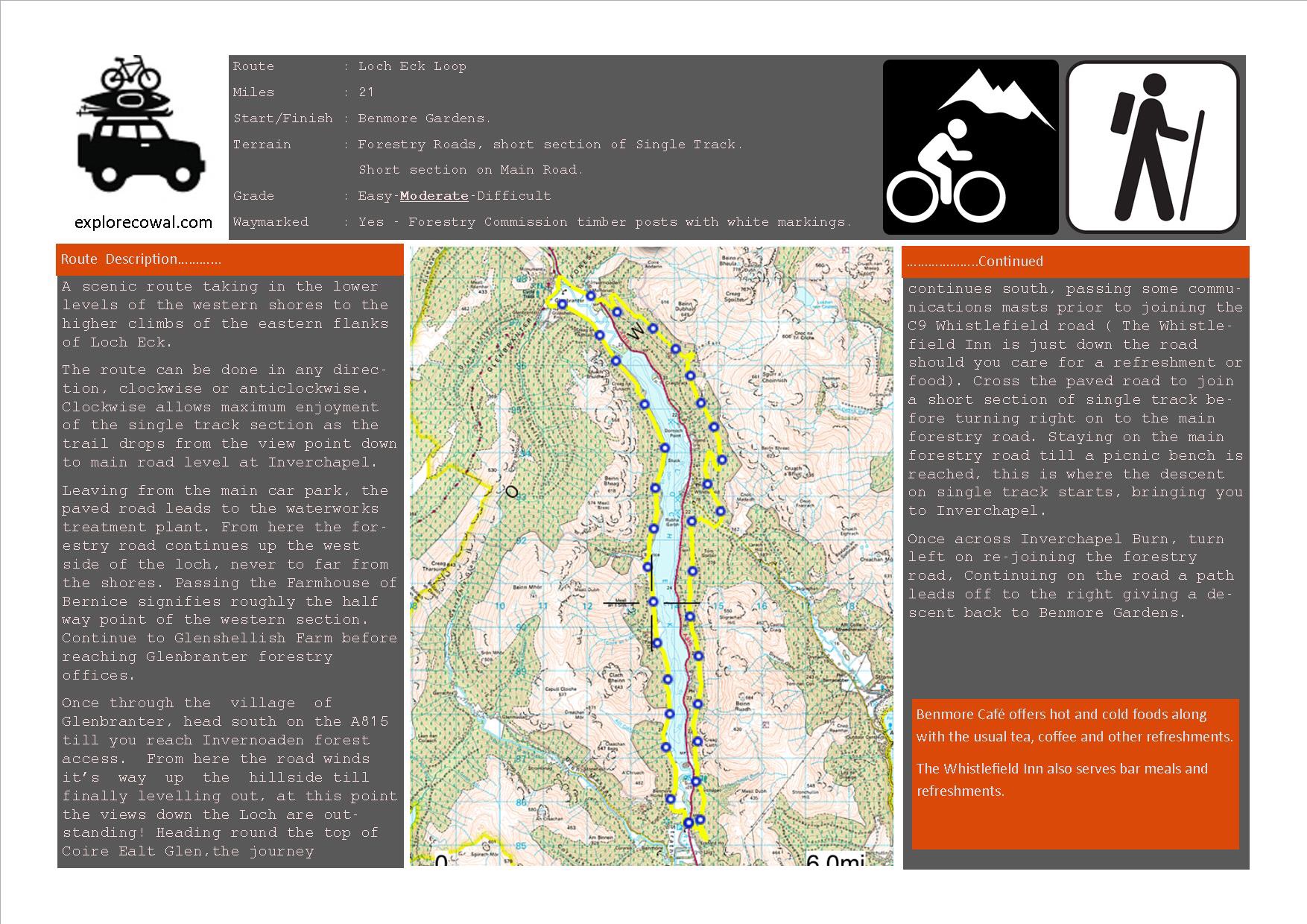
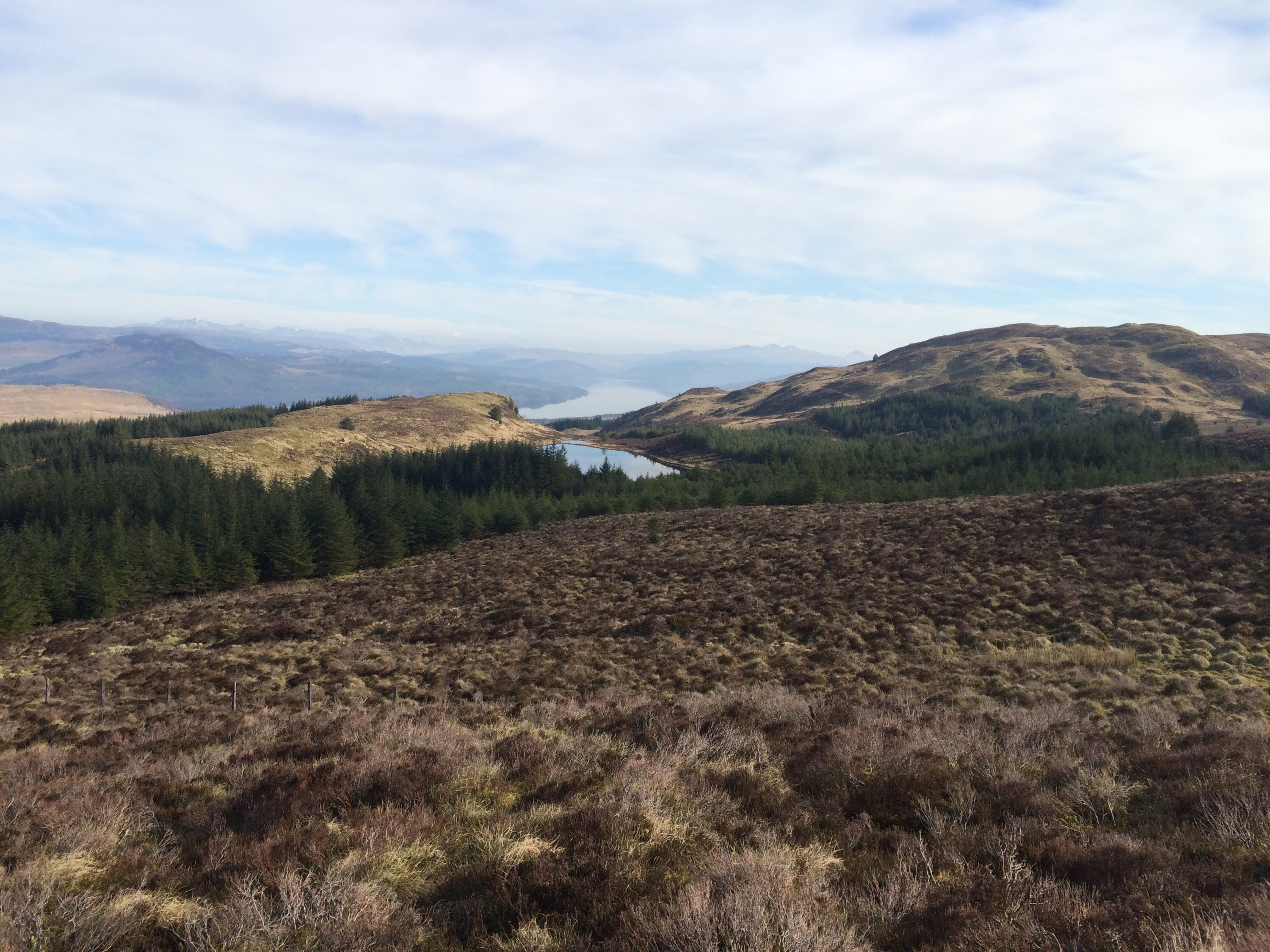
21 mile loop of Loch Eck. A great trail giving a scenic tour of Loch Eck. Ground covered is mostly on wide forestry roads, there is a section of hardcore hill path above Inverchapel.
Starting from Benmore Gardens in a clockwise direction. Heading up the West side to Glenbranter then returning down the East side via Invernoden and Inverchapel.Can also start/finish at Glenbranter. The West side offers mostly Loch level walking, with a slight climb at the North end. Of course, what goes up must come down. The East side gives the chances if some fantastic elevated view points, so some bigger climbs on this side…..but worth it.
West side,never strays to far from the edge of the Loch. Benmore to Glenbranter.
A few points of interest on the West side.
– Small burial ground/cemetery.
– Bernice farmhouse, used as outdoor centre.
– Stuck Farmhouse ruin.
")
")
")
")
")
")
")
")
")
")
")
East side, climbs away from the main road high above the Loch. Glenbranter,Invernoaden, Inverchapel and to back to Benmore.
")
")
")
")
")
")
")
")
")
")
")
")
")
")
")
")
Of course, a huge incentive to complete this loop is a well earned treat at the Benmore Cafe .
For a fully interactive map with more photos and stats , CLICK HERE
Below is a basic route card.
Starting off from upper Glenmassan,climbing to the summit of Beinn Mhor ( 741mts) continuing to A’Chruach before a final descent to Benmore Gardens.
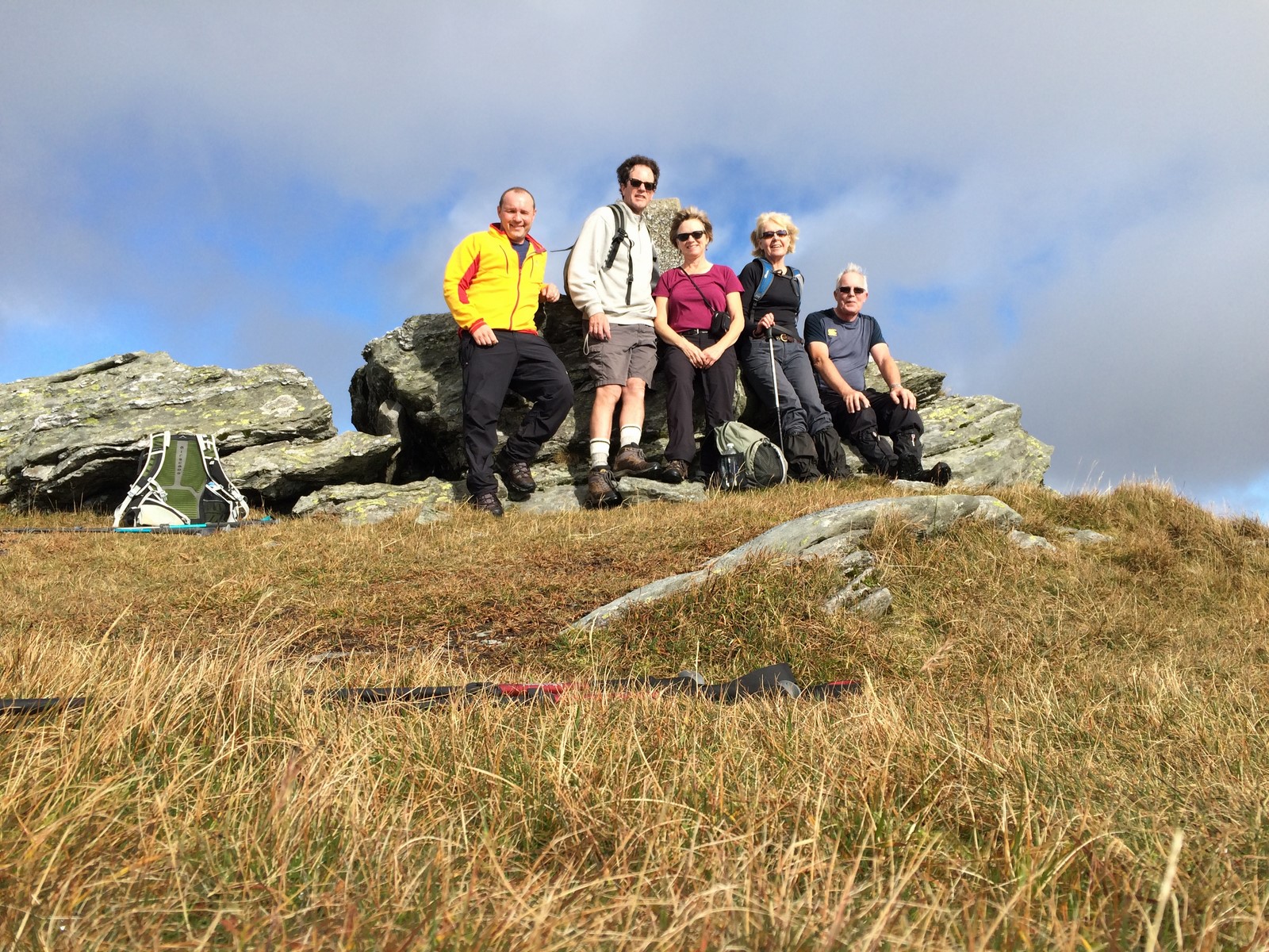
Four hardy souls signed up this epic 10 mile walk. Gillian, Renata,Russell and myself joined Roy our guide for the day. A special mention to Renata and Russell who were paying their first visit to Scotland from Canada and were wanting to sample some of the Scottish wilderness.
The weather forecast didn’t disappoint and provided us with a dry clear day for this high level walk.
Left to right – Beinn Mhor and the ridge.
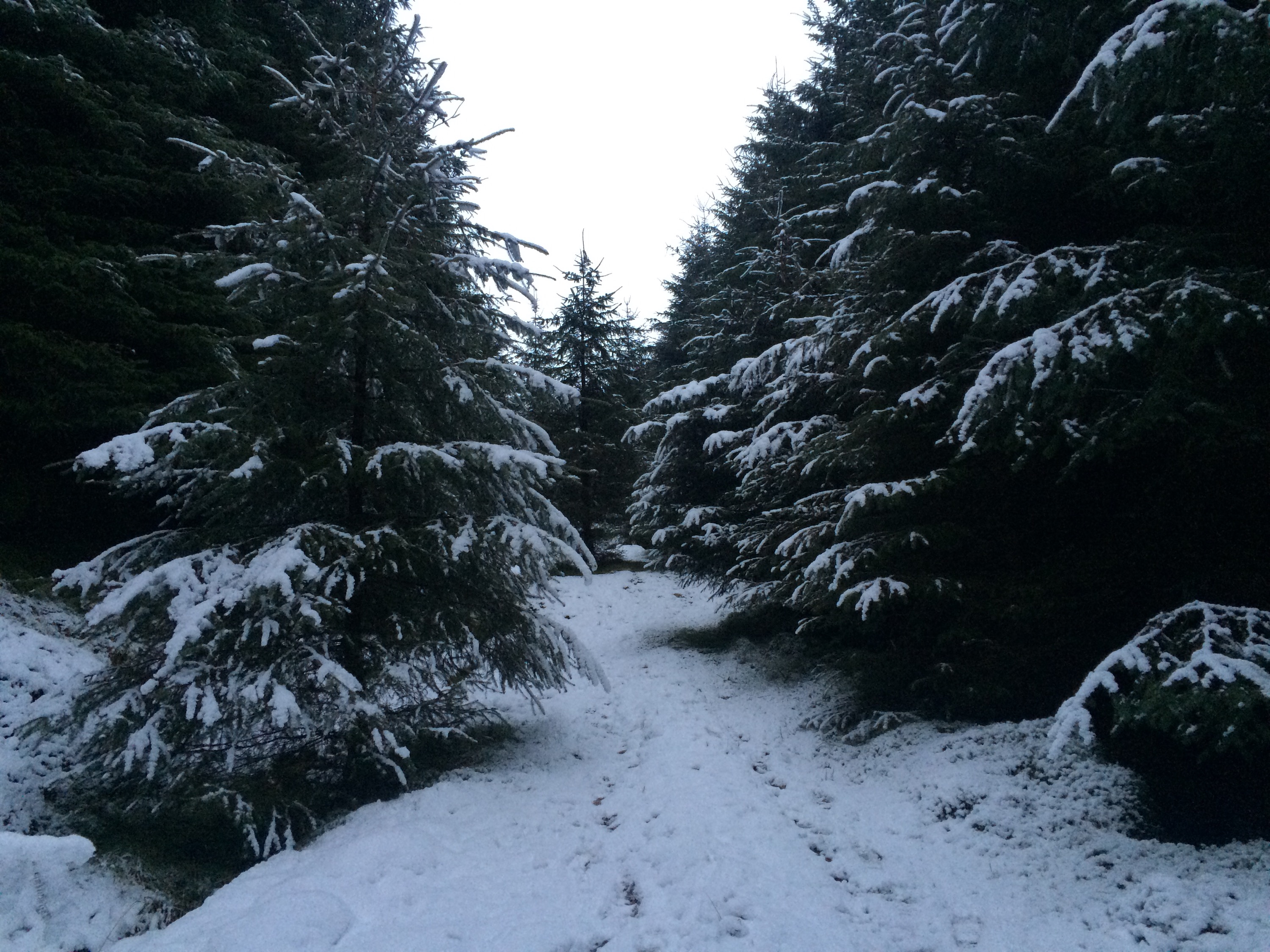
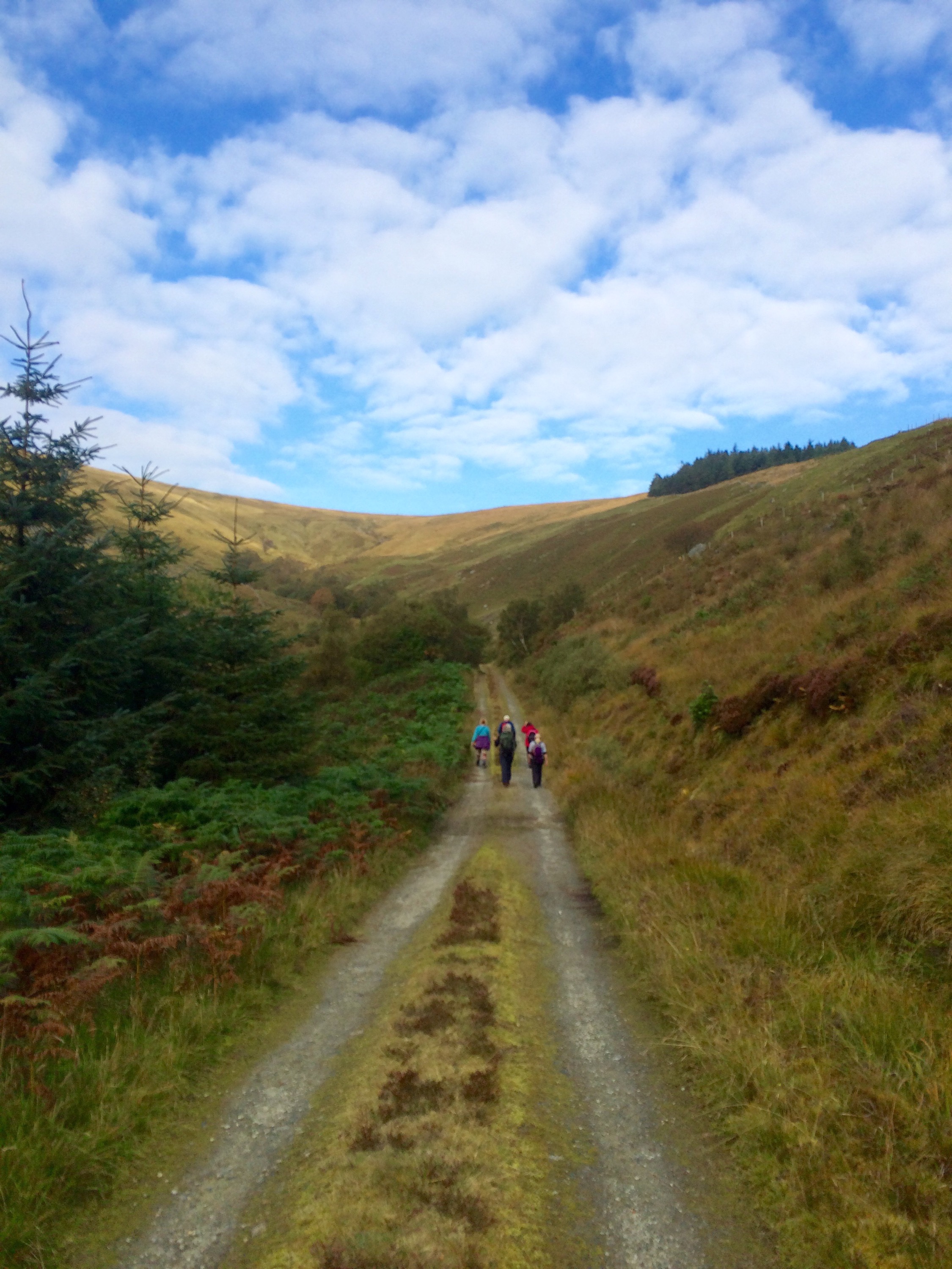
Starting off at the end of the public road in Glenmassan, the first section on level forestry road leads to the old sheep fank where the climb starts. The road continues steadily uphill, winding it’s way through the trees. The road terminates and is replaced with an ATV track which again climbs through the trees giving access to the open hill.
")
")
")
")
")
")
")
")
")
")
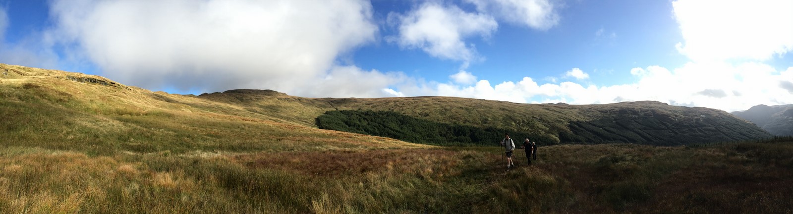
Following the well defined ATV track as it turns left followed by a right onto the ridge that leads to the summit, looking back provides great views to Loch Tarsan and beyond.
")
")
")
")
")
")
")
")
")
")
")
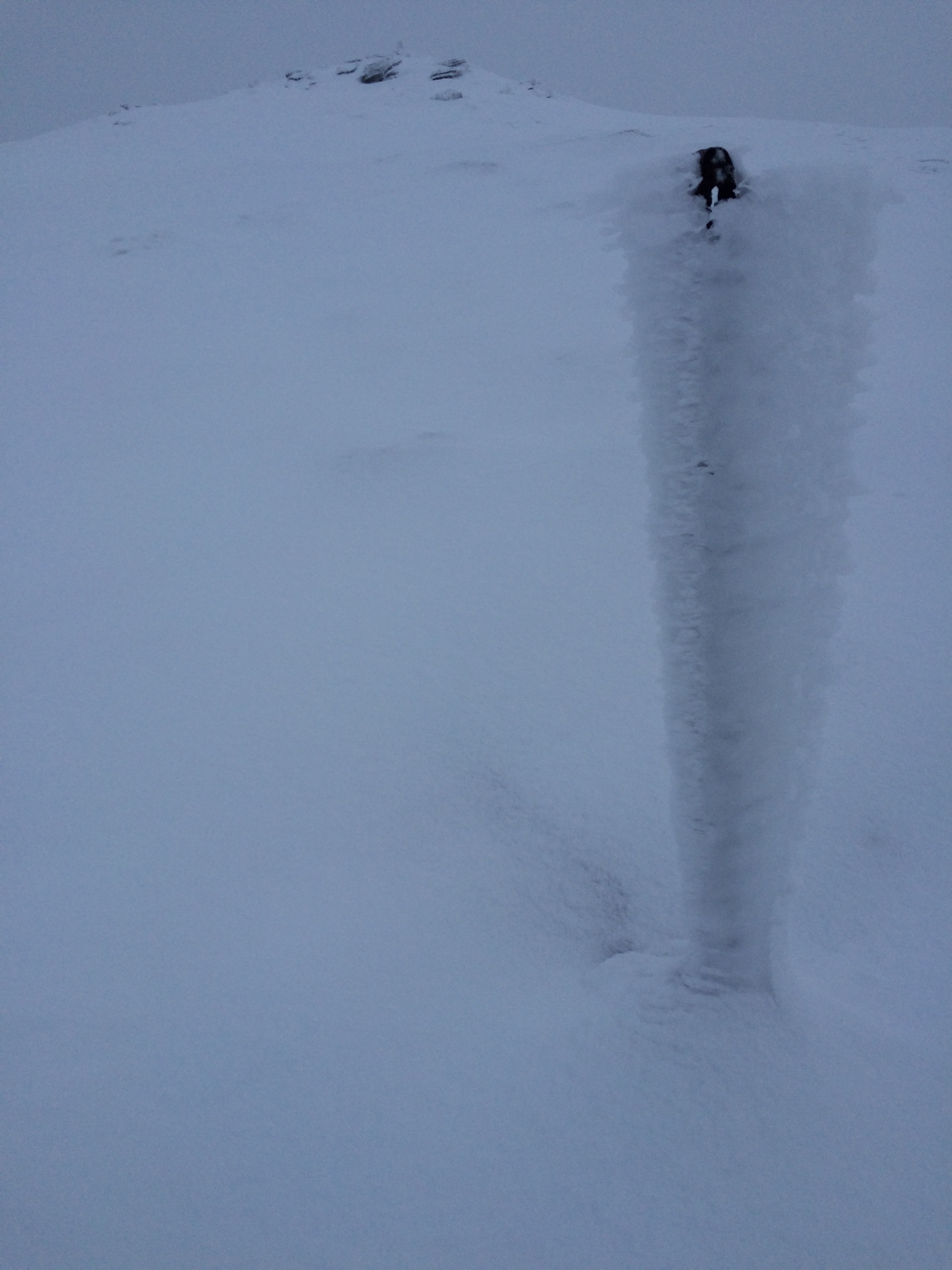
Beinn Mhor summit conquered
Summit 360 degree video.
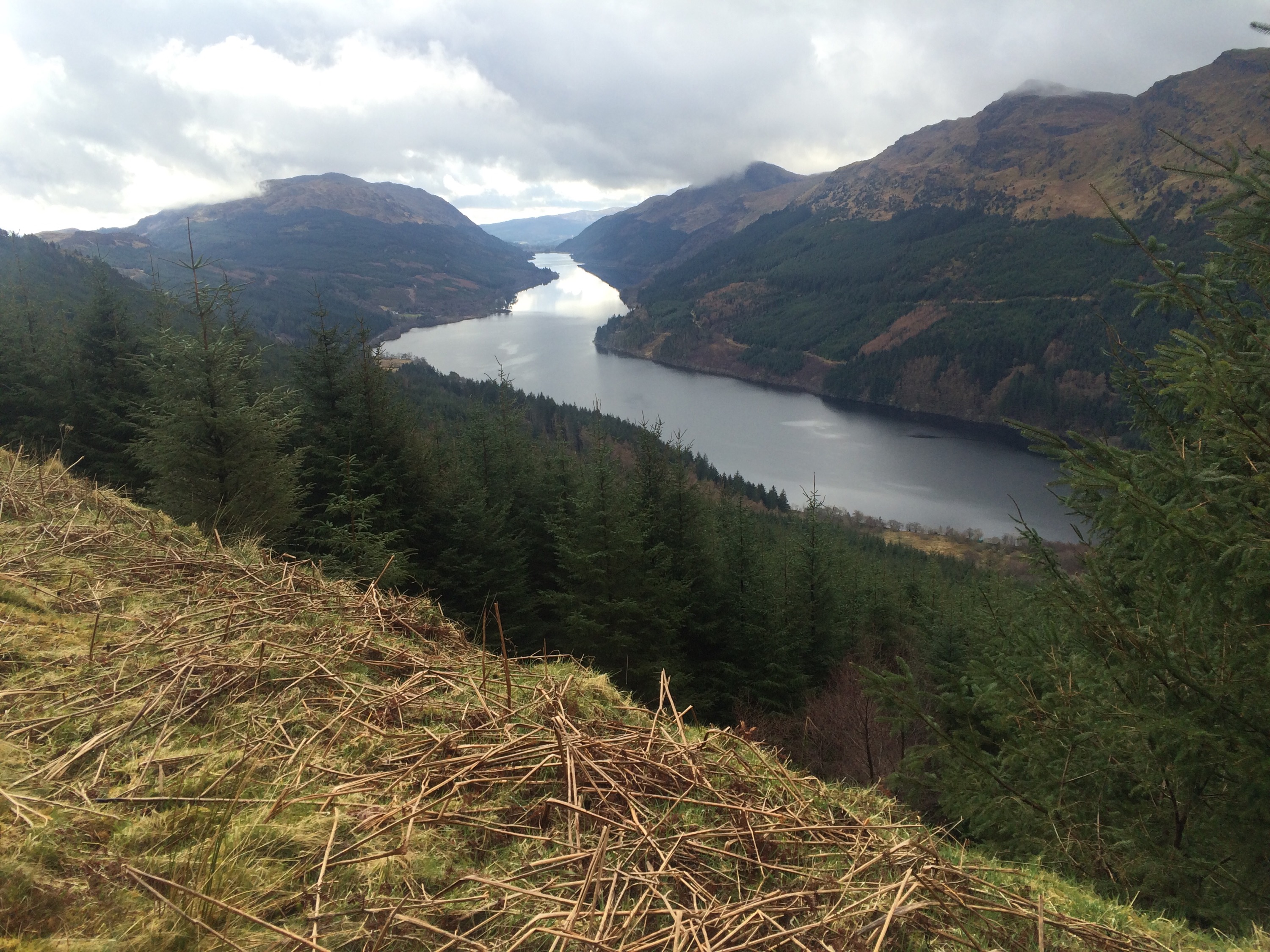
After a bite to eat it was time to set off for Benmore Gardens. Taking in Creachan Mor, Creachan Beag and A’Chruach before descending to Benmore Gardens. A fantastic section providing wonderful vistas of the surrounding area. Referring to this section as a ridge may be a bit dramatic at he plateau is quite wide. However, when walking along the edge of Coire an t-Sith to gain views of Loch Eck, there is definitely a sense of exposure. The prominent rocky formation of Clach Bheinn is never out of sight.
")
")
")
")
")
")
")
")
")
")
")
")
")
")
")
")
")
")
")
")
")
")
")
")
")
")
")
The gate marks the exit from the open hillside, an ATV track descends down to the forestry road above Benmore then access to the top of the Gardens. The path through the Gardens is followed back to Benmore Cafe.
")
")
")
")
")
An interactive map with pictures ( all 93 of them !) and statistics is available by CLICKING HERE
A standard map of route.

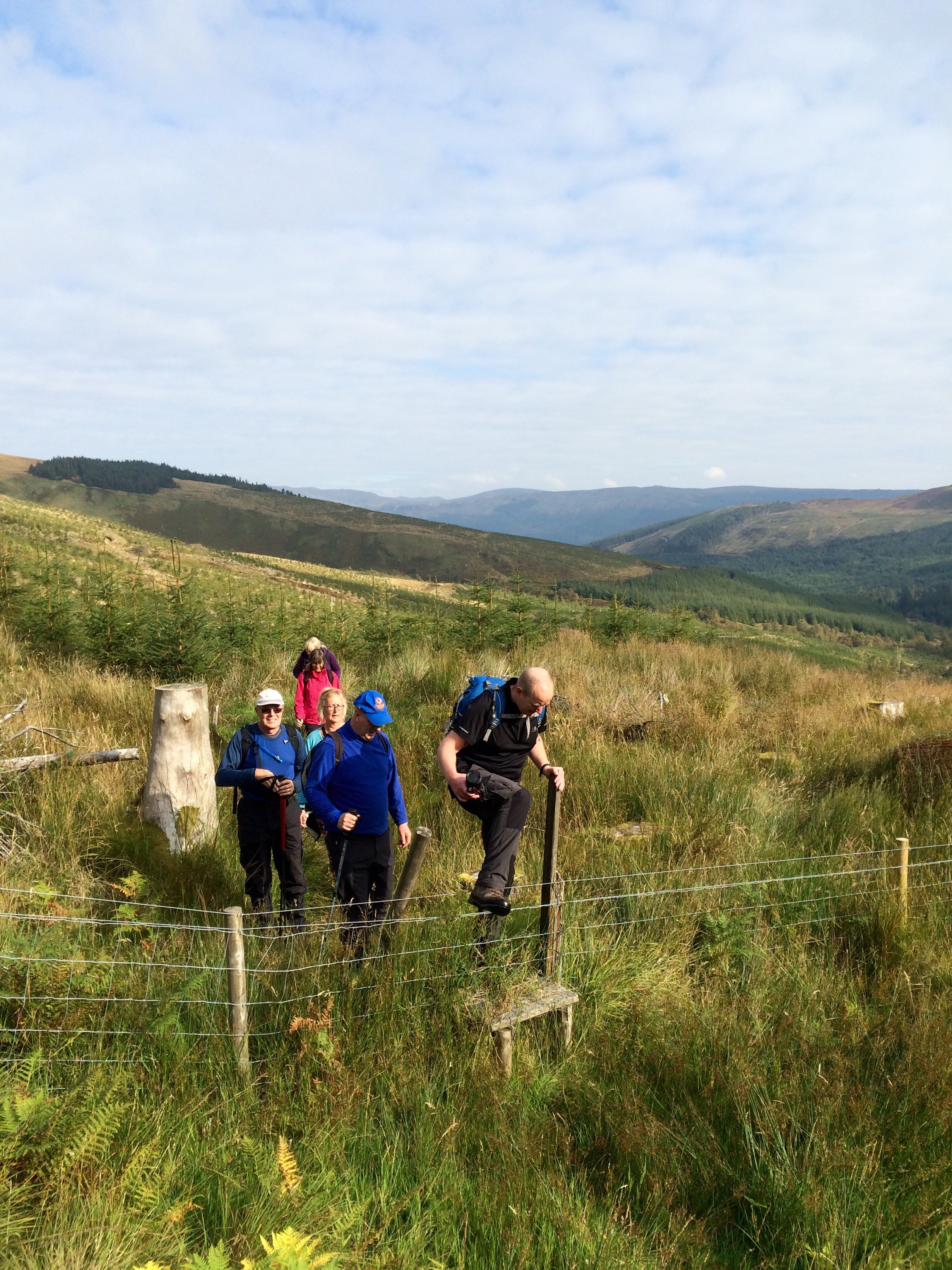
The Coffin Trail leads from Glenkin over to the church at Inverchaolain. Whilst the trail is non-distinguishable the rise from Glenkin over the saddle down to Inverchaolain Glen is a great walk.
Approximately 5.5 miles.

Andy Armstrong led seven of us on this great walk. Andy himself grew up in Inverchaolain so passed on his knowledge of the area prior to the commencement of the walk.
Leaving from the ‘Rumbling’ bridge, heading up the right side of the Glen to reach the sign and the open hill of the trail.


After a brief stop, the open hill awaited. A stile aids the crossing of the fence that was followed to the top of the saddle. A steep but short lived section.


With the ascent completed, a short walk over the tussocky ground provided great views down to Inverchaolain Glen.


The descent was made,again over tussocky ground to the forestry road at the foot of the Glen. Views over to Bute and Arran, though obscured by light cloud were still stunning.


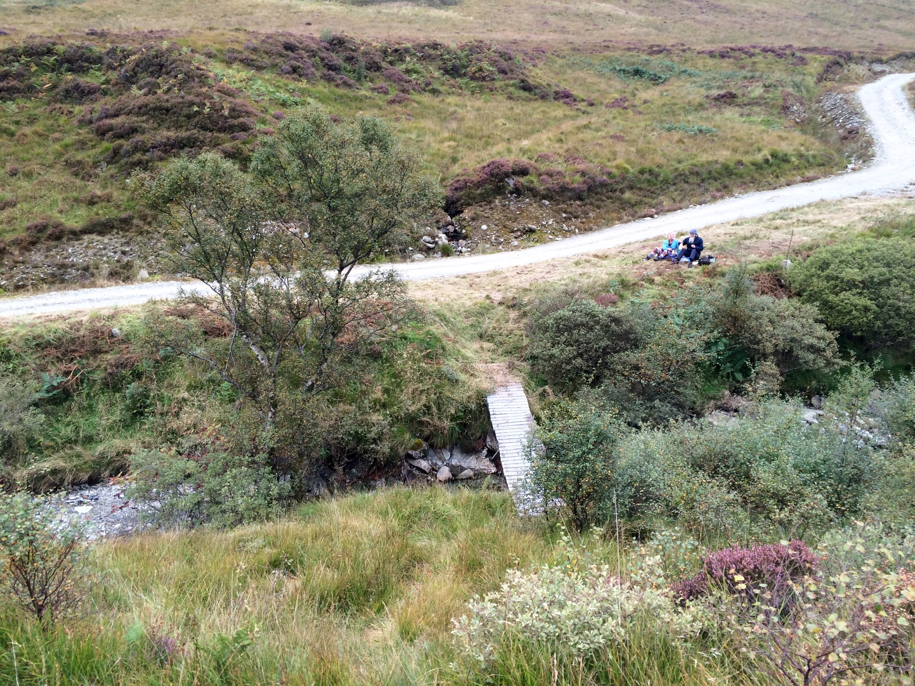
A wee bite to eat and top up on fluids before the final stretch to the Church.

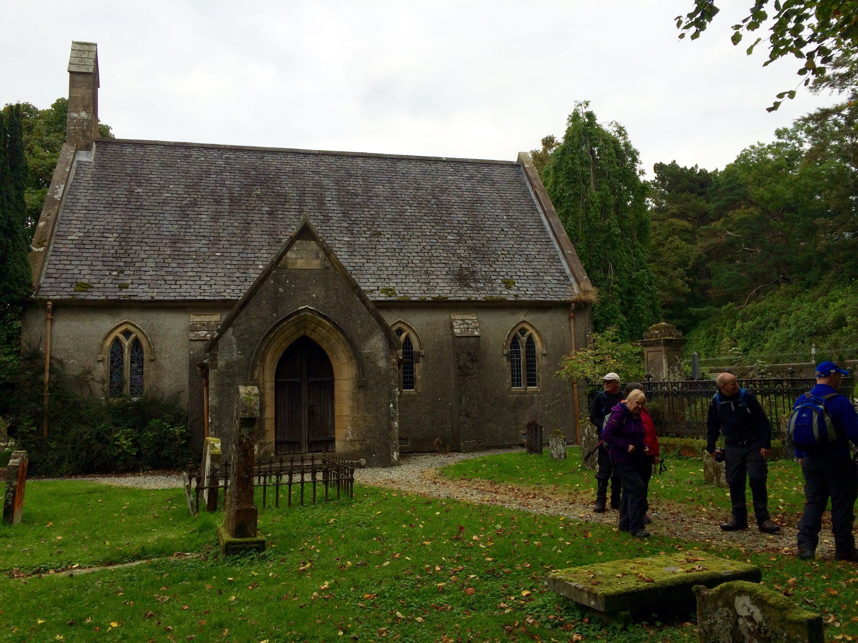
Progress was fast on the last few miles, arriving at the Church with time for a few photos.
Recently the Church has been put of for sale.


Another great walk organised by Cowalfest,again in great company.

For further pictures and route detail please CLICK HERE for interactive map.

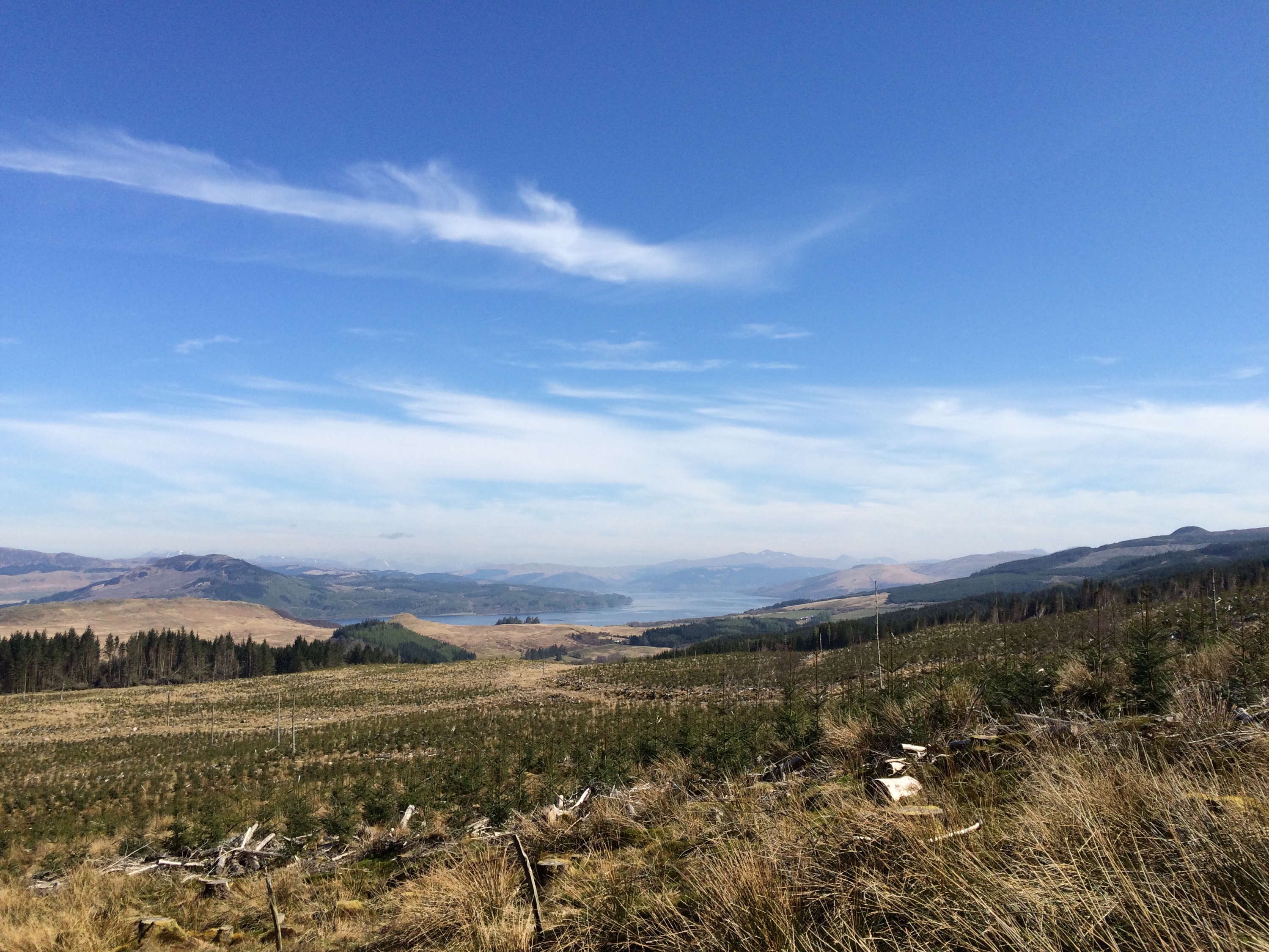
It had been twenty plus years since I last cycled this circuit from Lochgoilhead. A combination of forestry roads and single track makes ideal terrain for the bike or even a walk. The Forestry Commission have marked the 22 mile route with red marker posts,the diversion to Mark Cottage Bothy adds 3 miles. Travelling this route is best done in a clockwise direction
To quote the forestry commissions website………..
A grand tour of the wild, rugged and remote Ardgartan Peninsula with excellent views of the Clyde and the surrounding mountains. It’s a real challenge of a route: you’ll need lots of stamina for the climbs but you’ll be rewarded with fantastic views, chances to spot wildlife and of course some exhilarating downhills.
I started from Lochgoilhead,heading up Gleann Mhor adjacent to the B828, a continuous climb to the foot of Ben Donich. Once through the gate at the mast it’s mostly descent to Ardgarten.The forestry road runs parallel to the Rest and be Thankful. Instead of following the route right to the lowest section at Ardgarten I decided to follow the upper section of the Cat Craig loop. This saved a loss in altitude and a climb back out of Ardgarten. Joining a short section of surfaced road below the Coilessan car park, a quick climb leads to level ground above Loch Long.
A worthwhile diversion is a visit to Mark Cottage bothy. A bothy maintained by the Mountain Bothy Association (MBA). Situated right across from the Finnart Oil terminal,a view with a difference!

I met two couples who’d stayed the night walking their way out. When I arrived at the bothy there was a group with their bikes that’d also stayed and were just packing up for their return home. A bite to eat and a chat and I was back on the road. The 1.5 mile climb back out from the bothy was another climb I didn’t need but worth the effort.
Onwards to Corran Lochan, then the single track of the Dukes Path leading back to Lochgoilhead. A great section in amongst the hills. Some sections did require a push, but I was glad to get off the saddle now and again !

Some pictures along the way………..
")
")
")
")
")
")
")
")
")
")
")
")
")
")
")
")
")
")
")
")
")
")
")
")
")
")
")
")
")
")
Interactive map of route with further pictures CLICK HERE.

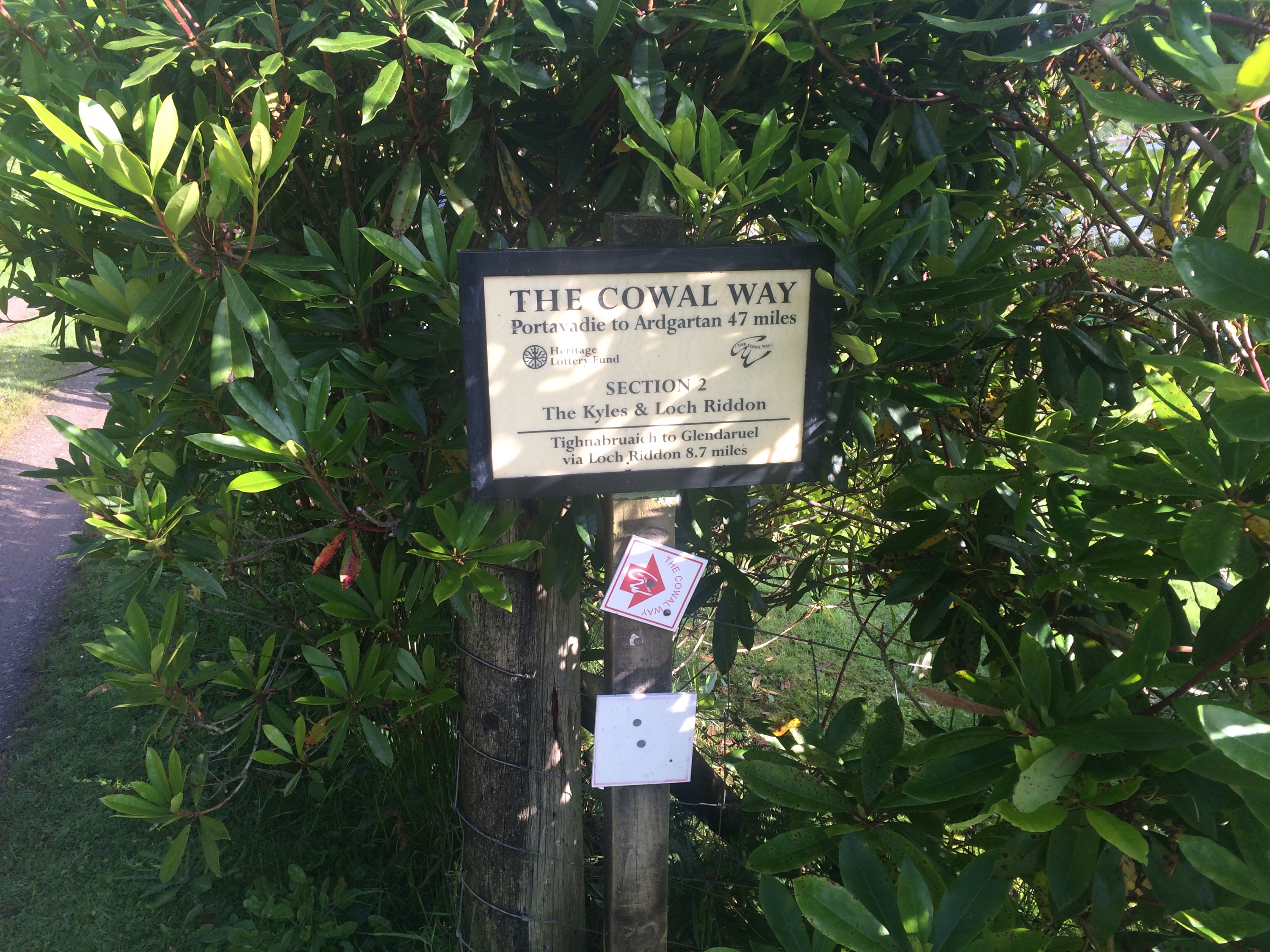
It might be like watching paint dry but you will be able to track my progress as I undertake the Cowal Way ( signal dependant) via Viewranger.
Hopefully this Thursday.
Updates should be every 5 minutes or so , starting approx’ 06:00hrs Thursday the 13th August.
Link will be posted on Explore Cowal’s Facebook and Twitter pages as I’m ready to set off.
Click HERE to take you to my tracking page.
Thanks.
A morning trip to Buachalean,Toward.Taking advantage of the clear dry mornings,an early start so i could get back for work.
Leaving from the FCS car park at Ardyne,turning right once on the first trail and following it as it passes over an overgrown forestry road. Looking back the view over towards Bute already opening up. Continuing straight up the trail ingnoring any others that lead off,soon joins a forestry road. A left turn is required then a right turn leaving the road for an ATV track. The ATV track is defined and soon follows a wall to the base of the hill. A hole in the wall leads to a track that leads straight up the hillside to the summit. The views to the South over Bute and Arran make the trip well worth it.
On the return, a visit to the Chinese Ponds is a must. Situated on the left once descending from the top forestry road.
")
")
")
")
")
")
")
")
")
")
")
")
")
")
")
")
")
")
An interactive map with pictures and stats is available by clicking HERE
Summit 360 degree video
I’ve been out and about recently,mostly repeating previous reported routes.
However, after a message from Malcolm of Scotland Hikers Group, I decided to head for the hills. He’s planning a trip taking in Inverchapel Burn,passing over Beinn Ruadh to head for the Lochain situated high amongst the rocky summits.
There are no paths, however there are various deer/sheep tracks that can help with some navigation.
First trip was the access the open hill via Inverchapel burn. Natural woodland and side slopes pretty much sum up the terrain of the river section,prior to the climb onto the open hillside. I returned via the route I did in the winter time. Route confirmed the continuation to the summit on the day would be straight forward.
Some pictures……….
")
")
")
")
")
")
")
")
")
")
")
")
")
Second reccy trip was to establish a route off the hill from the Lochain,to join the forestry rd for the the return to Inverchapel. My ascent route was the same as descent route,have only included the pics for the return section as hopefully that’ll be the direction final the walk will be carried out in.
The weather wasn’t ideal for navigation,but the track through the hills seemed ok. A steep descent with wet slippery grass prior to entering the forest was the hardest part.
Some pics of todays reccy……..
")
")
")
")
")
")
")
")
")
")
")
")
")
")
")
")
")
")
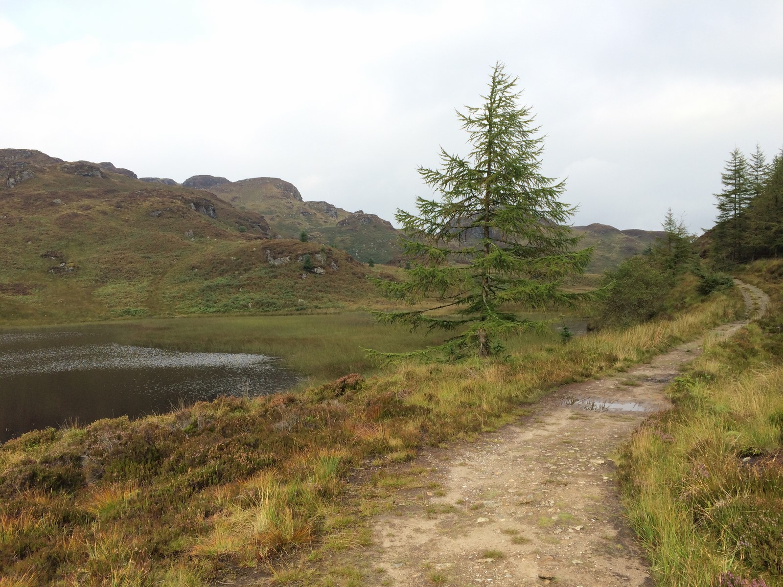
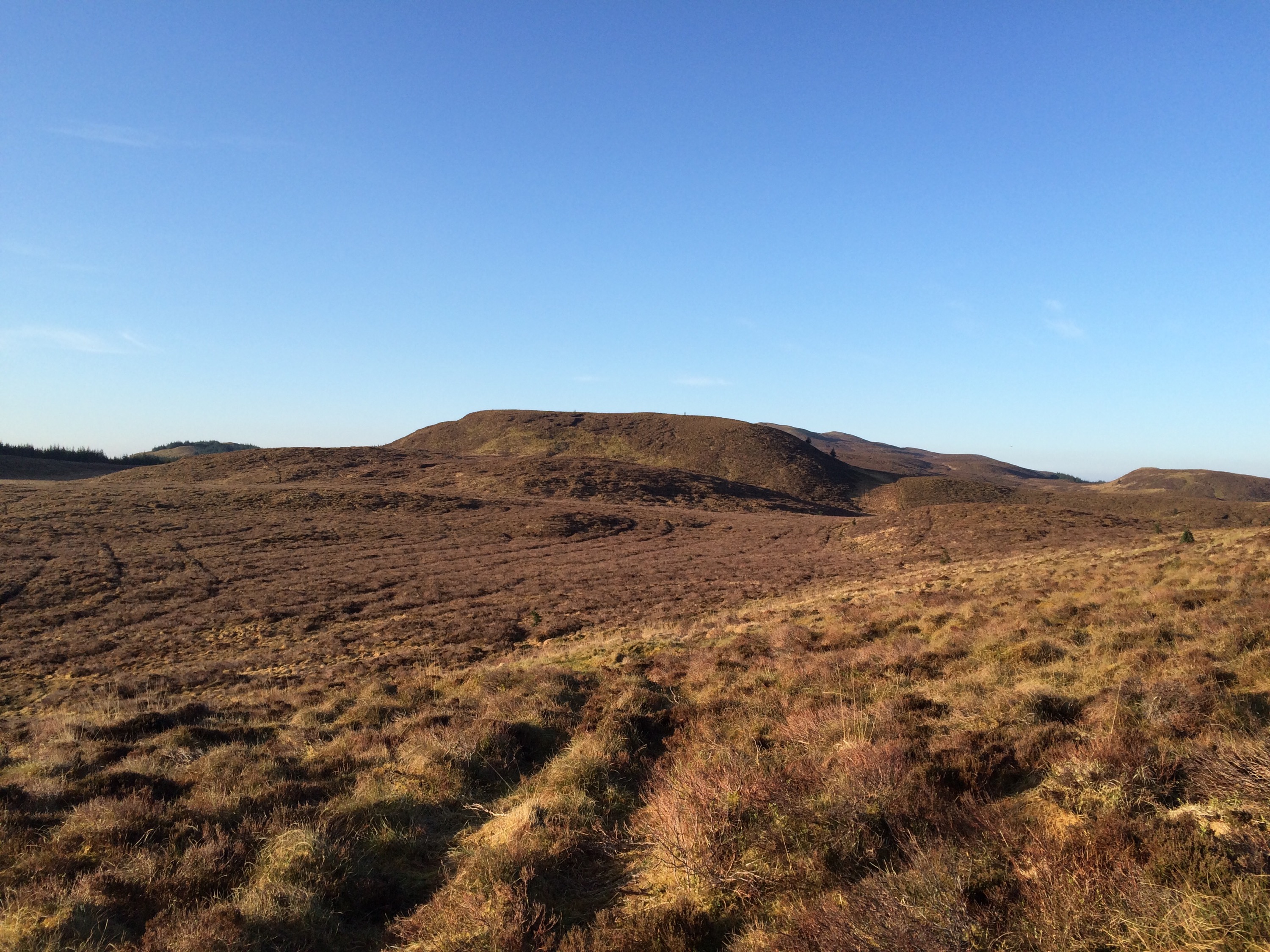
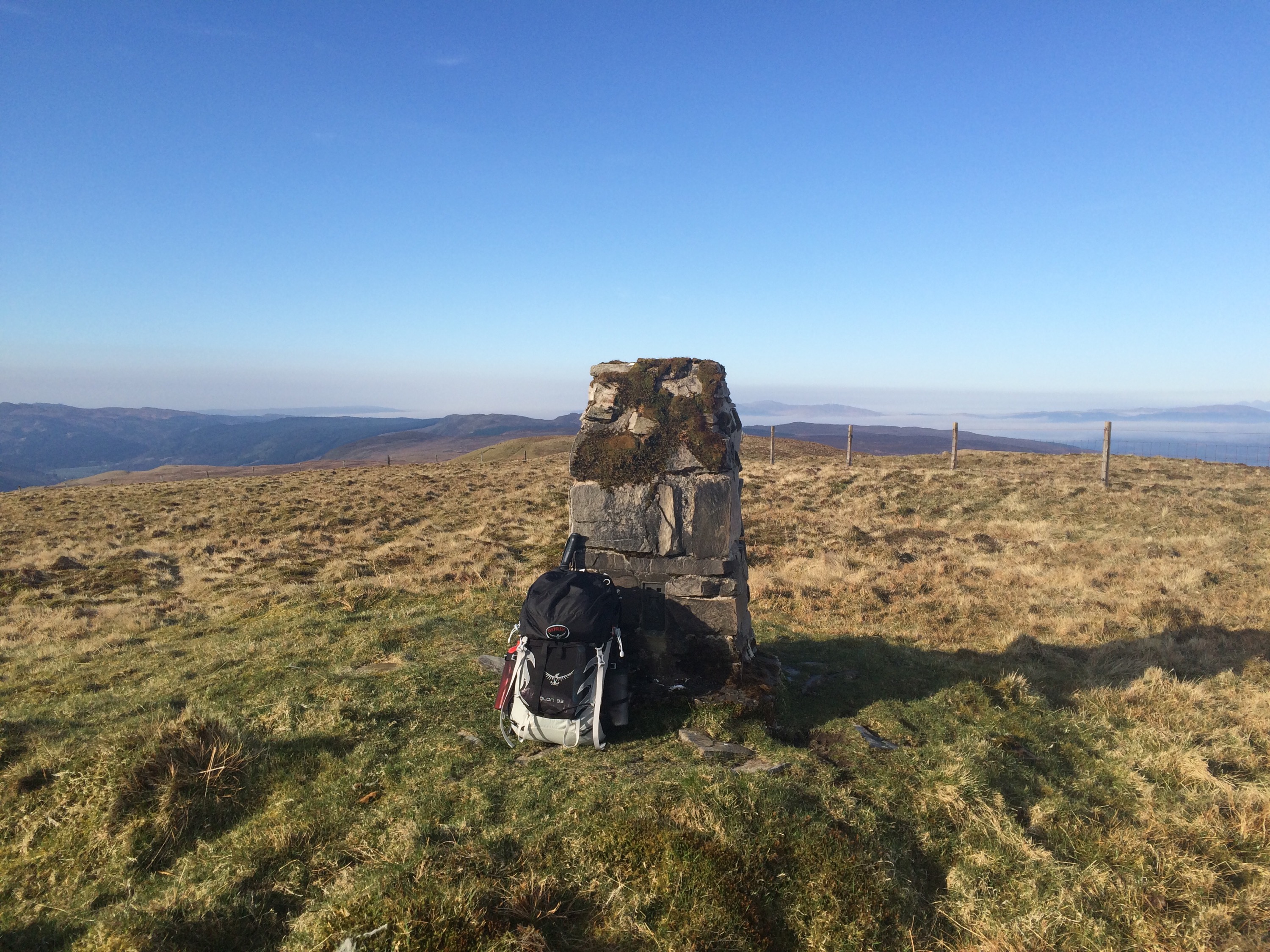
A trip to an area I’ve never visited before, the hills above Glendaruel/Srtathlachlan. Initially my plan was to visit the Lochain but with some extra time on my hands I decided to go for the trig point as well.
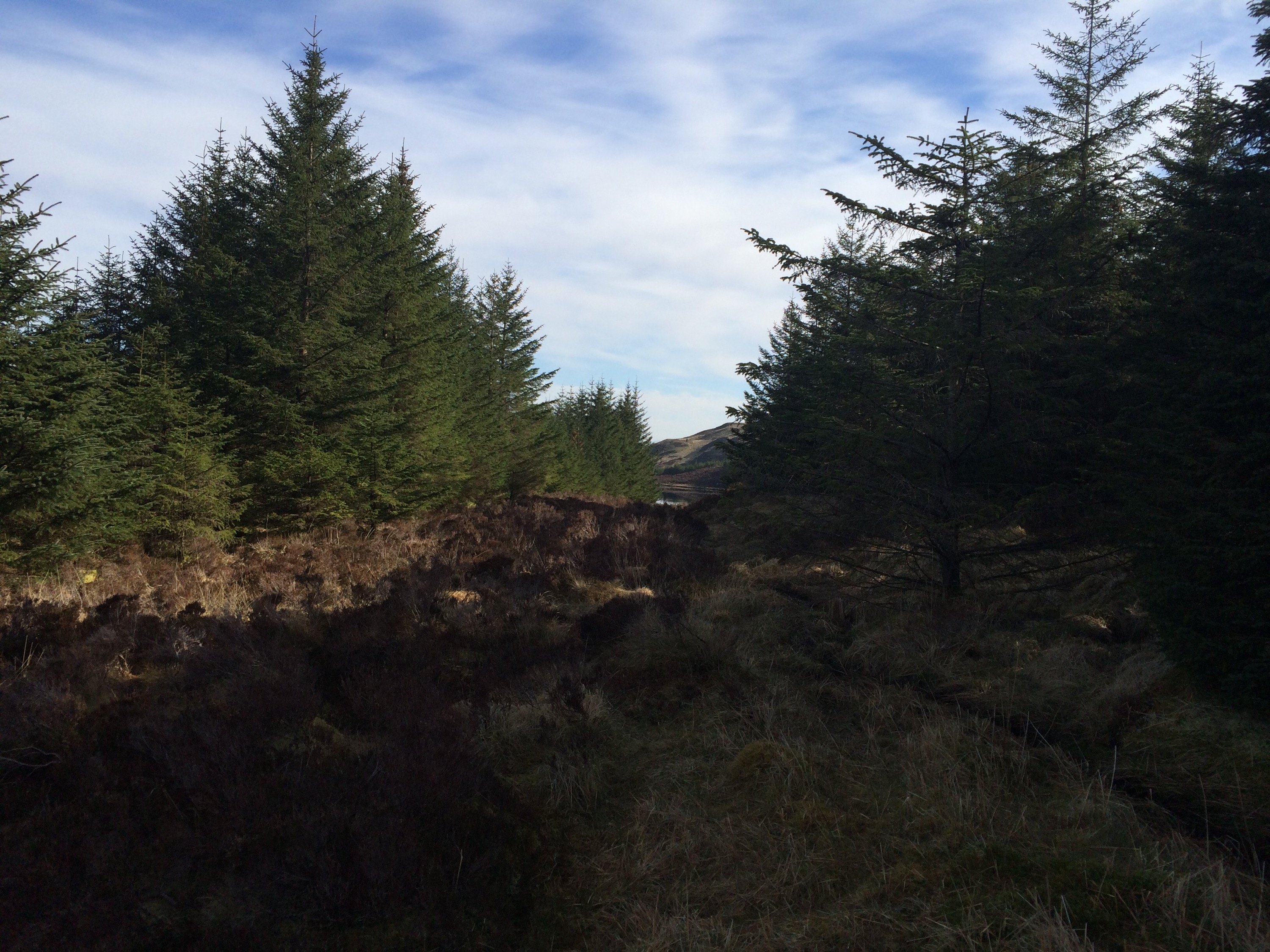
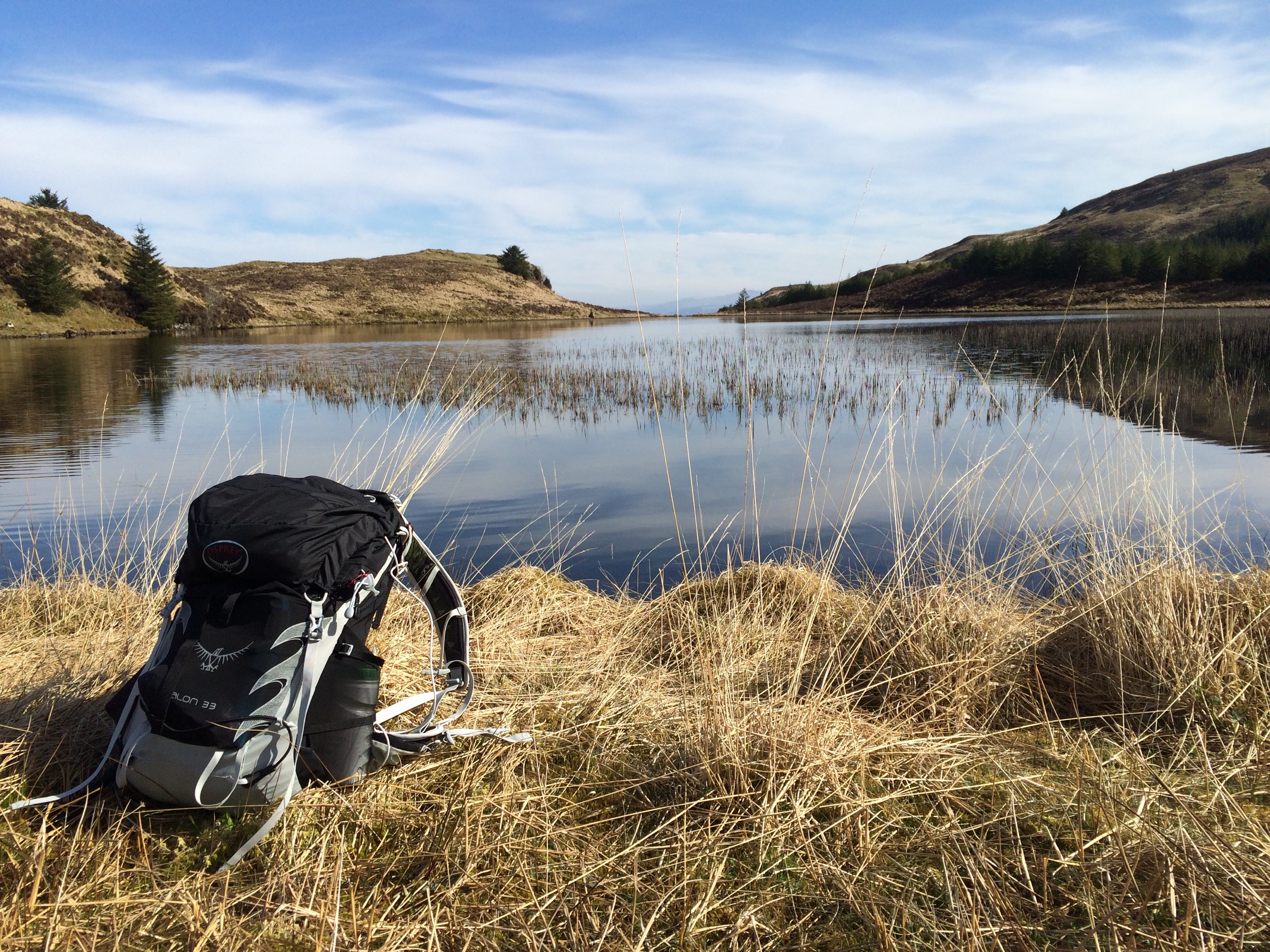
Setting off from the forestry road at Garbhallt, joining an atv track and finally onto the open hill where you can choose your own route. A fence line on the open hill aids navigation over the tussock strewn landscape. Once the trig was checked off the list, it was time to head for the Lochain. Not before taking in the views over to the Paps of Jura. Unsure of how to approach the Lochain it was a case of heading to the highest vantage point to check for access. Couldn’t see much on the way of access so headed for a burn that showed on the OS map, a wise choice as the clearing at the burn lead straight to the Lochain.
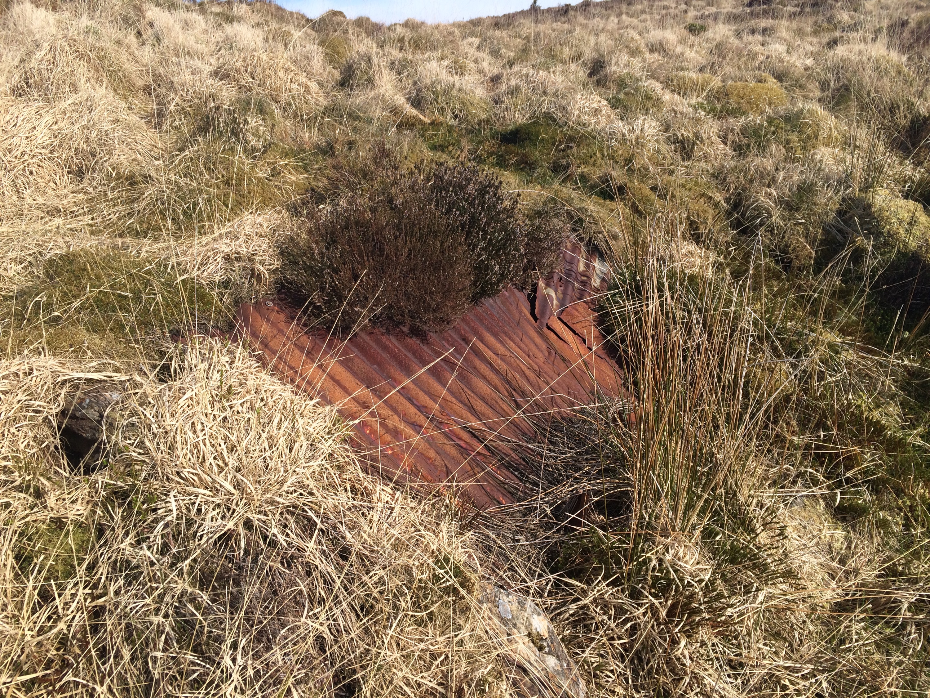
The Lochain was stunning, lying low, surrounded by the hills, hardly a breath of wind. The OS map indicated there was a boat house, however only a few bits of corrugated iron remain. One I’d circumnavigated the Lochain I headed back via the access route and back down to join the ATV track.
To the Trig.


To the Lochain.

Fully interactive Map with additional pictures and stats click HERE
Just for fun……..


……….The Gruffalo Trail.
A great walk round Arkinglas Estate today. Mainly to find the Gruffalo, but the trees and shrubs can’t be ignored.


")
")
")
")
")
")
Plenty of info on the Gardens by clicking HERE
