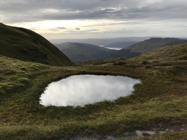
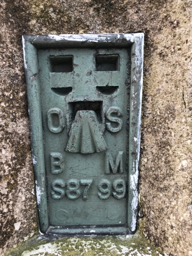
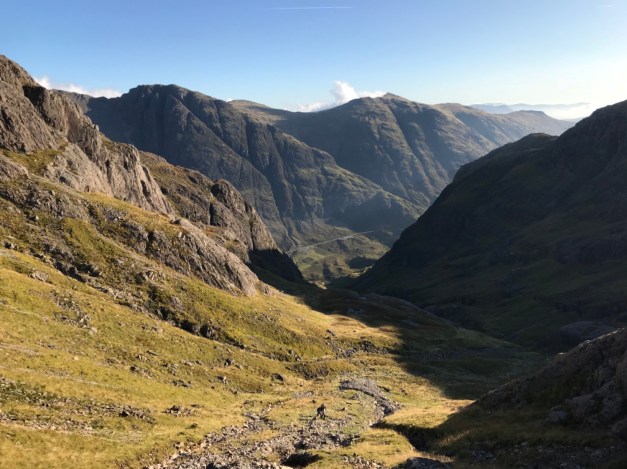
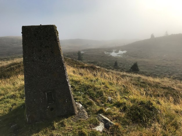
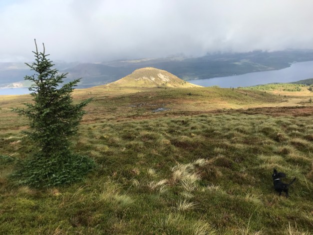
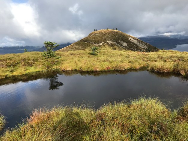
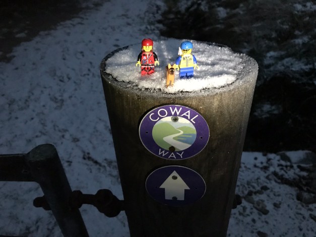
Looking for a quick fix, the trig of Cruach nan Capull was the target. There seems to be a number of Cruach nan Capulls, this one off the A886 with the Fairy Knowe as it’s neighbour – a great combination.
Headed off from the lay-by on the A886 above Strachur. Easy to navigate using the fence lines, the trig was an easy find despite the boggy terrain in some sections. Once the trig was conquered we headed over to Sidhean Sluaigh (Fairy Know) a prominent hill seen from the main road.
It’s been a while since I put anything on here! I have been out n about but mostly mundane repetitive stuff aimed at shifting some weight! Been busy the last 6 months renovating a flat so I’ve lost a few seasons!!
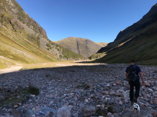
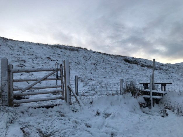
Anyway……. the Cobbler in Arrochar, Ben Arthur as it’s also known. A fine Corbett and always a busy one too – despite the £9 a day parking charge at the Succoth car park. A well documented hill, with a well trodden defined path to the summit, threading the needle an option for the brave or mentalists 😂.
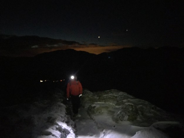
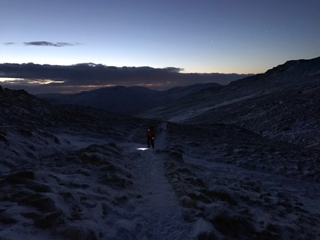
Moral of the story is my mate text to see if I wanted head to the Cobbler on Saturday, sure….why not? I could do with some Hill time. He then confirmed it’d be good to be on the summit for sunrise!! A 04:30 drive from Dunoon was the start of our journey. This did afford us the luxury of being first on the hillside breaking a trail through the spindrift sometimes hard to distinguish snowy path.
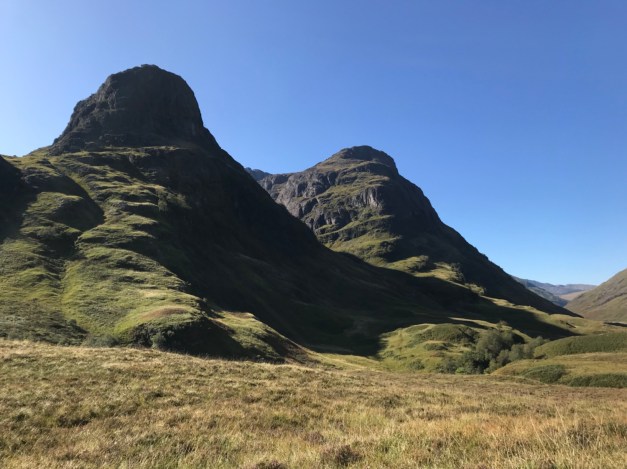
Enough narrative, photos can explain the rest 👍
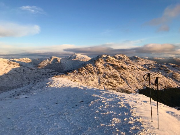
Dark ascent.
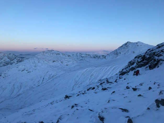
First light.
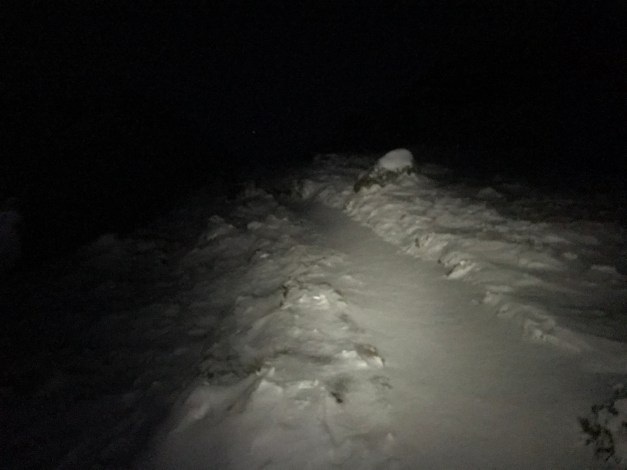
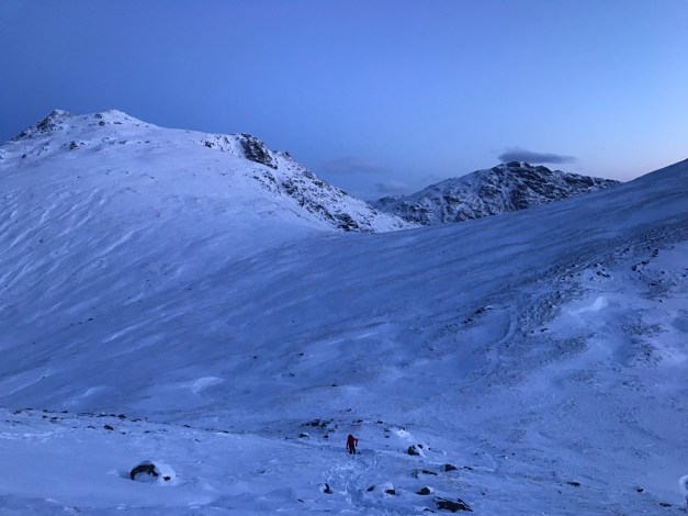
Final ascent.
It was -18 on the summit for sunrise! Needs less to say, spending 20 minutes at the top was enough time up there. A great day on a fantastic hill in great conditions. My micro spikes proving their worth on the lower paths, especially on the descent.
Attempted to load a video but it’s not having it!!
At 764mts the recent addition to the Corbett family (July 2016) provides an excellent walk.
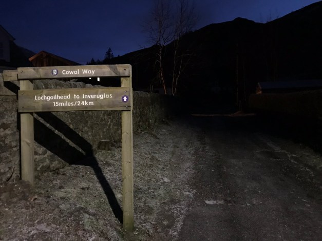
The walk beginning in Lochgoilhead initially takes in part the Cowal Way before heading away from the way marked trail.
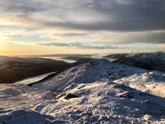
The snowy summit of Beinn Bheula on the opposite side of Loch.
Navigation of the Cowal Way isn’t problematic, initially on a forestry road, then a hill track to the gates fence line before the open hill. The path is less distinguished however, marker posts lead the way.
Once on the open hill, the views open up, the hills enhanced by the recent snow fall-caught at sunrise only made the views better.
From the top marker post, it’s time for the open hill. I was fortunate to pick up a track through the snow made by a previous group, looks like they’d headed in via The Brack.
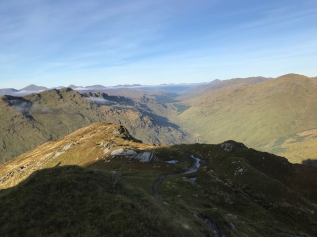
The gain in elevation provides more stunning views in all directions.
The summit view is stunning. It’s worth walking out to the furthest point to gain a better vantage point over the surrounding lochs.
Summit 360.
Descent made by the ascent route in slightly better light. Allowing a quick stop off at one of the waterfalls.
A great shift on the hill in ideal conditions, providing excellent vistas.
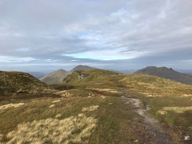
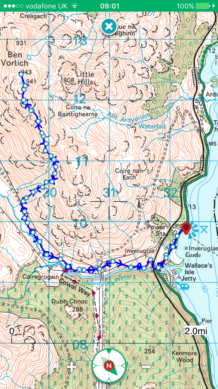
At 943mts Ben Vorlich is a Munro and forms part of the ‘Arrochar Alps’.
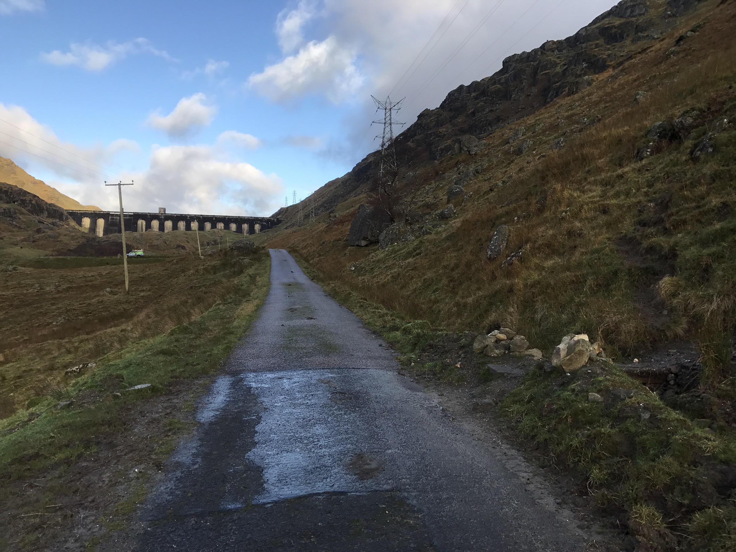
The start/finishing point is at Inveruglas, Loch Lomond. Parking is adjacent to the Loch Sloy power station on the shoreside, charges apply when the machine is working.
An early start meant the first few miles were in darkness. Initially along the main road then onto the tarred access road to the Sloy dam, an easy straightforward approach.
The start of the hill section is highlighted by a cairn at the side of the road.
Pic taken on return off hill.
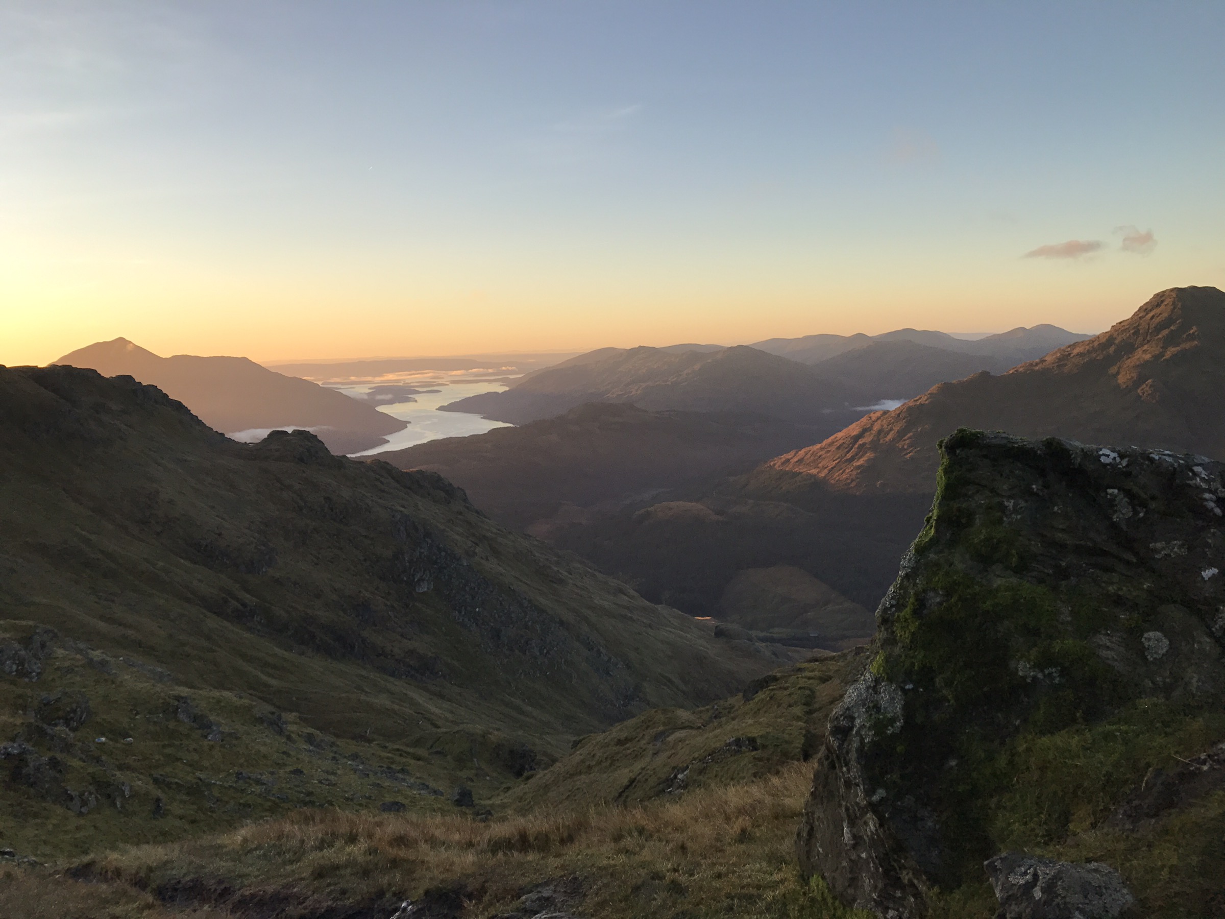
Leaving the main road it’s a steep ascent, eroded path, washed out and boggy sections await until the path improves higher up. Views over Loch Sloy are obtained in the initial climb.
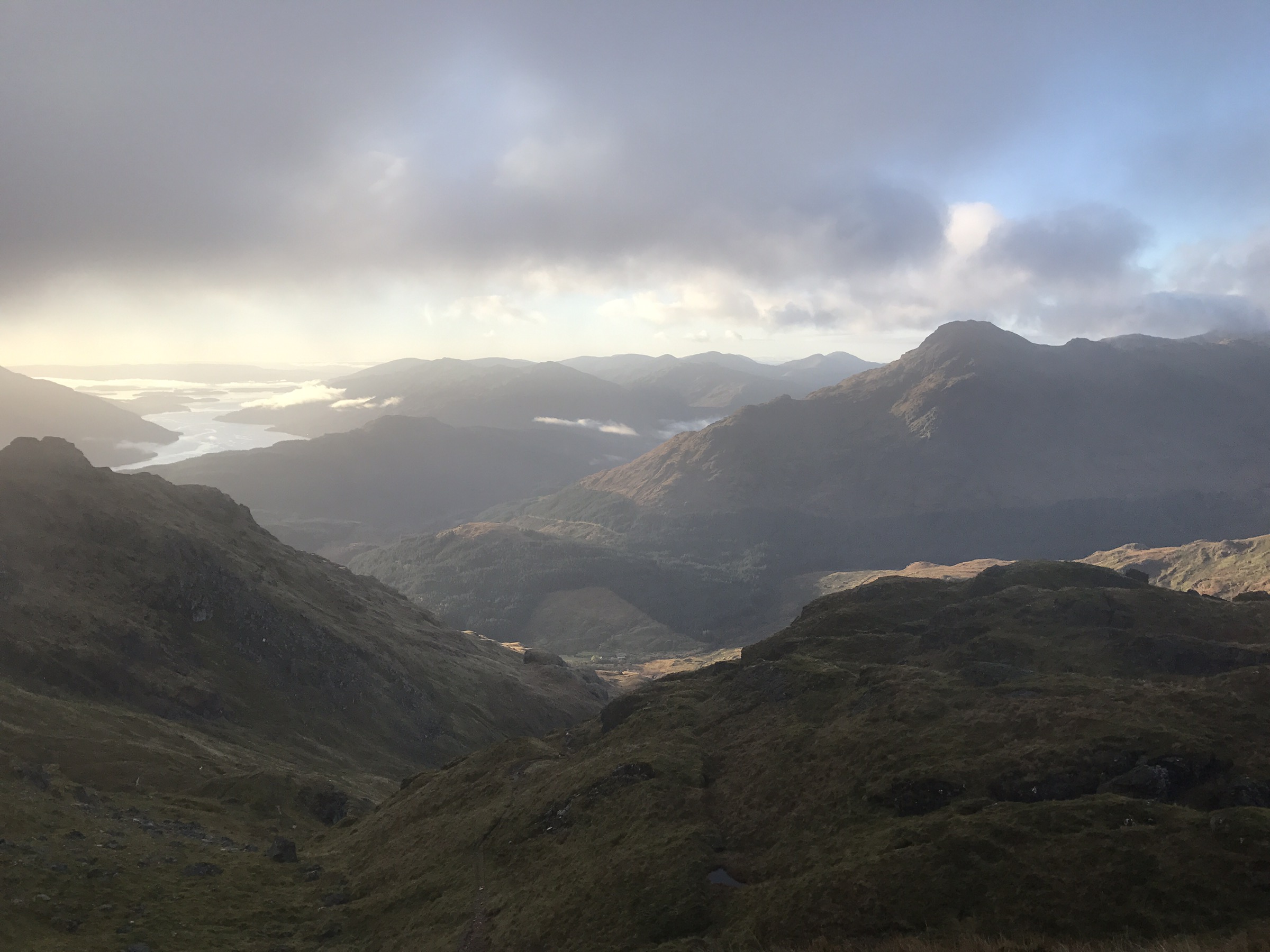
Pushing on, the views only get better – Loch Lomond and it’s islands catching the most attention.
The path eventually tapers out to become a less relentless, enjoyable ascent.
Onwards to the trig and the summit cairn just beyond, sadly the clag came in within seconds of reaching the summit.
Returning on the same route, the descent of the lower section was a slippy one!
A great morning on the hill and well worth the early start! 👍
A walk that may or may not be to everyone’s taste.
A blot on the landscape or engineering marvel? You decide.
7 miles.
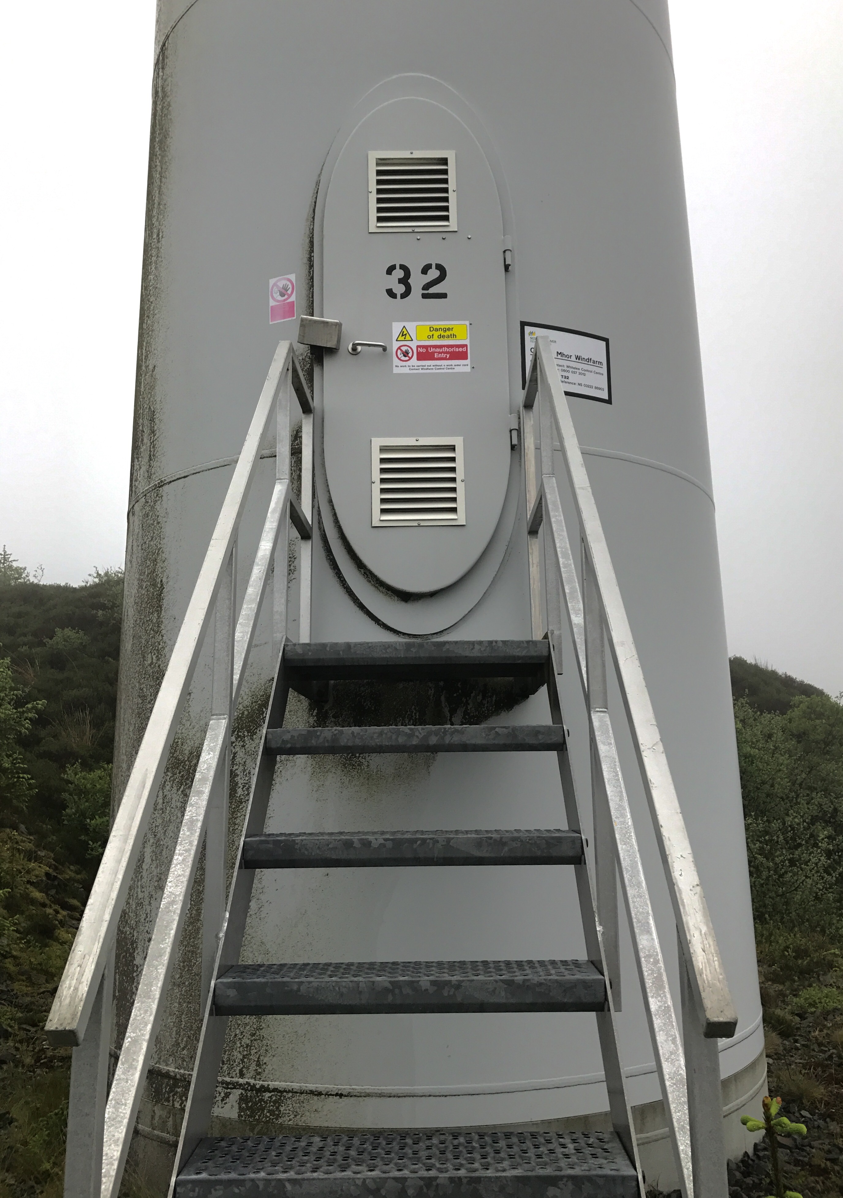
Looking for something different, a walk round the perimeter of the Cruach Mhor wind farm.
Parking by the main road (A886) a forestry road winds its way up the hill giving access to the wind farm. The construction of the access road in generous due to the logistics of getting the apparatus to site. Easy to navigate without straying off onto the spur roads.
A maze of tracks leading to the turbines awaits, a good circular route can be chosen to circumnavigate the turbines.
First view of the turbines.
On the time of visit the mist wasn’t far away, sometimes engulfing the structures. They could be heard but not seen until within 100mtr proximity.
Some of the 35 turbines.
Misty
Access
The tracks within the site are fairly undulating, so after the initial climb progress is easy.
An interesting walk, something different that divides opinion.
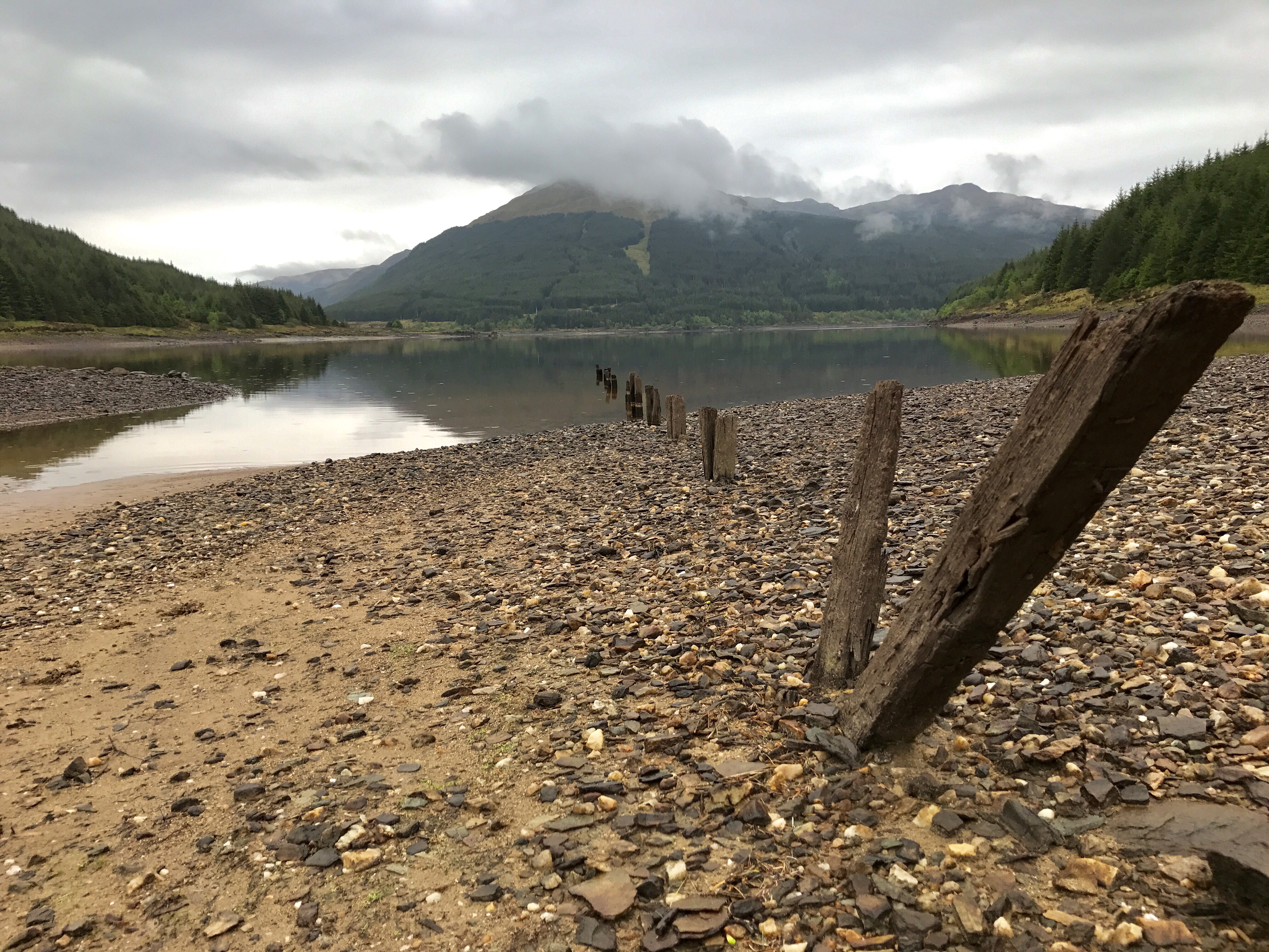
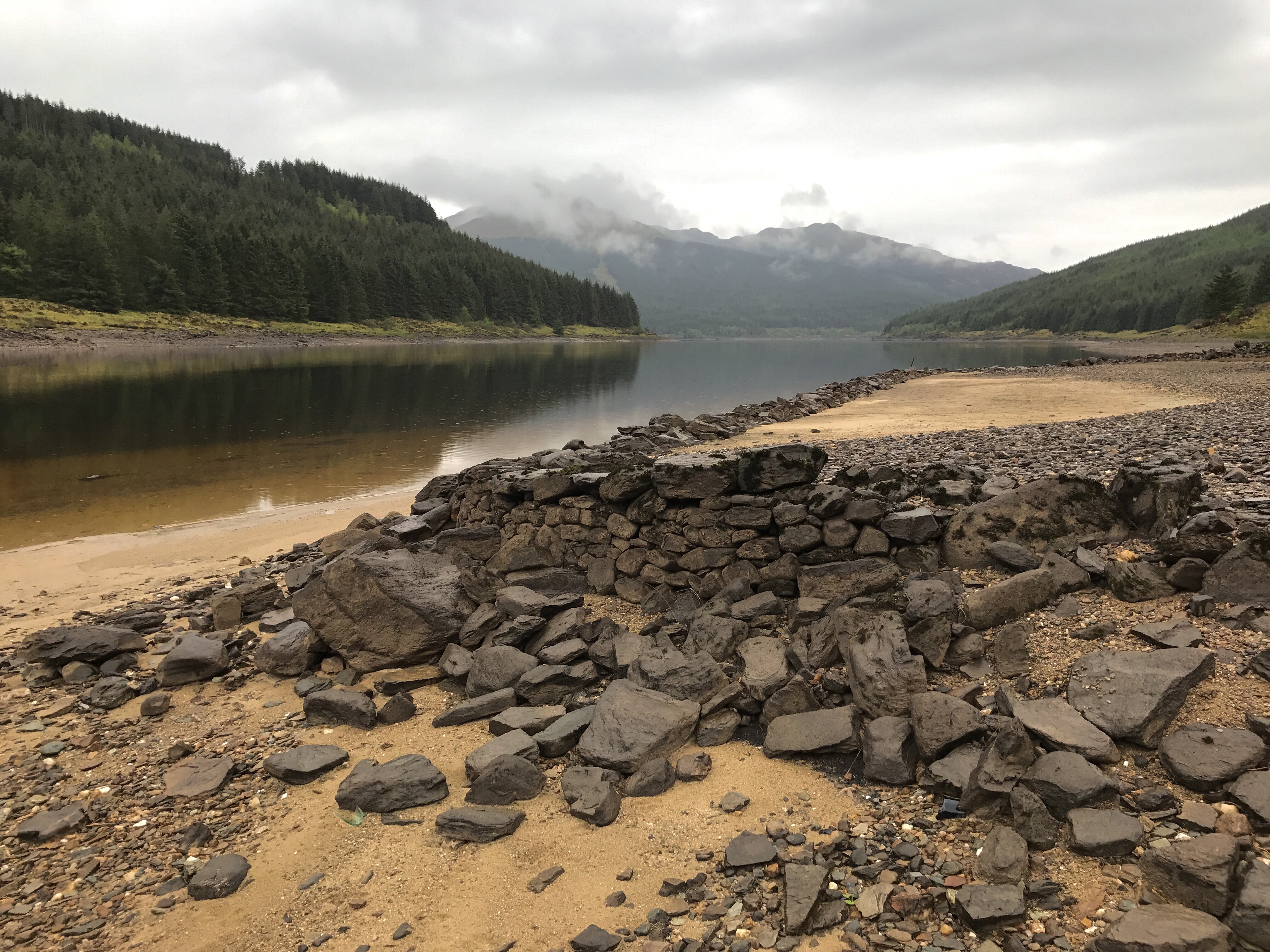
An unplanned route taking full advantage of the low water level at the reservoir allowing the full circuit to be completed.
8 miles.
Outward bound on the forestry road that provides views over Loch Tarsan, a picnic bench perfectly placed for a break.
The original plan was to head to the head of the loch and return on the same route.
On arrival at the larger than normal shore, the recent prolonged dry spell was evident – the flow from the inlet pipe at minimum in comparison to previous visits.
The water line had dropped enough to provide sufficient foreshore to allow progress without the usual restrictions of rocks, vegetation and trees.
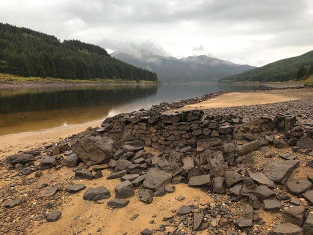
The last remaining parts of the old building on the shore still holding together.
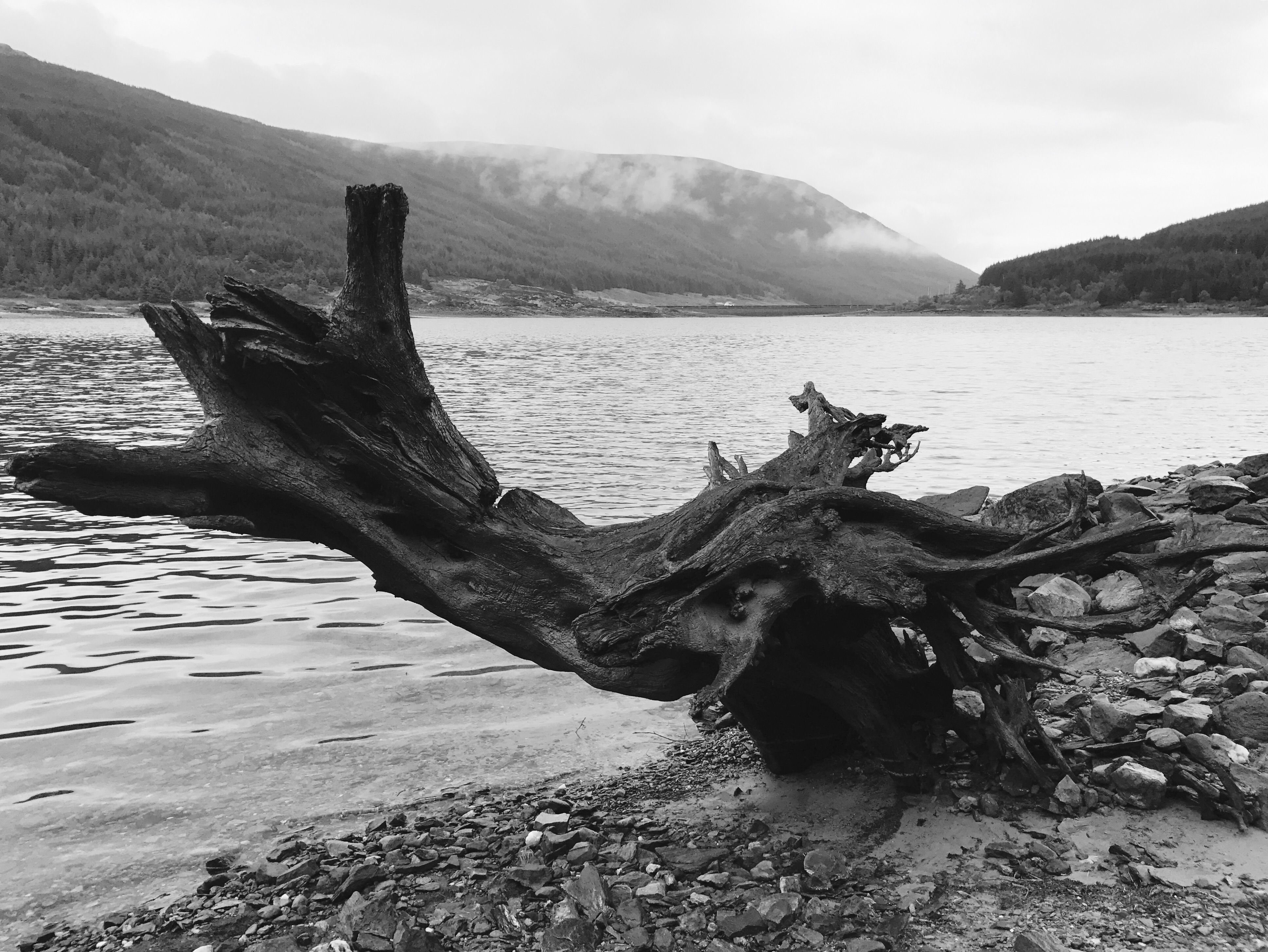
Ground conditions were a mixture of stone,rock,boulders and silt – softer areas could be easily avoided, but the first warning is usually the attempted abduction of footwear.
Raised platforms and diminishing fence lines that disappear into the water perhaps signs of the Glen prior to flooding.
Rugged terrain easily negotiated although 1ft less of water would have made progress easier.
The old boat launch remains.
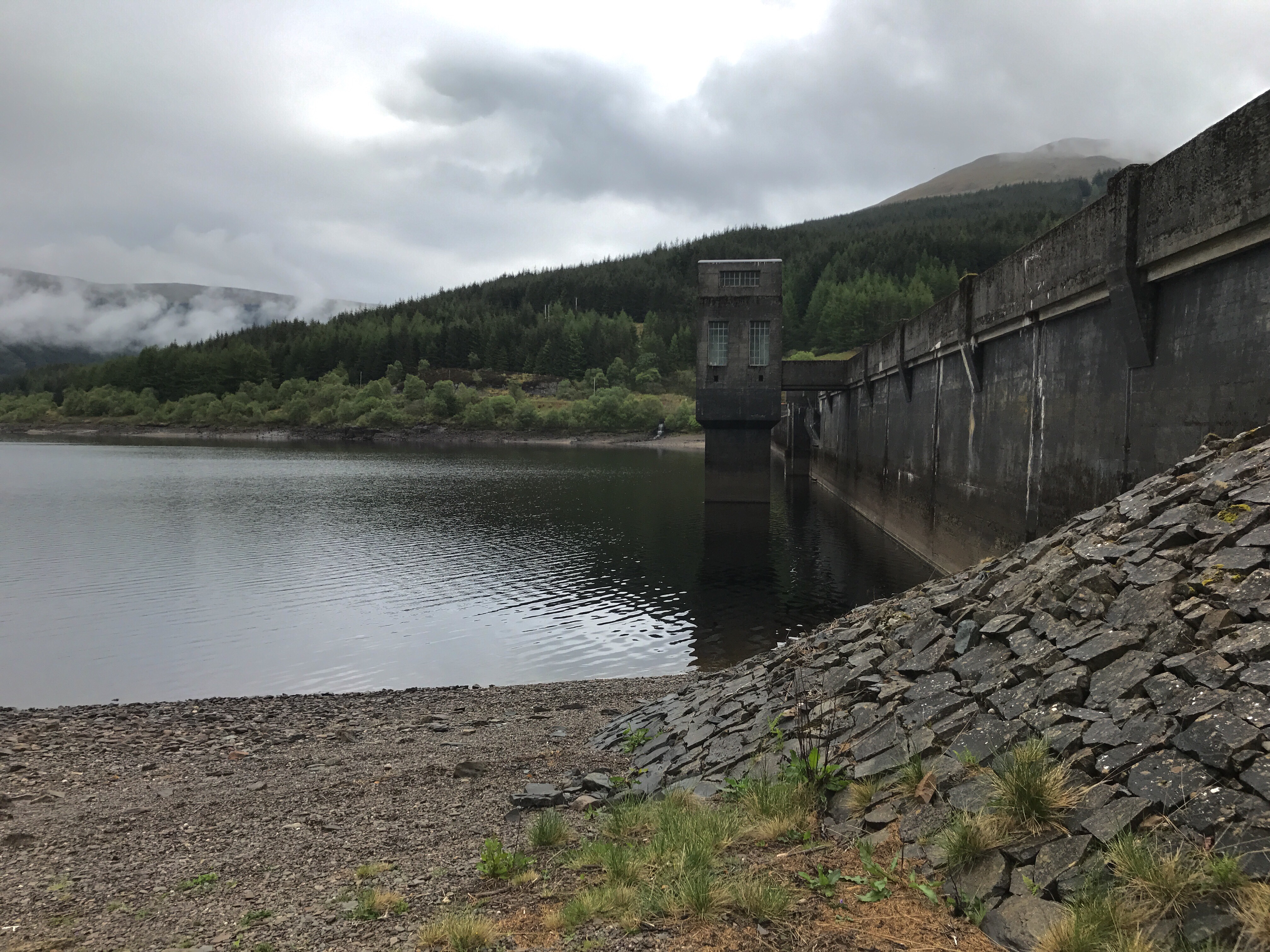
A climb up the bank at the big dam did not pose a problem.
The return to start was via the main road as time was against us on already extended route.
Something completely different that can’t be undertaken normally. It’s not often it’s so dry for so long in the West 👍
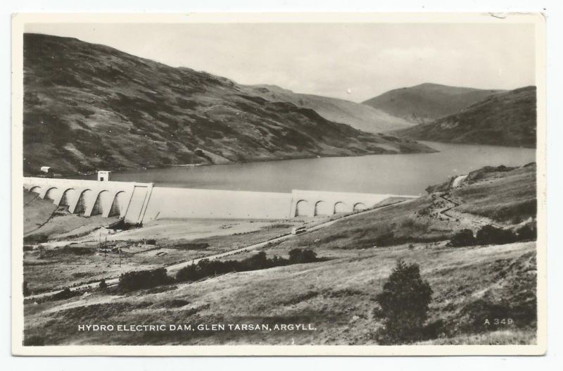
Loch Tarsan; is a freshwater loch and is an impounding reservoir located 13 kilometres Northwest of Dunoon, on the Cowal peninsula in Argyll and Bute, Scotland. This three-armed Reservoir extends into both Glen Tarsan and Glen Lean. It supplies water to the Striven Hydro-Electric Scheme (also known as the Cowal Hydro-Electric Power Scheme). The larger of the two dams is 17.6 metres high and was completed in 1953.
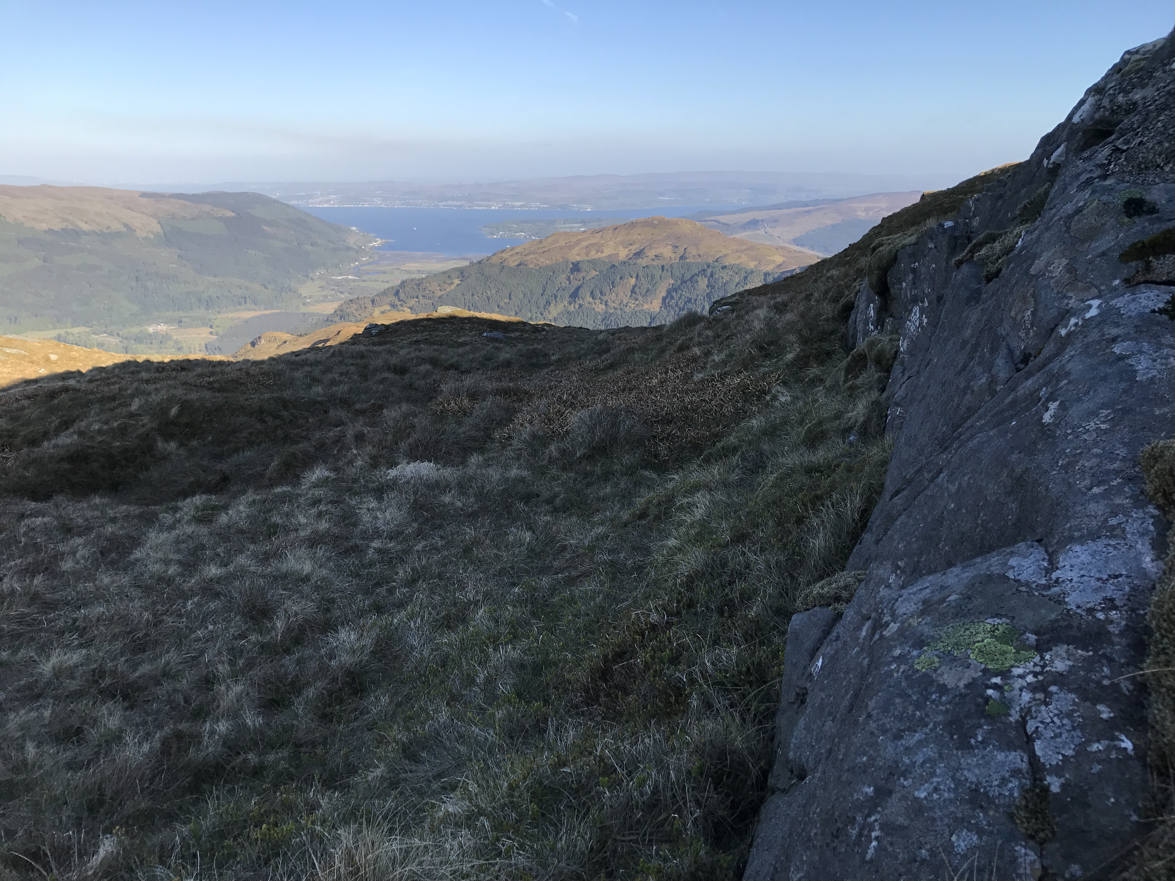
An Creachan at 580 mts was sure to provide some great views.
6 miles:3 Hours
Have attempted this trig point from numerous approaches, another attempt was due.
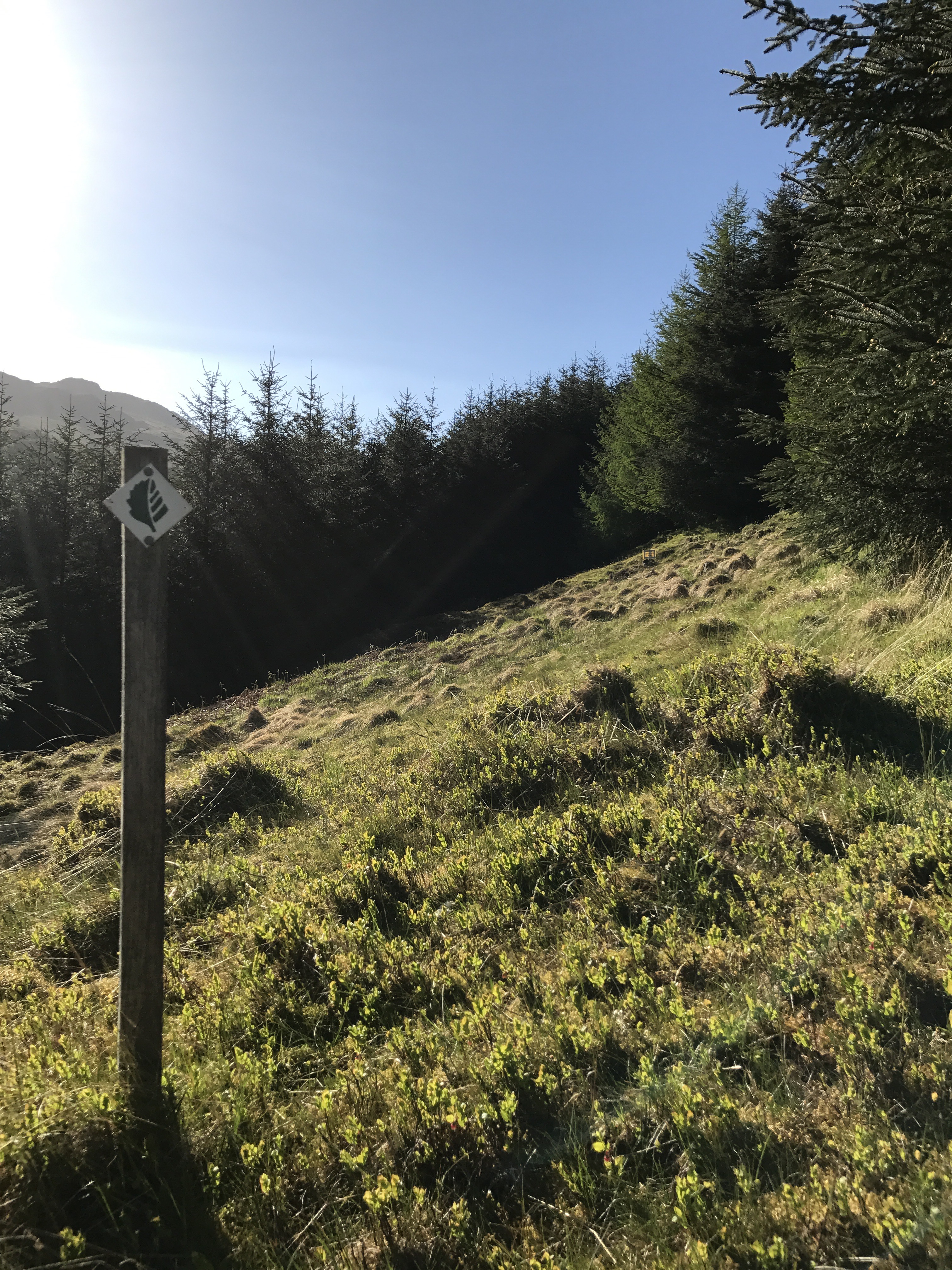
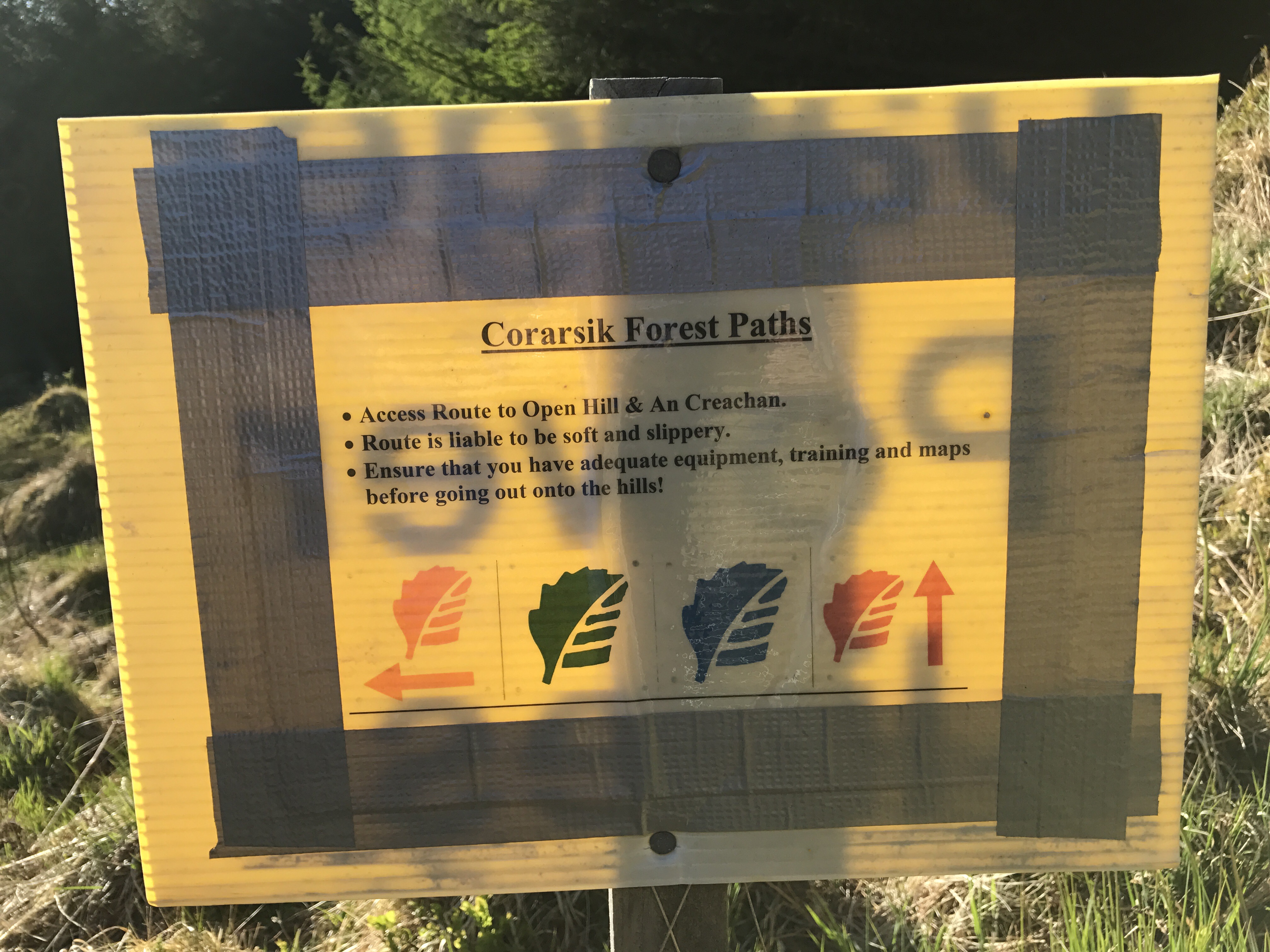
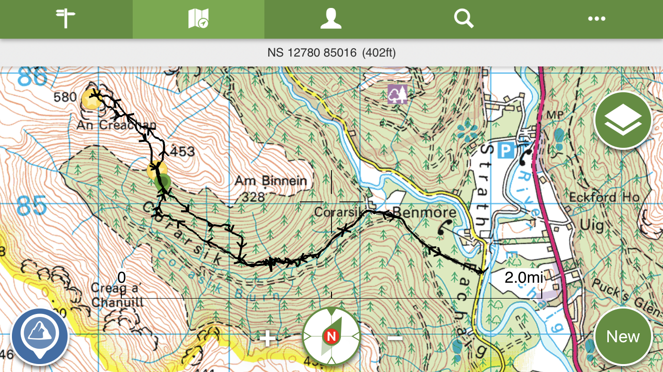
Parking on the Glen Massan road and heading for Corarsic farm,once over the bridge a sign pointing left aids navigation to the top of the glen. The track easily followed and there are marker posts en route, eventually leaving the track and into an opening in the woods.
The track seemed to terminate at the sign, despite the information provided.
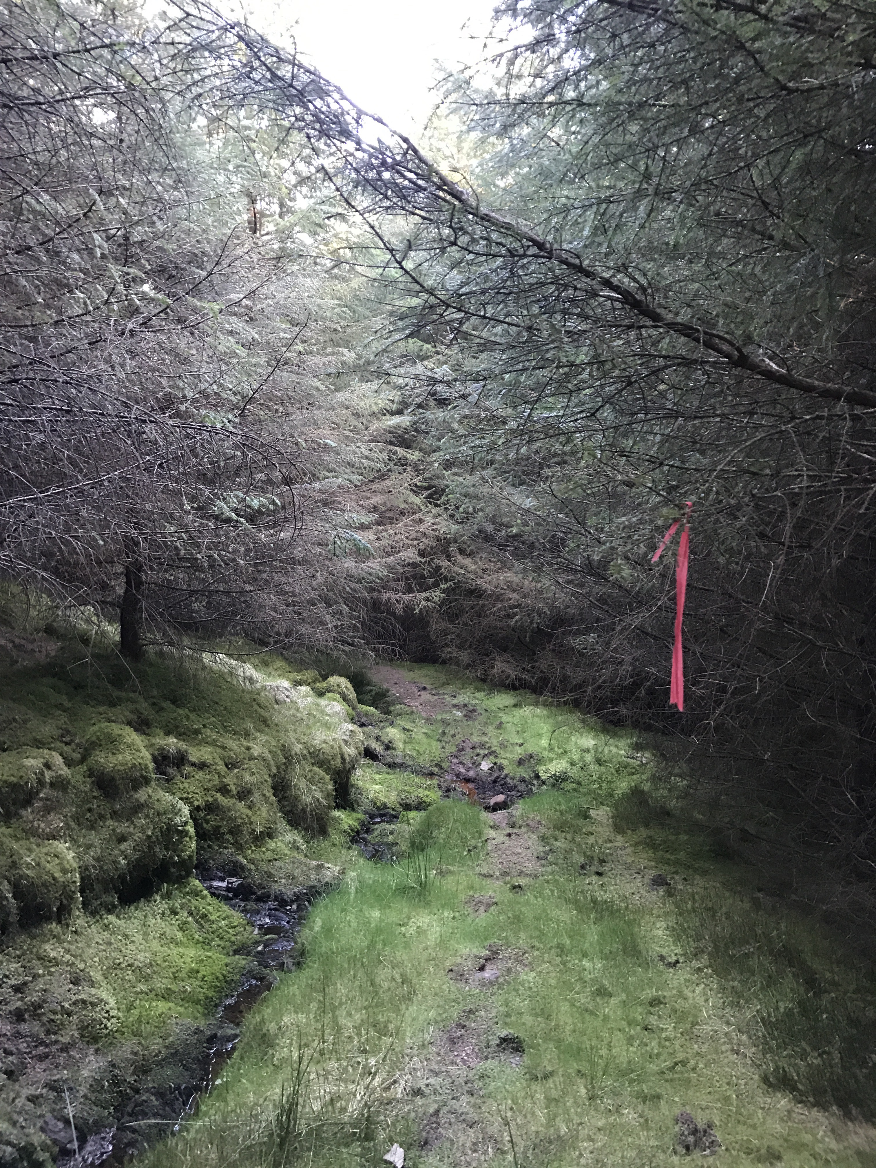
After looking about for a marker or any evidence of a trail I decided to head up the burn, ducking under trees and crossing the burn heading to the open hill. Prior to emerging out of the trees a found an old path with some tape tied to the trees, this led to the open hill.
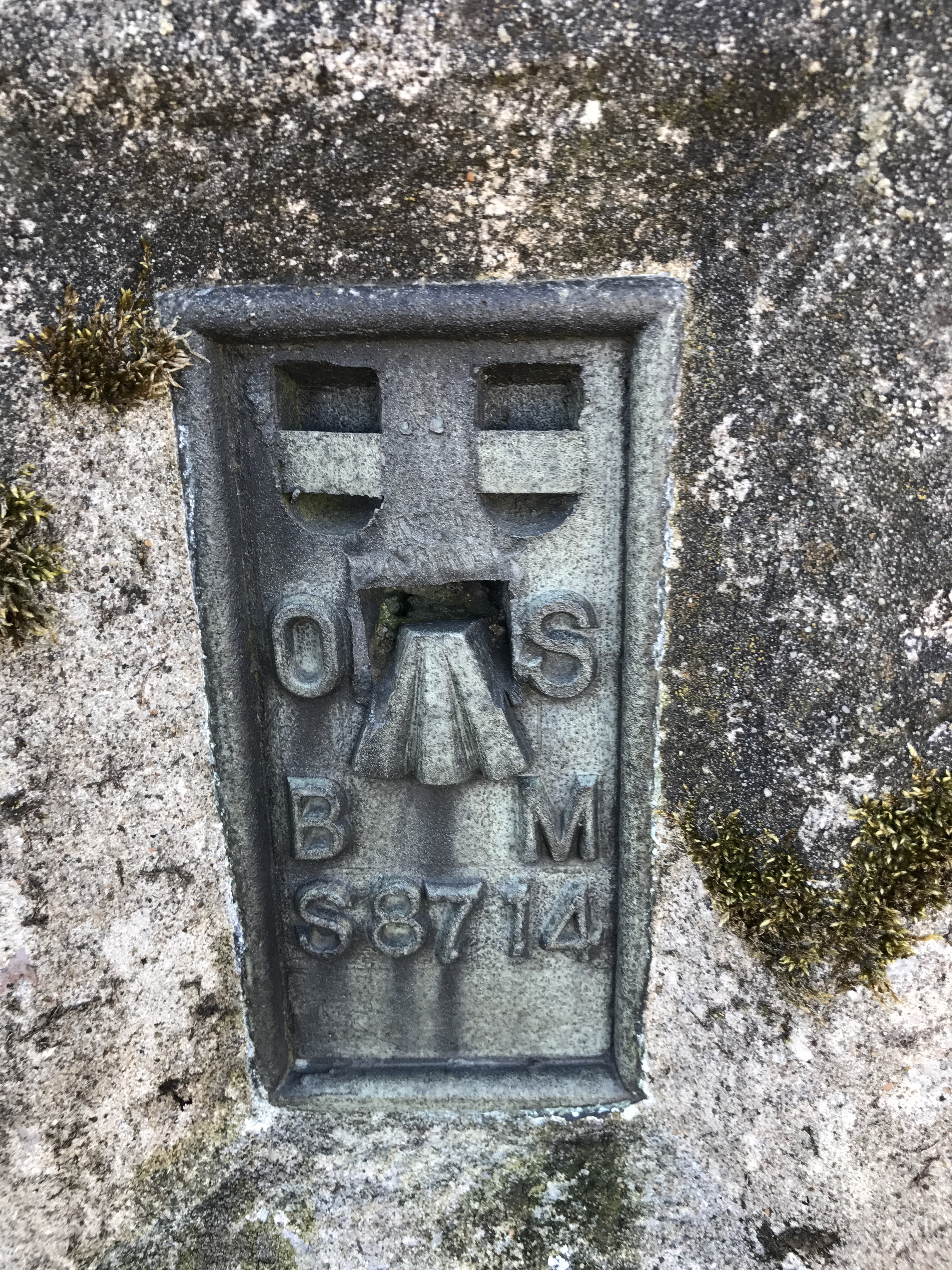
Once out the trees it was a straight forward ascent, heading straight up the hill turning left to pick up an old fence line to the summit and its Trig.
The views over Glenmassan the Holy Loch and beyond were stunning, well worth the effort.
On return thankfully I’d taken note of where I’d emerged from the forest i picked up the path. Curiosity got the better of me so I decided to try follow the path with the taped branch markers.
I got to the point where there was no tape but still a track, instead of heading down hill in the direction of the ascent track I followed the path.
It never led to much and it started to climb again. Instead of retracing my steps to the last bit of tape I decided to push downhill through the woods till I got the the track, it was torture,ha.
Made it back to the track, battered and bruised and made my way back to the car.
Plan to return to confirm the best route and perhaps take a hand saw or axe to clear a/the path.


