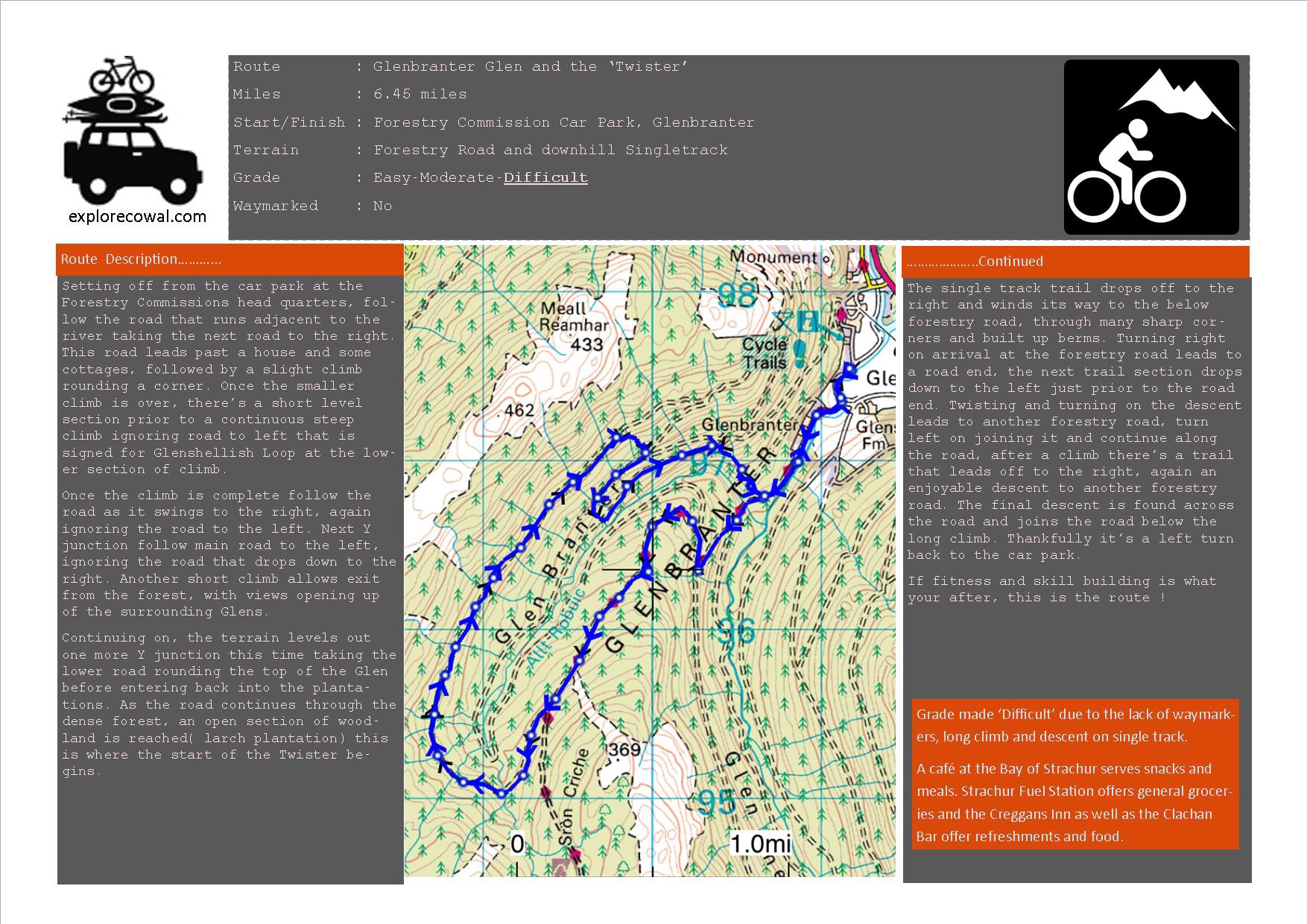
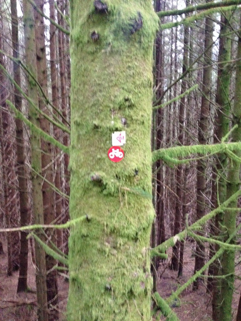
I’ve alway wanted to take on the trail known as the Twister. This trail involves a loop round the top of Glenbranter using the forestry roads with a descent on a purpose built section of single track. Starting off and finishing at the Forestry Commissions head quarters in Glenbranter,there’s plenty of parking available.
Please see below Route Card,Pictures and Interactive Map.
If your looking for a route to build up fitness and skill,this is it !!!
GPX file for GPS units/ Viewranger App can be downloaded by clicking here ( Click on the icon top right with the three horizontal bars). You may have to register with Viewranger, but it’s free.
Routecard
Found these videos in Youtube showing the sections of the Twister,ideal.
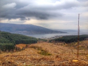
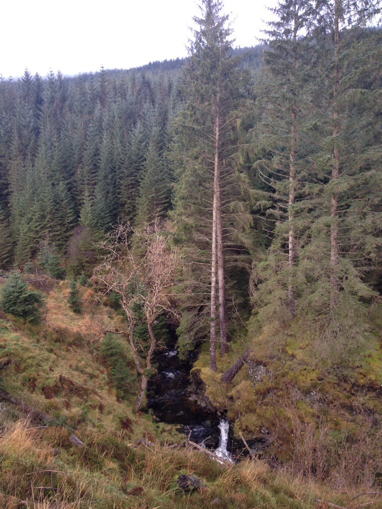
Decided to try something different,a bike followed by a hike to get to this trig point.
Parking at Glenbranter at the FCS car park, I headed off on the bike for the forestry road section. I’d found an ATV track by chance when descending from Beinn Bheag a good while back, so relocating this track for access to the hill was the next step. Remarkably I found the track, as if I was there yesterday, just as I remembered. The track too steep to cycle up, I pushed the bike the point of the washed out burn crossing then walked the remainder and onto the open hill. There’s a couple of splits in the track, two lefts and a right gets you onto the hill. The second left hand track was unknown to me as my descent on last trip came from the right, but the choice paid off.
The track took me out at the base of the hill, leaving a short and steep ascent to the trig, far easier than I thought it’d be.
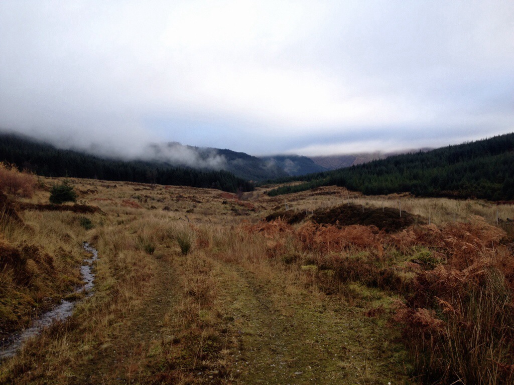
Stunning views were to be had, snow covered hills and mountains all around, along with partial views over Loch Eck.
I remember seeing a mast at the top of this hill many years ago, but it had vanished and I never thought anything about it…….until I reached the summit. The control station still exists along with the dismantled mast, the internals of the station stripped out…..a good wee place to hide in extreme weather! Even if there’s no door.
After a wee wander about the tops I returned on the same route, picking up a frosty bike for the downhill return. I’m no mountain biker, mostly forestry roads but I enjoyed hanging of the back of the bike on the track section!! The forestry road hardly took a turn of the pedals to get back to the car, the quickest descent I’ve ever done!!!
Time saving and energy saving……it’s the future!!!! 😉
Route:Toward Hall to Glenbranter Forestry Office. Length: 26.2 miles 41.9 km Ascent: +1345m -1327m Naismith: 10h 38m (walking pace) Terrain : Forestry road and short sections of rural paved road.
I was looking to create a route similar in distance to the Loch Eck Loop, a route that isn’t weather dependent (lower level) or to difficult to navigate but still giving rewarding views. As always staying away from public roads as much as possible and making the route manageable in smaller sections if need be. The availability of public transport is always a bonus. The route can be either cycled or walked and tackled in either direction.
A scenic route, starting from Toward, South Cowal extending to Glenbranter,south of Strachur.
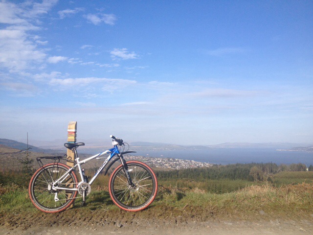
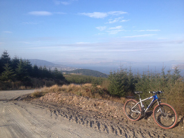
Leaving Toward,heading north, passing above Innellan and Dunoon enjoying view over the Firth of Clyde. Continuing through to Glenkin and on to Glenmassan, before heading to Benmore and finishing at Glenbranter.
I’m going to aim for the 26.2 miles as that’d make it a marathon, should Cowal ever hold it’s own Marathon Trail Run
Map will default to Auto,however there should be an option in the drop down menu (top right of map) to choose ‘Ordnance Survey GB’. If it’s not an option you may have to register with an email and password (Login). Perhaps set up an email and password (Login) for your club/group that can be shared.
0 miles to 9.5 miles.
Had an afternoon off work, so managed to cover the south section of Route 26. Toward Hall to the link bridge in Bishops Glen,Dunoon. Works in at exactly 9.5 miles.
Got to Toward via a lift but there is a bus service that takes you to the start point.
Further route info available on an interactive map with Route,Statistics and Pictures, click below.
Interactive map HERE.
Pictures from walk,due to light and conditions pictures aren’t the best but give an idea of views and route.
9.5 to 17.65 miles
A wet and windy Sunday morning! Might as well record some of the route in the worst conditions!!
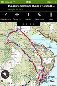
Started off where section 1 finished at the link bridge at the Bishops Glen. This route takes in, Dunoon, Sandbank, Glenkin, Ballochyle, Lower Glenmassan and Benmore with lots to see ( weather permitting ).
Bridge to Bridge came in at 8.15 miles and took me 2hr 45mins, that’s including stopping for pics but little else in the conditions.
See below for pictures and interactive map.
Viewranger have made it possible to view pictures from the route rather than the track only. Clicking on the camera icon at each location should bring up a picture below the map. You can zoom in and out and pan round the map. Any feedback welcome on this mapping system.
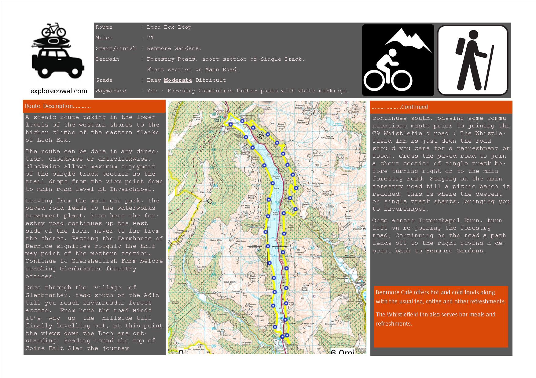
I finally got round to recording the final section of route 26. This section starts off at Benmore Gardens and finishes at Glenbranter. A scenic loch side journey.
Once I’d figured out where the 26.2 accumulative total ended, I continued the loop of Loch Eck, decided to take the bike for this section so I could get the miles in.
The mathematics were done,I needed 8.55 miles to get the the 26.2 from the bridge at Benmore. Now,whilst it’s not an exact science but this distance brought me to a forestry gate,right in front of Glenshellish farm……an excellent finishing point.
Interactive map with pictures can be found by clicking HERE. It’s for the full Loch Eck Loop but details the western flank of the loch for Route 26. Could always continue and make the route an Ultra!! (38.5ish miles).
There marks the end of Route 26. Its an extra half mile to the Forestry Commissions office.
Now just to piece it all together in one run and report back.
Some scenic footage of sections 2 & 3. Dunoon to Glenbranter.
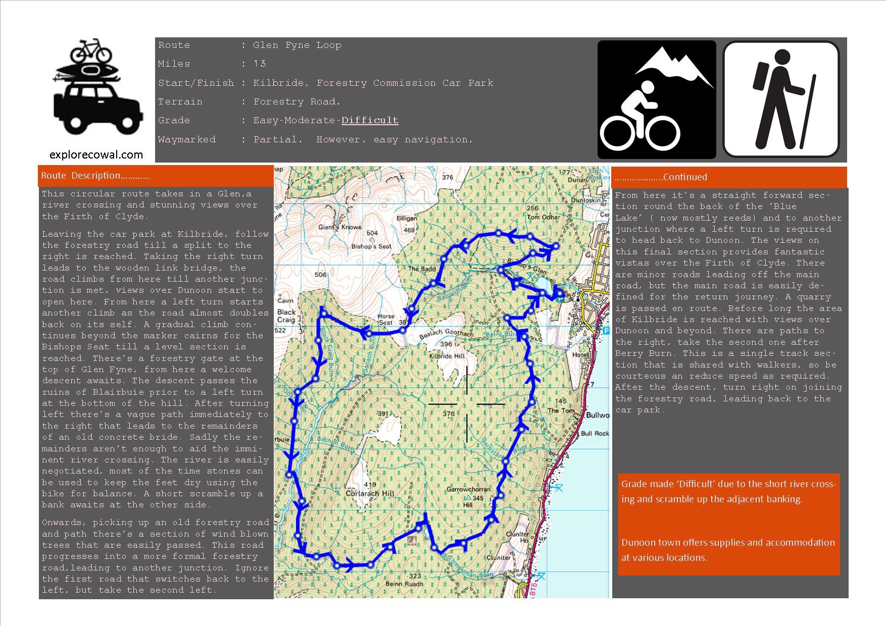
Approx 13 miles on forestry roads with a river crossing.
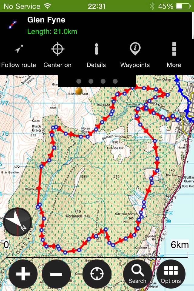
A great circular route, giving great views. Walk it, run it or cycle it.
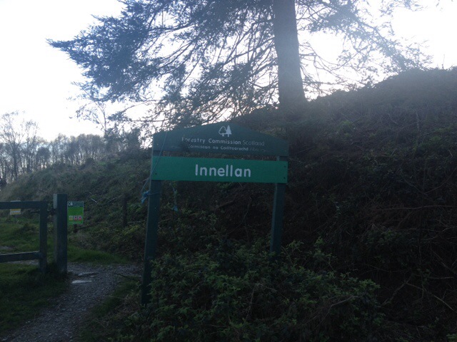
Starting and finishing at Kilbride car park in Dunoon,via the top road behind Kilbride hill,down Glen Fyne returning with views over the Clyde as you head from Innellan to Dunoon. Opposite to what I’ve plotted on the map, but can be done either way.
Overlooking Dunoon after climb from Kilbride car park.
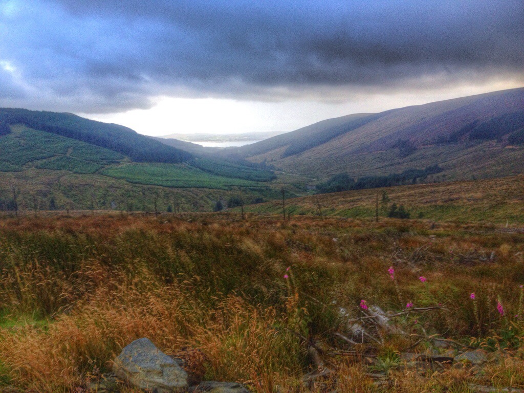
Looking down Glen Fyne
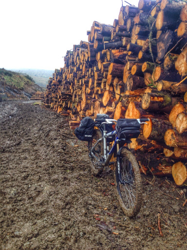
The road down to the river crossing. A tad muddy due to forest operations. All good fun though.
Looking back up the Glen to the far away plantation,where the descent started.
Road conditions slightly better
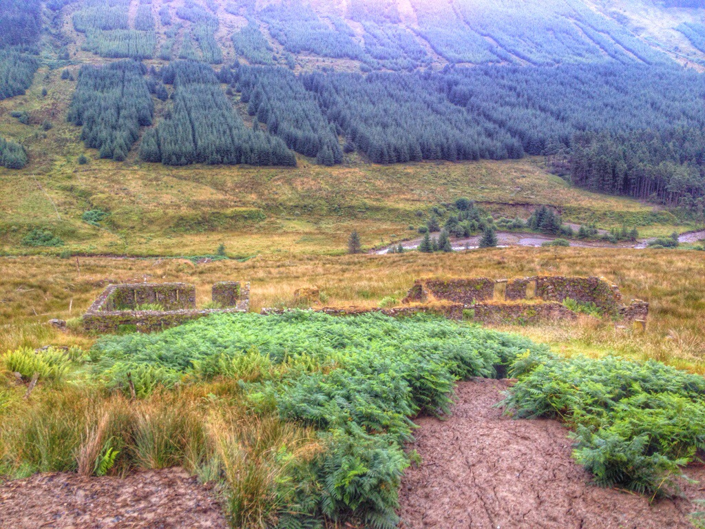
Ruins of Blairbuie
The river crossing at the old concrete bridge and the wind blown road/track on the other side!
Back on the open road.
Left here.
Then left again.
The home straight,including a few bends and a wee climb at Kilbride before returning to the car park.
Also see this report for further pictures and alternative return via Innellan-Dunoon main road. Click here.
Another great cycle. Heading out on forestry roads and returning on main roads.
10 ish Miles.
Whilst I’m not a great fan of cycling on main roads, at the time the route worked for me. Again, there’s plenty of options of start/finish/turning points if you want to extend/shorten the route ( Kilbride car park,Ardanadam etc).
I chose to start at the top of a John Street in Dunoon. Easy access onto the forestry road which pretty much climbs all the way till your above Dunan.
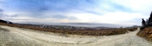
There’s some great views over the town before you take a left where the road splits,climbs and continues through a gate up to Dunan. There’s a mast on the bottom side of the road but continue straight ahead on the new section of link road.
View over Dunoon and beyond,prior to where road splits
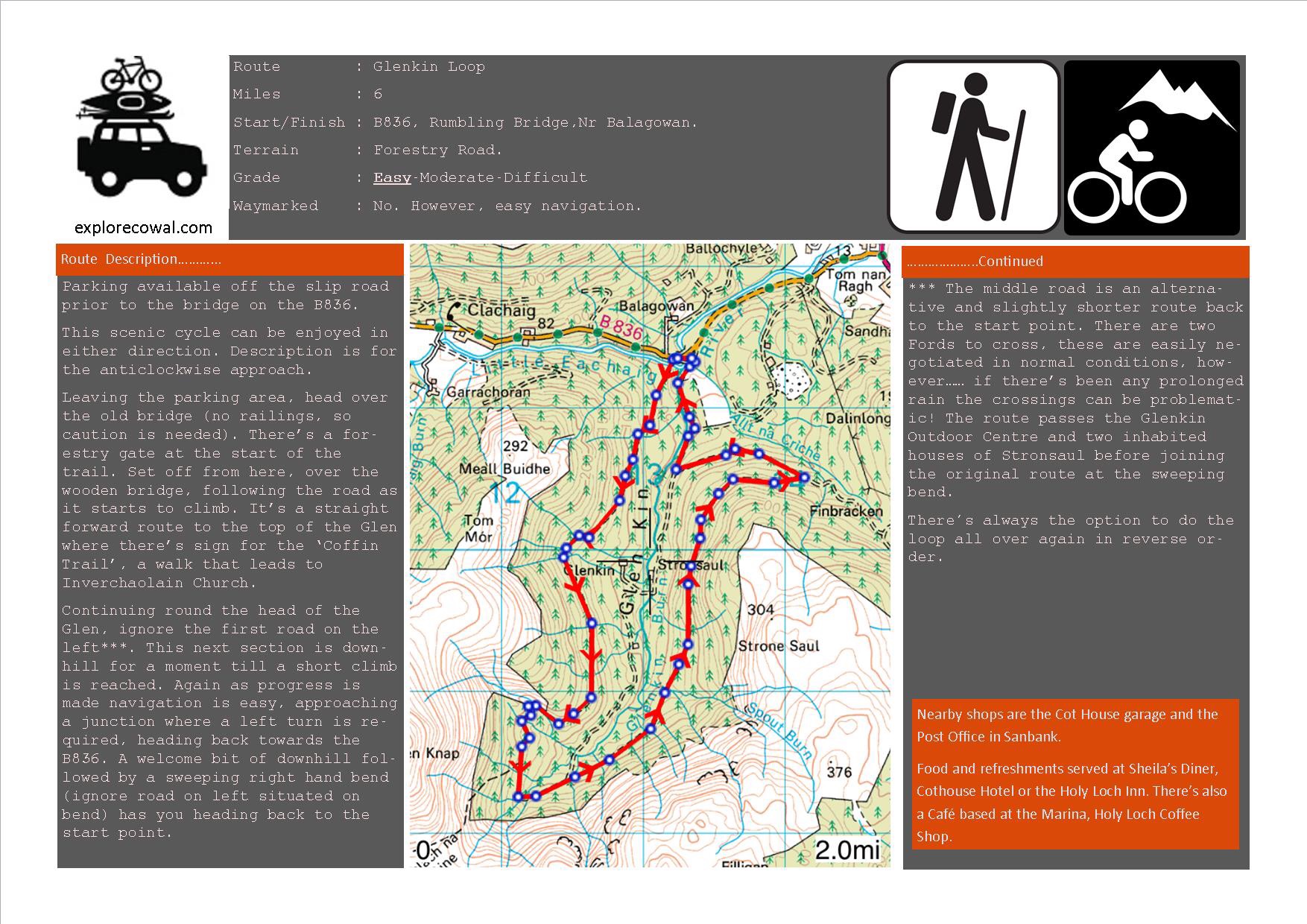
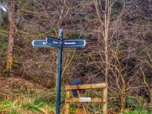
It’s an easy cycle from the mast and your soon ‘bombing’ downhill till you come to a signposted junction. Here I took a left for Glenkin opting out of the shorter Sandbank route.
Navigational aid
After turning left a small climb to the brow of the hill, giving views over Hunters Quay and Strone.
Hunters Quay and Strone
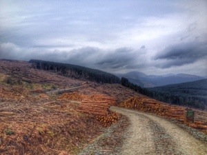
At the time I cycled this section there was quite a bit of forestry activity, so it was necessary to dismount at the loading lorries and move on when prompted by the drivers. Didn’t fancy my chances against a couple of ton of timber swinging about!
Recently harvested timber
Once through the ‘active site’ there was a great view down the Holy Loch and Ardanadam pier.
From here it’s pretty much down hill all the way to the B836. Again there’s a sign post at the next junction offering some navigation help. The Glenkin option is roughly and additional 6 miles if you fancy adding another loop.
The Glenkin 6 Mile route. The signposted junction is just left of the text for Finbracken Hill. So uphill at junction for the whole Glen or downhill for the B836
Heading downhill for the B836 there’s a sweeping bend to the right, follow this to the rumbling bridge. The road to left is the middle road that takes you to the Glenkin Outdoor centre and continues to top of Glen through two Fords.
Looking up Glenkin from right hand bend
Downhill to B836
Once on the B836, it’s down to the junction of the A815, turning right for Dunoon. Nice easy road miles,one climb on the High Road at the primary school.
Another cycle that can be done in a few hours. For me,after work or early
morning. With plenty of scope to add/subtract miles.
A great cycle with few climbs.
10 (ish) miles all in. Forestry road and main road.
Completed this cycle one night after work, taking advantage of the lighter nights we now have.
Leaving from Kilbride car park following the forestry road, a quite straight forward route. The first climb of significance is from where the road splits to the new link road and bridge. Continuing straight on you wind up the hill and follow it as it switches back carrying on climbing till you get to the bench overlooking Dunoon. There’s also the option of a wee downhill track returning to the forestry road if you want a short cycle. Note, this is a shared track with other users.
Continuing heading South is enjoyable and the climb above Ardhallow isn’t to bad. Just before the climb there’s the chance to look North towards Dunoon for a great view through the trees.
Continuing to the quarry which has recently been active there are more great views over the Firth of Clyde.
Finally before the descent to main road a view over Innellan and surroundings.
As you continue south the road splits. Turning right takes you out to Auchafour at Toward, but today’s journey was destined for Innellan, taking a left down hill. The descent to Innellan doesn’t take long with one more turn to the left, through a gate which takes you to the reservoir at the Golf Club continuing to Wyndham Rd.
From the forestry road turn left onto main road , past the school and down Royal Brae. Before you start your return you can get refreshments from the local shop, or a choice of two premises selling meals and stronger refreshments!! The return is easy, especially if the wind is behind you and you can be back in Dunoon in no time.
A great after work or a ‘few hours spare’ cycle that gives great views. Always the option for adding more miles or returning on the forestry road if you like.
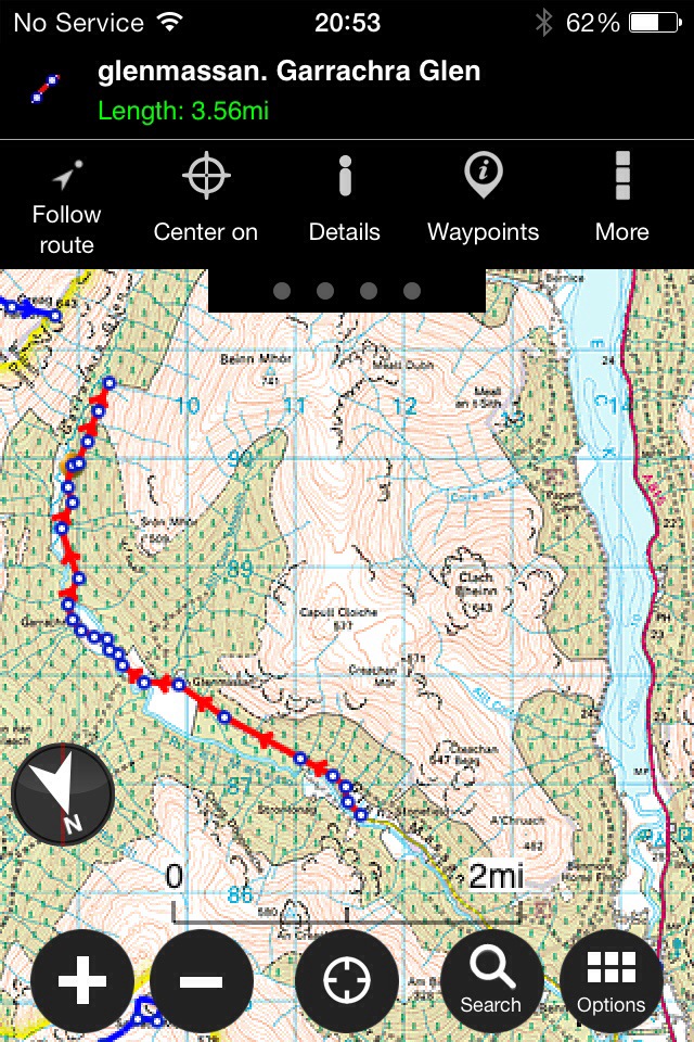
A wee 6 mile cycle through Glen Massan and Garrachra Glen.
Didn’t get as far as intended due to the wind blown trees…..maybe next time !!! Left from the small car park beyond Stonefield Farm at the end of the surfaced road. An easy level cycle on forestry roads. Starting to harvest the trees at the top of the glen,wont be long till they’re planting again.
Plenty of scope for future camping ares 🙂
A stop on the way to car park was required to get a few quick pics of the waterfalls.
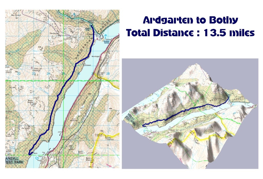
01/12/13 A trip out for a look at Mark Cottage Bothy.A bothy owned and maintained by the MBA.
We set off from Ardgartan on a 7 mile cycle to Mark Cottage. The return was the route reversed, giving a good 14 mile trail ….enough for a Sunday morning. In the clearances there are great views of Loch Long, both North and South. Also en route to the Bothy, there are numerous road side waterfalls.
The reason for the visit was prompted by further plans to visit the Bothy by kayaking from Ardentinny. Suitable landing points were found close to the bothy and there’s enough fallen/dead timber lying about for that all important fire.
A great bothy, the first ‘real’ bothy I’ve visited. Well laid out and kept clean by previous visitors and maintained by the MBA.
Planing to go back with kayak, but prior to that a wee winter sleep over could be on the cards. Either biking or walking, no matter what way, it’d be worth the journey. 🙂
Approx. 11 miles
Duration. 2hrs on the move, plus stops .
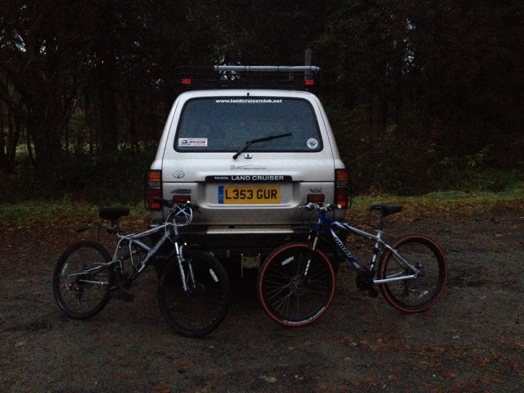
Looking forward to getting out on my new purchase (well new to me) ,the bike was loaded into the back of the motor ready for an early start.
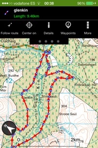
Headed for Glenbranter picking up Martin ‘Mears’ and his trusty stead en route. Parking beyond the FCS offices at the events car park it wasn’t long till we were on our way.
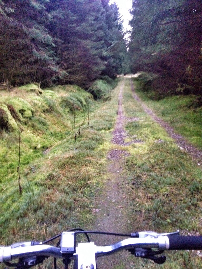
Choosing to take the Blue route. The Glenshellish Loop, a route suitable for beginners and families, approx 7 miles long. An ideal choice since I’ve not been on a bike for 10 years!! However in addition to this the Glenbranter Glen was added, giving an additional 3-4 miles.
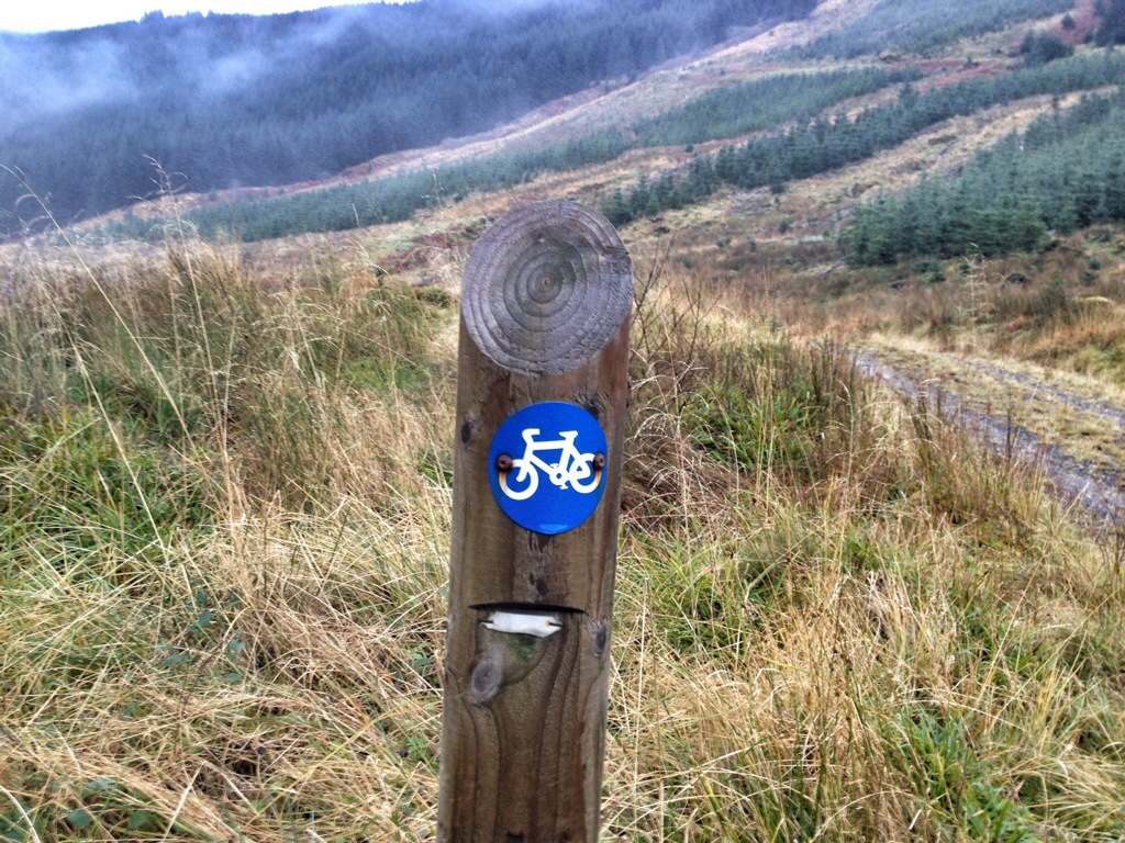
Heading towards Glenshellish Farm over the bridge and taking the road on the immediate right. The route is well marked by posts at junctions, it continues up the East side of the Glen. There is a picnic bench for a wee stop at 3 miles into the loop just prior to the Ford crossing. The return via the West side to Glenbranter was mostly downhill.
Before heading back into Glenbranter we took a sharp left followed by a long climb then a sharp right, heading to Glenbranter Glen. A road leads off this section downhill to the right, marked by both Red Route and Cowal Way markers.
Again, at the bottom if the hill you follow the East side of the Glen on a less defined forestry road. Reaching the top of the Glen there’s a deep Ford to cross! We however went up stream, crossing at a shallower narrower section.
Safely across
Once across, the going is not to bad. Another Ford in a dip must be crossed but at this time it had little water passing through it. The run back down the West side again, like Glenshellish was mostly downhill and good progress made.
On the return we passed the Red Route again where the downhill section joins the road from the left. Continuing along the Red Route drops away to the right, unfortunately the lower section is closed for now due to wind blown trees. Beyond this a crossing where the roads meet lets we headed straight down the hill to the back of the Lauder car park, where we returned to the Events car park via a surfaced road.
I great cycle today, especially as a reintroduction to Mountain Biking.


")
")
")
")
")
")
")
")
")
")
")
")
")
")


")


")

")

")


")

")
")
")
")

")
")
")
")
")

")


")

")
")
")

")


")


")
")
")
")
")
")
")
")
")
")
")
")
")
")
")
")
")
")
")
")
")
")
")
")
")
")
")
")
")
")
")
")
")
")
")
")
")
")
")
")
")
")
")
")
")
")
")
")
")
")
")

")
")
")
")
")
")
")
")
")
")
")
")
")
")
")
")
")
")
")
")
")
")
")
")
")
")
")
")
")
")
")
")
")
")
")
")
")
")
")
")
")
")
")
")
")
")
")
")
")
")
")
")
")
")
")
")
")
")
")
")
")
")
")
")
")
")
")

")

")
")
")
")
")
")
")
")
")
")
")
")
")
")
")
")
")
")


![DSCF5301t [1600x1200]](https://i0.wp.com/explorecowal.com/wp-content/uploads/2013/12/dscf5301t-1600x1200.jpg?w=225&h=266&ssl=1 "DSCF5301t [1600x1200]")
![DSCF5297t [1600x1200]](https://i0.wp.com/explorecowal.com/wp-content/uploads/2013/12/dscf5297t-1600x1200.jpg?w=192&h=144&ssl=1 "DSCF5297t [1600x1200]")
![DSCF5294t [1600x1200]](https://i0.wp.com/explorecowal.com/wp-content/uploads/2013/12/dscf5294t-1600x1200.jpg?w=192&h=118&ssl=1 "DSCF5294t [1600x1200]")
![DSCF5288t [1600x1200]](https://i0.wp.com/explorecowal.com/wp-content/uploads/2013/12/dscf5288t-1600x1200.jpg?w=198&h=266&ssl=1 "DSCF5288t [1600x1200]")
![DSCF5287t [1600x1200]](https://i0.wp.com/explorecowal.com/wp-content/uploads/2013/12/dscf5287t-1600x1200.jpg?w=414&h=311&ssl=1 "DSCF5287t [1600x1200]")
![DSCF5285t [1600x1200]](https://i0.wp.com/explorecowal.com/wp-content/uploads/2013/12/dscf5285t-1600x1200.jpg?w=205&h=154&ssl=1 "DSCF5285t [1600x1200]")
![DSCF5279t [1600x1200]](https://i0.wp.com/explorecowal.com/wp-content/uploads/2013/12/dscf5279t-1600x1200.jpg?w=205&h=153&ssl=1 "DSCF5279t [1600x1200]")
![DSCF5272t [1600x1200]](https://i0.wp.com/explorecowal.com/wp-content/uploads/2013/12/dscf5272t-1600x1200.jpg?w=231&h=142&ssl=1 "DSCF5272t [1600x1200]")
![DSCF5269t [1600x1200]](https://i0.wp.com/explorecowal.com/wp-content/uploads/2013/12/dscf5269t-1600x1200.jpg?w=231&h=162&ssl=1 "DSCF5269t [1600x1200]")
![DSCF5264t [1600x1200]](https://i0.wp.com/explorecowal.com/wp-content/uploads/2013/12/dscf5264t-1600x1200.jpg?w=388&h=308&ssl=1 "DSCF5264t [1600x1200]")
![DSCF5261t [1600x1200]](https://i0.wp.com/explorecowal.com/wp-content/uploads/2013/12/dscf5261t-1600x1200.jpg?w=304&h=193&ssl=1 "DSCF5261t [1600x1200]")
![DSCF5256t [1600x1200]](https://i0.wp.com/explorecowal.com/wp-content/uploads/2013/12/dscf5256t-1600x1200.jpg?w=315&h=193&ssl=1 "DSCF5256t [1600x1200]")
![DSCF5254t [1600x1200]](https://i0.wp.com/explorecowal.com/wp-content/uploads/2013/12/dscf5254t-1600x1200.jpg?w=134&h=165&ssl=1 "DSCF5254t [1600x1200]")
![DSCF5249t [1600x1200]](https://i0.wp.com/explorecowal.com/wp-content/uploads/2013/12/dscf5249t-1600x1200.jpg?w=85&h=165&ssl=1 "DSCF5249t [1600x1200]")
![DSCF5243t [1600x1200]](https://i0.wp.com/explorecowal.com/wp-content/uploads/2013/12/dscf5243t-1600x1200.jpg?w=304&h=165&ssl=1 "DSCF5243t [1600x1200]")
![DSCF5240t [1600x1200]](https://i0.wp.com/explorecowal.com/wp-content/uploads/2013/12/dscf5240t-1600x1200.jpg?w=88&h=165&ssl=1 "DSCF5240t [1600x1200]")


![DSCF5175t [1600x1200]](https://i0.wp.com/explorecowal.com/wp-content/uploads/2013/12/dscf5175t-1600x1200.jpg?w=396&h=167&ssl=1 "DSCF5175t [1600x1200]")


![DSCF5164t [1600x1200]](https://i0.wp.com/explorecowal.com/wp-content/uploads/2013/12/dscf5164t-1600x1200.jpg?w=623&h=208&ssl=1 "DSCF5164t [1600x1200]")


![DSCF5135t [1600x1200]](https://i0.wp.com/explorecowal.com/wp-content/uploads/2013/12/dscf5135t-1600x1200.jpg?w=180&h=190&ssl=1 "DSCF5135t [1600x1200]")
![DSCF5134t [1600x1200]](https://i0.wp.com/explorecowal.com/wp-content/uploads/2013/12/dscf5134t-1600x1200.jpg?w=180&h=135&ssl=1 "DSCF5134t [1600x1200]")
![DSCF5131t [1600x1200]](https://i0.wp.com/explorecowal.com/wp-content/uploads/2013/12/dscf5131t-1600x1200.jpg?w=119&h=104&ssl=1 "DSCF5131t [1600x1200]")
![DSCF5130t [1600x1200]](https://i0.wp.com/explorecowal.com/wp-content/uploads/2013/12/dscf5130t-1600x1200.jpg?w=139&h=104&ssl=1 "DSCF5130t [1600x1200]")
![DSCF5124t [1600x1200]](https://i0.wp.com/explorecowal.com/wp-content/uploads/2013/12/dscf5124t-1600x1200.jpg?w=170&h=104&ssl=1 "DSCF5124t [1600x1200]")


